Alcamarinayoc
Alcamarinayoc (possibly from Aymara and Quechua allqamari mountain caracara)[8] or Colque Cruz (possibly from Aymara and Quechua qullqi money, silver,[8] Spanish cruz cross) is a 6,102-metre-high (20,020 ft) mountain in the Vilcanota mountain range in the Andes of Peru. It is situated in the Cusco Region, Quispicanchi Province, Ocongate District.[9] Alcamarinayoc lies northwest of the peak of Chumpe, north of Quevesere and northeast of Ichhu Ananta.[10]
| Alcamarinayoc | |
|---|---|
| Colque Cruz | |
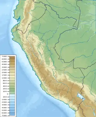  Alcamarinayoc Peru | |
| Highest point | |
| Elevation | 6,102 m (20,020 ft)[1] |
| Prominence | 1,310 m (4,300 ft)[2] |
| Parent peak | Callangate |
| Coordinates | 13°41′59″S 71°05′41″W[1] |
| Geography | |
| Location | Peru, Cusco Region |
| Parent range | Andes, Vilcanota |
| Climbing | |
| First ascent | 08/14/1957 - Craig Merrihue, William Hooker, Steven Jervis, Earle Whipple (USA)[3][4]08/14/1957 - Craig Merrihue, William Hooker, Steven Jervis, Earle Whipple (USA).[5][6] 1-1953 via N. ridge: N. face-1974: S.E. ridge-1974: W.- E.traverse-1984: N. face direct-1987.[7] |
First Ascent
Colque Cruz was first climbed by Craig Merrihue, William Hooker, Steven Jervis, Earle Whipple (USA) 14th August 1957.[11][12]
Elevation
Other data from available digital elevation models: SRTM yields 6069 metres,[13] ASTER 6050 metres[14] and TanDEM-X 6111 metres.[15] The height of the nearest key col is 4792 meters, leading to a topographic prominence of 1310 meters.[16] Colque Cruz is considered a Mountain Subrange according to the Dominance System [17] and its dominance is 21.47%. Its parent peak is Callangate and the Topographic isolation is 7.9 kilometers.[16]
References
- "Nevado Alcamarinayoc". IGN, Peru. Archived from the original on January 19, 2015. Retrieved January 19, 2014.
- "Colque Cruz / Alcamarinayoc / Allqamarinayuq". Andes Specialists. Retrieved 2020-04-12.
- Fantin. Le Ande.
- "AAJ (American Alpine Journal)". AAJ (American Alpine Journal): 60. 1958.
- Fantin. Le Ande.
- "AAJ (American Alpine Journal)". AAJ (American Alpine Journal): 60. 1958.
- Jill Neate, Mountaineering in the Andes, Peru (Colquecruz I 6102m:)
- Teofilo Laime Ajacopa (2007). Diccionario Bilingüe Iskay simipi yuyayk’anch [Quechua-English dictionary] (PDF). La Paz, Bolivia.
- escale.minedu.gob.pe - UGEL map of the Quispicanchi Province 1 (Cusco Region)
- PERU, Autor: GEO GPS. "Base de datos Perú - Shapefile - *.shp - MINAM - IGN - Límites Políticos". Retrieved 2020-04-30.
- Fantin. Le Ande.
- "AAJ (American Alpine Journal)". AAJ (American Alpine Journal): 60. 1958.
- USGS, EROS Archive. "USGS EROS Archive - Digital Elevation - SRTM Coverage Maps". Retrieved 12 April 2020.
- "ASTER GDEM Project". ssl.jspacesystems.or.jp. Retrieved 2020-04-14.
- TanDEM-X, TerraSAR-X. "Copernicus Space Component Data Access". Retrieved 12 April 2020.
- "Colque Cruz / Alcamarinayoc / Allqamarinayuq". Andes Specialists. Retrieved 2020-04-12.
- "Dominance - Page 2". www.8000ers.com. Retrieved 2020-04-12.