Anketell, Western Australia
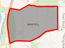
Anketell is a suburb of Perth, Western Australia, located within the City of Kwinana.
| Anketell Perth, Western Australia | |||||||||||||||
|---|---|---|---|---|---|---|---|---|---|---|---|---|---|---|---|
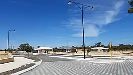 The new Albero Estate, Anketell, in 2020 | |||||||||||||||
| |||||||||||||||
| Coordinates | 32.219°S 115.865°E | ||||||||||||||
| Population | 248 (2016 census)[1] | ||||||||||||||
| • Density | 36.5/km2 (94.5/sq mi) | ||||||||||||||
| Postcode(s) | 6167 | ||||||||||||||
| Area | 6.8 km2 (2.6 sq mi)[2] | ||||||||||||||
| LGA(s) | City of Kwinana | ||||||||||||||
| State electorate(s) | Kwinana | ||||||||||||||
| Federal division(s) | Brand | ||||||||||||||
| |||||||||||||||
Anketell was part of early settler Thomas Peel's land grant, used for the 1920s Group Settlement Scheme in Peel Estate. It is named after Peel Estate's surveyor, Richard John Anketell.[3]
References
- Australian Bureau of Statistics (27 June 2017). "Anketell (State Suburb)". 2016 Census QuickStats. Retrieved 30 November 2021.

- Australian Bureau of Statistics (27 June 2017). "2016 Community Profiles: Anketell (State Suburb)". 2016 Census of Population and Housing. Retrieved 30 November 2021.
- Western Australian Land Information Authority. "History of metropolitan suburb names – A". Retrieved 31 August 2008.
This article is issued from Wikipedia. The text is licensed under Creative Commons - Attribution - Sharealike. Additional terms may apply for the media files.