Barber, Curaçao
Barber is a town in the north of the island of Curaçao. It is located inland from the north coast, to the southeast of Christoffelberg, at a major road junction. To the north lies the smaller settlement of San Hyronimo, and to the west lie Santa Cruz and Soto. The small settlement of Ascencion lies just to the east.
Barber | |
|---|---|
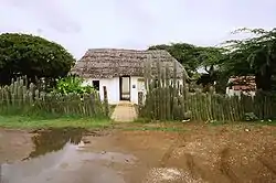 Slave house at the Kas di Pal'i Maishi museum | |
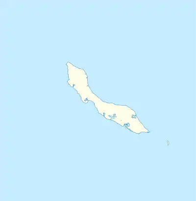  Barber Location in Curaçao | |
| Coordinates: 12°17′N 069°04′W | |
| State | Kingdom of the Netherlands |
| Country | Curaçao |
| District | Bandabou |
| Area | |
| • Total | 9.01 km2 (3.48 sq mi) |
| Population (2011)[2] | |
| • Total | 2,412 |
| • Density | 270/km2 (690/sq mi) |
| Climate | BSh |
History
Barber started as plantation Barber. The plantation was named after Barbara Exteen[3] In 1827, a church was built on Barber. In 1832, the plantation was sold to the Roman Catholic Church.[4] Barber quickly developed into the main town of the area.[5] In 1913, the plantation was bought by the Government who divided the grounds into pieces of two hectares which people could rent.[4]
The main sights of Barber include the oldest tree in Curaçao, a Ceiba pentandra or silk cotton tree.[4] It is claimed by some to be 800 years old, which could make it the oldest silk cotton tree in the world. [6] [7] Barber hosts a Sunday market, where local vendors sell delicacies such as stomach soup[8] and a local form of pasties.
Kas di Pal'i Maishi is an open air museum about the living conditions of the slaves.[9]
References
- Buurtprofiel Barber 2011, p. 14.
- "Census 2011". Central Bureau of Statistics. Retrieved 17 April 2021.
- Buurtprofiel Barber 2011, p. 9.
- Buurtprofiel Barber 2011, p. 8.
- Buurtprofiel Barber 2011, p. 10.
- https://www.inlander.be/single-post/2017/07/04/De-stokoude-kapokboom-van-Hofi-pastor
- Kateman, Thijs (2017). Curaçao, Aruba en Bonaire [Curaçao, Aruba and Bonaire] (in Dutch). ANWB. OCLC 150034176.
- https://www.acoyacuracao.com/blog/5-local-food-you-have-to-try-in-curacao-and-where-to-find-them
- "Kas Di Pal'i Maishi". Curaçao.com (in Dutch). Retrieved 17 April 2021.
Bibliography
- Buurtprofiel Barber (2011). "Buurtprofiel Barber" (PDF). Government of Curaçao (in Dutch).
 |
Wikimedia Commons has media related to Barber, Curaçao. |