Bear Run (Anderson Creek tributary)
Bear Run is a 4.57 mi (7.35 km) long 2nd order tributary to Anderson Creek in Clearfield County, Pennsylvania. Bear Run is classified as a High Quality-Cold Water Fishery (HQ-CWF) by the Pennsylvania Department of Environmental Protection (PADEP). Bear Run Reservoir, an impoundment of this stream, is used as a public water supply for the Pike Township Municipal Authority. Bear Run is the largest subwatershed draining the Anderson Creek watershed.[6] Bear Run has an ID number of 1168921 from the US Board of Geographic Names.[1]
| Bear Run Tributary to Anderson Creek | |
|---|---|
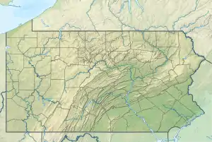  Location of Bear Run mouth  Bear Run (Anderson Creek tributary) (the United States) | |
| Location | |
| Country | United States |
| State | Pennsylvania |
| County | Clearfield |
| Physical characteristics | |
| Source | Coupler Run divide |
| • location | about 6 miles northeast of Greenville, Pennsylvania |
| • coordinates | 41°03′51″N 078°34′40″W[1] |
| • elevation | 2,270 ft (690 m)[2] |
| Mouth | |
• location | about 0.5 miles east-northeast of Greenville, Pennsylvania |
• coordinates | 41°00′54″N 078°34′58″W[1] |
• elevation | 1,414 ft (431 m)[3] |
| Length | 4.57 mi (7.35 km)[4] |
| Basin size | 4.28 square miles (11.1 km2)[5] |
| Discharge | |
| • location | Anderson Creek |
| • average | 7.77 cu ft/s (0.220 m3/s) at mouth with Anderson Creek[5] |
| Basin features | |
| Progression | Anderson Creek → West Branch Susquehanna River → Susquehanna River → Chesapeake Bay → Atlantic Ocean |
| River system | Susquehanna River |
| Tributaries | |
| • left | unnamed tributaries |
| • right | unnamed tributaries |
| Waterbodies | Bear Run Reservoir |
| Bridges | Bear Run Road |
Course
Bear Run rises about 6 miles northeast of Greenville, Pennsylvania, and then flows generally south to join Anderson Creek at about 0.5 miles northeast of Greenville.[3]
Watershed
Bear Run drains 4.28 square miles (11.1 km2) of area, receives about 45.4 in/year of precipitation, has a wetness index of 398.08, and is about 94% forested.[5]
Natural History
Bear Run is located within the Anderson Creek-Montgomery Creek LCA in the Clearfield County Natural Heritage Inventory.[7] The LCA is described as providing large forest corridors for interior forest species. Bear Run contains naturally reproducing Brook Trout and is considered to have the best habitat of the streams in the greater Anderson Creek watershed.[6]
Geology
The Bear Run Watershed contains the highest elevation of the larger Anderson Creek watershed at 1,414 ft (431 m). The headwaters begin in the Allegheny formation, which contains most of the coal seams, and then cuts into the Pottsville Formation and ends in the Mauch Chunk Formation. While some other tributaries reach the Mauch Chunk Formation, Bear Run and Anderson Creek are the only ones within the greater Anderson Creek watershed where the Mauch Chunk is prominently exposed.[6]
Watershed Maps
_in_Clearfield_County%252C_Pennsylvania.jpg.webp)
_in_Clearfield_County%252C_Pennsylvania.jpg.webp)
See also
References
- "GNIS Detail - Bear Run". geonames.usgs.gov. US Geological Survey. Retrieved 22 August 2021.
- "Get Maps". USGS Topoview. US Geological Survey. Retrieved 22 August 2021.
- "Get Maps". USGS Topoview. US Geological Survey. Retrieved 22 August 2021.
- "ArcGIS Web Application". epa.maps.arcgis.com. US EPA. Retrieved 22 August 2021.
- "Bear Run Watershed Report". US EPA Geoviewer. US EPA. Retrieved 22 August 2021.
- "Anderson Creek Watershed Assessment, Restoration and Implementation Plan" (PDF). Western Pennsylvania Conservancy. Retrieved 22 August 2021.
- "Clearfield County Natural Heritage Inventory" (PDF). Pennsylvania Natural Heritage Program. Western Pennsylvania Conservancy. Retrieved 22 August 2021.