Bireuën Regency
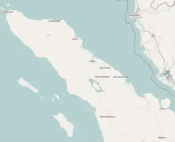
Bireuën Regency (Indonesian: Kabupaten Bireuen) is a regency of Aceh, the westernmost province of Indonesia. It is located on the island of Sumatra. The capital is Bireuën, 105 miles east of the provincial capital, Banda Aceh. The regency covers an area of 1,798.25 square kilometres and had a population of 340,271 people according to the 2000 Census;[2] at the 2010 Census it had a population of 389,288, which had risen to 436,418 at the 2020 Census.[3] It is bordered by the Strait of Malacca on the northeast coastline. Bireuen has been affected by the clashes between the Free Aceh Movement (GAM) and the government.
Bireuën Regency
Kabupaten Bireuën | |
|---|---|
 Seal | |
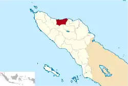 Location within Aceh | |
| Coordinates: 5°5′N 96°36′E | |
| Country |  Indonesia Indonesia |
| Region | Sumatra |
| Province |  Aceh Aceh |
| Established | 1999 |
| Regency seat | Bireuën |
| Government | |
| • Regent | Dr. H. Muzakkar A. Gani, S.H., M.Si |
| Area | |
| • Total | 1,798.25 km2 (694.31 sq mi) |
| Population (2020 Census)[1] | |
| • Total | 436,418 |
| • Density | 240/km2 (630/sq mi) |
| Time zone | UTC+7 (IWST) |
| Area code | (+62) 644 |
| Website | bireunkab.go.id |


The regency's name, however, is commonly spelled without the diaeresis on the letter Ë: Kabupaten Bireuen (in Acehnese, Ë represents a schwa ([ə]) in diphthongs). It was affected by the Indian Ocean earthquake and tsunami on 26 December 2004.
Administrative districts
The regency is divided administratively into seventeen districts (kecamatan), tabulated below with their areas and their populations at the 2010 Census[4] and the 2020 Census.[5]
| Name | Area (in km2) | Population Census 2010 | Population Census 2020 |
|---|---|---|---|
| Samalanga | 141.42 | 27,209 | 27,907 |
| Simpang Mamplam | 155.50 | 24,470 | 27,237 |
| Pandrah | 114.01 | 7,669 | 8,806 |
| Jeunieb | 112.51 | 22,309 | 25,244 |
| Peulimbang | 127.89 | 10,243 | 12,085 |
| Peudada | 312.81 | 23,996 | 27,839 |
| Juli | 231.18 | 28,738 | 33,731 |
| Jeumpa | 109.14 | 32,189 | 36,930 |
| Kota Juang (Bireuën town) | 16.91 | 44,604 | 47,670 |
| Kuala | 17.11 | 16,169 | 18,731 |
| Jangka | 37.58 | 25,698 | 28,687 |
| Peusangan | 59.08 | 47,494 | 52,716 |
| Peusangan Selatan (South Peusangan) | 94.15 | 13,080 | 14,889 |
| Peusangan Siblah Krueng | 111.57 | 10,447 | 11,956 |
| Makmur | 71.74 | 13,887 | 15,656 |
| Ganda Pura | 46.95 | 20,881 | 23,732 |
| Kuta Blang | 38.70 | 20,205 | 22,602 |
| Totals | 1,798.25 | 389,288 | 436,418 |
References
- Badan Pusat Statistik, Jakarta, 2021.
- Seta,William J. Atlas Lengkap Indonesia dan Dunia (untuk SD, SMP, SMU, dan Umum). Pustaka Widyatama. p. 7. ISBN 979-610-232-3.
- Badan Pusat Statistik, Jakarta, 2021.
- Biro Pusat Statistik, Jakarta, 2011.
- Badan Pusat Statistik, Jakarta, 2021.
Regencies and cities of Aceh | ||
|---|---|---|
Capital: Banda Aceh | ||
| Regencies |  | |
| Cities | ||
Authority control  | |
|---|---|
| General | |
| National libraries | |