Bogra District
Bogra District, officially known as Bogura District,[2] is a district in the northern part of Bangladesh, in the Rajshahi Division.[3] It is called the gateway to North Bengal. Bogra is an industrial city where many small and mid-sized companies are sited. Bogra district was a part of the ancient Pundravardhana territory. The ruins of Mahasthangarh, the ancient capital of Pundravardhana, are located north of Bogra.
Bogra District
বগুড়া জেলা | |
|---|---|
| Bogura District | |
.JPG.webp) Mahasthangar Gokul Medh Bogra Bangladesh. | |
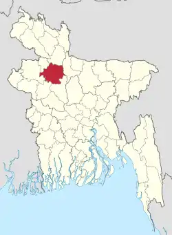 Location of Bogra District in Bangladesh | |
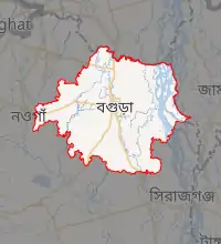
Expandable map of Bogra District | |
| Coordinates: 24.78°N 89.35°E | |
| Country |  Bangladesh Bangladesh |
| Division | Rajshahi Division |
| Pundravardhana | 1280 BC |
| Government | |
| • Deputy Commissioner | Md. Ziaul Hoque |
| Area | |
| • Total | 2,899 km2 (1,119 sq mi) |
| [1] | |
| Population (2011 census)[1] | |
| • Total | 3,400,874 |
| • Density | 1,200/km2 (3,000/sq mi) |
| Literacy rate | |
| • Total | 68.4% |
| Time zone | UTC+06:00 (BST) |
| Postal code | 5800 |
History
Ancient history
In the ancient period, Bogra District was a part of the territory of the Pundras or Paundras, known by the name of Pundravardhana. Pundravardhana was one of the kingdoms of Eastern India, and was separated by the stream of Karatoya from the more easterly kingdom of Prag-Jyotisha (or Kamrupa). The name Pundravardhana occurs frequently in the Mahabharata, Ramayana and the various Puranas. According to the Mahabharata and the Puranas, Vasudeva, a powerful prince of the Pundra family, is said to have ruled over Pundravardhana as far back as 1280 BC. The claims of the district to antiquity, however, rest chiefly on association with the old fortified town, now known as Mahasthangarh.[4]
This district has been under a number of rulers.
The Mauryas, and subsequent rulers (up to c. 750)
The district was under the rule of the Mauryas in the 4th and 3rd century BC. This is evident from the existence of pillars of Ashoka in many parts of Pundravardhana and the discovery of an old Brahmi inscription at Mahasthangarh in this district. Bhadra Bahu, a high monk of the Jain religion and the son of a Brahmin of Kotivarsha, was the Jain-Guru of Chandra Gupta Maurya. As Ashoka was a firm believer in Buddhism, he put to death many naked sectarians (presumably the Jains) in Pundravardhana.[4]
The Gupta authority (3rd century AD - 5th century AD) over this district is revealed from the discovery of a number of inscriptions of that period from Pundravardhana. Pundravardhana was a Bhukti under the rule of Guptas till the end of the 5th century.[4]
At the beginning of the 7th century, Sasanka came upon the throne of Gauda and exercised his authority over Pundravardhana (including this district).[5]
This region must have passed after the death of Sasanka under the rule of Harshavardhana (606–647). This is evident from the account of the Chinese pilgrim Xuanzang, who may have visited Pundravardhana in 640 AD.[5]
The Palas (c. 750–1150)
By the middle of the 8th century, Gopal the First assumed control of the affairs over North Bengal, establishing a royal dynasty known as the Pala Dynasty. After Gopal was elected king, he took his seat in Pundravardhana. He ruled over the region up to c. 780 and was succeeded by his son Dharmapala (c. 781–821). The Pala Kings had peaceful possession of this district until the end of their rule over Bengal, which ended in the 12th century. Dharmapala was the son and the successor of Gopala, extended his power beyond Pundravardhana. Like his father, he was a Buddhist and founded the famous Buddhist Vihara at Somapuri in Varendra, the ruins of which have been discovered in the Naogaon District.[5]
The Senas (c. 1150–1204)
The Senas originally came from the Deccan and settled in West Bengal. Vijayasena was the first great ruler of the dynasty. He defeated the last Pala king Madanapala, and established his authority over this district. He was succeeded by his son, Vallal Sena (1160–1178) who was in definite possession of the district. He built his capital at Bhabanipur (a shakti-peeth) in this district. Lakshmanasena (1178–1204), the son and successor of Vallal Sena, exercised authority over this district till he was driven out by Ikhtiyaruddin Muhammad-bin-Bakhtiyar Khalji in 1204. Even after this date, a dynasty of Sena Rajas ruled for nearly a century over the north-eastern tract of this district as feudatory chiefs under the suzerainty of the Muslim rulers of Bengal. Their capital was at Kamalpur, a few miles to the north of Bhabanipur (a site of pilgrimage for the Hindu devotees) and a little to the south of Sherpur. Achyuta Sena was the last Prince of the line.[6]
British Era
The present Bogra District was first formed in 1821 during British rule. In the 1901 census, the population of the district (on a reduced area) was around 854,533, an increase of 11% over the past decade, and it also revealed there was no town with a population above 10,000.[7] The famous Prafulla Chaki (1888–1908) was born in this district.
Battle of Bogra and recent history
The area was enveloped in fighting during the Battle of Bogra, between the allied troops of Mukti Bahini and Indian Army (combined) and the Pakistan Army during the Bangladesh Liberation War of 1971, with the former being victorious.
Recent Times
In 2018, the Government of Bangladesh changed its spelling of the name of the district from Bogra to Bogura.[8]
Geography and climate
Formation of land
| Karatoa River | |
|---|---|
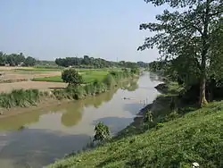 Karatoa River near Mahasthangarh | |
 | |
| Location | |
| Country | Bangladesh |
| Region | Rajshahi Division |
| City | Bogra |
The area consisting of Upazila Sariakandi, Gabtali, Sonatala and the majority of Dhunat, is called the eastern alluvial tract. Fertilized by the silt of floodwaters, the eastern alluvion is one of the most fertile and prosperous areas in Bogra; jute, aman paddy, sugarcane and pulses are grown locally. Sometimes, as many as three or more crops are grown on one field in a year, with little diminution of its productivity.[9]
The western portion of the district is a marked contrast to the eastern one. In most parts it is well-wooded. Dense shrub jungles are found in Upazilas of Sherpur and in parts of Sibganj, which has a comparatively large proportion of cultivable wasteland. This part of the district is slightly higher than the eastern parts and is mostly above flood level. The soil of this part is generally suited to the growth of paddy. Adamdighi is well known for the fine qualities of rice, which is also grown to some extent in the Shibganj Upazila. [9]
The tract to the east of the Karatoya is a part of the valley of the Brahmaputra, and is generally low-lying and intersected by numerous khals (canals, shallow swamps, and marshes). It is subject to yearly inundation from the overflow of the Brahmaputra and, therefore, gets a rich deposit of silt. There is very little jungle and almost the entire area is under cultivation.
Rivers
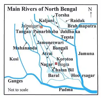
There are many rivers in the Bogra District. The Karatoya is the central divider of the water channel in the district. The other rivers may be classified into the eastern and western systems.[10] Some of the major rivers in this district are:
Climate
The district has a humid subtropical climate.
| Climate data for Bogra | |||||||||||||
|---|---|---|---|---|---|---|---|---|---|---|---|---|---|
| Month | Jan | Feb | Mar | Apr | May | Jun | Jul | Aug | Sep | Oct | Nov | Dec | Year |
| Average high °C (°F) | 23.0 (73.4) |
27.3 (81.1) |
32.6 (90.7) |
35.1 (95.2) |
33.5 (92.3) |
32.0 (89.6) |
31.4 (88.5) |
31.4 (88.5) |
31.5 (88.7) |
31.0 (87.8) |
28.9 (84.0) |
25.5 (77.9) |
30.3 (86.5) |
| Daily mean °C (°F) | 16.4 (61.5) |
20.0 (68.0) |
25.2 (77.4) |
28.8 (83.8) |
28.8 (83.8) |
28.7 (83.7) |
28.7 (83.7) |
28.7 (83.7) |
28.5 (83.3) |
27.1 (80.8) |
23.2 (73.8) |
19.0 (66.2) |
25.3 (77.5) |
| Average low °C (°F) | 9.8 (49.6) |
12.7 (54.9) |
17.9 (64.2) |
22.5 (72.5) |
24.1 (75.4) |
25.5 (77.9) |
26.1 (79.0) |
26.1 (79.0) |
25.6 (78.1) |
23.2 (73.8) |
17.6 (63.7) |
12.6 (54.7) |
20.3 (68.6) |
| Average precipitation mm (inches) | 9 (0.4) |
13 (0.5) |
21 (0.8) |
61 (2.4) |
210 (8.3) |
326 (12.8) |
396 (15.6) |
303 (11.9) |
257 (10.1) |
145 (5.7) |
15 (0.6) |
6 (0.2) |
1,762 (69.3) |
| Average relative humidity (%) | 44 | 34 | 36 | 45 | 63 | 74 | 74 | 74 | 72 | 68 | 50 | 46 | 57 |
| Source: National newspapers | |||||||||||||
Local language (dialect of Bogra)
The mother tongue of this district is Bengali. In this district of Bogra "the dialect spoken is what is known as Northern dialect of Bengali of the Eastern Branch," says Dr. Grierson, may be taken to be the form of the language, which is spoken in the Dinajpur District, but the form of the dialect spoke in Bogra differs very little from that of Dinajpur. The northern dialect is spoken in the district of Rajshahi, Dinajpur, Rangpur, Bogra and Pabna. The whole of the tract has within historic times been subject to Koch tribes and members of this tribe still exist in each district. They were originally reported as speaking their original Koch language, but on an examination of the specimens of the language, Dr. Grierson found that they have given up their original speech, and now only speak a more or less corrupt variety of Northern Bengali.[11] Some peculiarities (examples) are given below (Bengali>Dialect, English).[12]
- Initial a in the first person becomes ha, e.g. ami>hami, I ; amar>hamar, my; amra>hamra, we; amak>hamak, me; etc.
- Aspirated sound becomes unaspirated e.g. chokh>chok, eye; gachh>gach, tree; Jachchhi>Jachi, going; etc.
- In vocative case go, have ba reba are used, e.g. kya ra ba? jabuna?, hello! Will you not go. In feminine gender ro is used in place of ra e.g. Kyaro! Ki Kortitachu? Hello! What are you doing?
- U is used as final vowel in verb e.g. Jabi>Jabu? Will you go? Khachchhish??Khachchu?, Are you eating?; etc.
Religion
The district of Bogra consists 3472 mosques, 686 temples, 37 churches and 58 tombs.
Culture
Folk literature
Marefati, dehatatwa, dhua, meyeli gan and other types of folk songs and also Prabad, Prabachan, folk-tales etc. are in use among the people of the Bogra District.
Administration
- Administrator of Zila Porishod: Mokbul Hossain[13]
- Deputy Commissioner (DC): Nur-E Alam Siddique
Upazilas
Bogra has 12 Subdistricts (Upazilas):
Education
- Bogra Zilla School
- Bogra Cantonment Public School and College
- Bogra Polytechnic Institute
- Government Azizul Haque College
- Government Mustafabia Alia Madrasha
- Shaheed Ziaur Rahman Medical College
- Bogra Govt. College
- Govt. Shah-Sultan College
- Bogra Govt. Mujibur Rahman Mahila College
- Kahaloo University College
- Bogra Govt. Girls' High School
- Bogra Armed Police Battalion Public School And college
- Police Lines School and College, Bogra
- Biam Model School and College, Bogra
- Pundra University of Science & Technology
- Millennium Scholstic School & College,jahangirabad Bogra
Notable residents
- Mohammad Ali Bogra (1909–1963), Prime Minister of Pakistan (1953-1955), was elected to the legislature from Bogra.[14]
- Prafulla Chaki (1888–1908), revolutionary and nationalist, was born in Bihar village.[15]
- Mafiz Ali Chowdhury (1919-1994), cabinet minister, was elected to parliament from Bogra.[16]
- Tarun Majumdar (born 1931), Bengali Indian film director, was born in Bogra.[17]
- M. R. Akhtar Mukul (1929–2004), author and journalist, migrated to Mahasthangarh after the Partition in 1947.[18]
- Ziaur Rahman (1936–1981), President of Bangladesh (1977–1981), spent part of his childhood in Bagbari village.[19]
- Begum Khaleda Zia (born 1945), former prime minister of Bangladesh, was elected to parliament from Bogra.[20]
References
- "District Statistics 2011: Bogra" (PDF). Bangladesh Bureau of Statistics. Archived from the original (PDF) on 23 July 2014. Retrieved 14 July 2014.
- Mahadi Al Hasnat (2 April 2018). "Mixed reactions as govt changes English spellings of 5 district names". Dhaka Tribune. Retrieved 8 April 2018.
- Md Nazmul Haq (2012). "Bogra District". In Sirajul Islam and Ahmed A. Jamal (ed.). Banglapedia: National Encyclopedia of Bangladesh (Second ed.). Asiatic Society of Bangladesh.
- Bangladesh District Gazetteers:Bogra. Government of Bangladesh. 1979, pp. 27
- Bangladesh District Gazetteers:Bogra. Government of Bangladesh. 1979, pp. 27–28
- Bangladesh District Gazetteers:Bogra. Government of Bangladesh. 1979, p. 28
- Bogra – Encyclopædia Britannica article
- "English spelling of five districts changed". New Age. Dhaka. 2 April 2018. Retrieved 3 April 2018.
- Bangladesh District Gazetteers:Bogra. Government of Bangladesh. 1979, p. 81
- Bangladesh District Gazetteers:Bogra. Government of Bangladesh. 1979, pp. 2–8
- Bangladesh District Gazetteers:Bogra. Government of Bangladesh. 1979, pp. 217–219
- Bangladesh District Gazetteers:Bogra. Government of Bangladesh. 1979, pp. 219–220
- "AL men appointed administrators". The Daily Star. 15 December 2011. Retrieved 7 April 2016.
- Ali, Syed Hamde (20 October 2009). "Mohammed Ali of Bogra". The Daily Star. Retrieved 1 April 2015.
- Md. Muktadir Arif Mozammel (2012). "Chaki, Prafulla". In Sirajul Islam and Ahmed A. Jamal (ed.). Banglapedia: National Encyclopedia of Bangladesh (Second ed.). Asiatic Society of Bangladesh.
- Akbar, Md. Ali (2012). "Chowdhury, Mafiz Ali". In Islam, Sirajul; Jamal, Ahmed A. (eds.). Banglapedia: National Encyclopedia of Bangladesh (Second ed.). Asiatic Society of Bangladesh.
- Kamol, Ershad (2 August 2008). "A filmmaker's affinity for literature and Rabindra Sangeet". The Daily Star.
- "Bangladesh: MR Akhtar Mukul passes away". The Daily Star (Bangladesh). 27 June 2004. Archived from the original on 7 March 2012. Retrieved 20 November 2010.
- Emajuddin, Ahamed (2012). "Rahman, Shahid Ziaur". In Islam, Sirajul; Jamal, Ahmed A. (eds.). Banglapedia: National Encyclopedia of Bangladesh (Second ed.). Asiatic Society of Bangladesh.
- "Parliament Election Result of 1991,1996,2001 Bangladesh Election Information and Statistics". Vote Monitor Networks. Archived from the original on 28 December 2008. Retrieved 1 April 2015.
 |
Wikimedia Commons has media related to Bogura District. |
| Barisal Division | 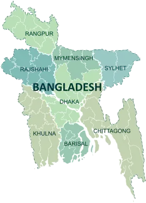 | |
|---|---|---|
| Chittagong Division | ||
| Dhaka Division | ||
| Khulna Division | ||
| Mymensingh Division | ||
| Rajshahi Division | ||
| Rangpur Division | ||
| Sylhet Division | ||
Authority control  | |
|---|---|
| General | |
| National libraries | |
| Other | |