Bureya Range
The Bureya Range (Russian: Буреинский хребет, Bureinskiy Khrebet) is a mountain range in the Khabarovsk Krai in the southern part of the Russian Far East.
| Bureya Range | |
|---|---|
| Russian: Буреинский хребет | |
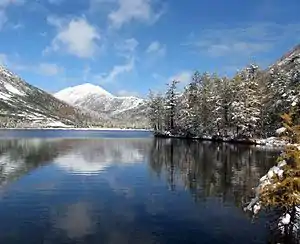 View of Korbokhon lake at the northern end of the range | |
| Highest point | |
| Peak | Unnamed |
| Elevation | 2,167 m (7,110 ft) |
| Dimensions | |
| Length | 400 km (250 mi) |
| Geography | |
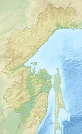  Location in Khabarovsk Krai | |
| Country | Russia |
| Region | Khabarovsk Krai |
| Range coordinates | 50°0′0″N 133°0′0″E |
| Geology | |
| Orogeny | Alpine orogeny |
| Type of rock | Granite, gneiss, sedimentary and effusive rocks |
The Dusse-Alin Tunnel on the Baikal Amur Mainline crosses the range to enter the Amgun River valley.
Geography
The Bureya Range consists of a number of separate ridges with a total length of about 400 km and with a maximum height of 2,167 metres (7,110 ft).[1] To the northeast it connects with the Badzhal Range. The range forms the drainage divide of the Bureya, Amgun and Urmi rivers. The sources of the Selemdzha River are located at the northern end, where other three ranges meet the Bureya mountain chain, the Dusse-Alin from the south, the Ezop Range from the west and the Yam-Alin from the north.[2] The Dusse-Alin and Yam-Alin are a northern prolongation of the Bureya Range.[3]
Flora
The slopes of the range are covered by conifer and deciduous forests.[1]
References
- Bureya Range // Great Soviet Encyclopedia : (in 30 vols.) / Ch. ed. A.M. Prokhorov . - 3rd ed. - M .: Soviet Encyclopedia, 1969-1978.
- Google Earth
- Ям-Алинь — Great Soviet Encyclopedia : (in 30 vols.) - Ch. ed. A.M. Prokhorov. - 3rd ed. - M .: Soviet Encyclopedia, 1969-1978.