Caerfai Bay
Caerfai Bay near St Davids in Pembrokeshire, West Wales has cliffs of purple sandstone and a sandy beach at low tide reached by steep steps. The beach is situated in the Pembrokeshire Coast National Park and on the Pembrokeshire Coast Path. There is free parking above the beach with picnic benches and views of the islands of Penpleidiau, Skomer and Skokholm.[1]
 Caerfai Bay | |
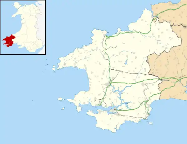  Caerfai Bay Location within Pembrokeshire | |
| OS grid reference | SM 7606 2430 |
|---|---|
| Principal area | |
| Ceremonial county | |
| Country | Wales |
| Sovereign state | United Kingdom |
| Post town | HAVERFORDWEST |
| Postcode district | SA62 |
| Police | Dyfed-Powys |
| Fire | Mid and West Wales |
| Ambulance | Welsh |
Location

Caerfai beach is only 1.4 kilometres (0.87 mi) from centre of the cathedral city of St Davids. Along the coast to the west is the Chapel of St Non (51.8722°N 5.2688°W) which is the most westerly in Wales. On the eastern headland are ramparts of the Iron Age fort of Castell Penpleidiau and Caer Bwdy is next bay to the east.[2][3]
Commercial activity
Caerfai Bay Caravan and Tent Park which started in the 1930s is open between March and November and has static hire, touring and camping pitches which overlook Caerfai Bay.[4] Caerfai Farm is 140 acres (0.57 km2) producing organic milk, cheeses and potatoes using sustainable energy sources, including solar, geothermal, wind and biomass energy.[5] The farm also has a seasonal shop and a campsite.[6]
Geology
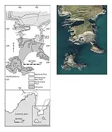
Both western and eastern cliff sections display distinctive red, purple and greenish mudstone and sandstone formations representing the Caerfai and Porth-y-rhaw Groups of lower to middle Cambrian age.[7] Southern tip of the eastern Penpleidiau headland and its small islets are composed of an Intrusive igneous rock loosely and commonly referred to in the literature as felsite. the intrusion is in sharp sill-like contact with baked fossiliferous Middle Cambrian (Drumian) mudstones of the Menevia Formation and Tomagnostus fissus Biozone of Scandinavian biostratigraphic terminology (Rees et al., op. cit.). There are disused quarries below the car park and at Caer Bwdy Bay which provided stone in the original construction of St Davids Cathedral and its more recent stonework renovation during the 1980's.[2][8]
See also
References
- "Caerfai Bay". Archived from the original on 7 August 2009. Retrieved 4 August 2009.
- http://geology.malvernu3a.org.uk/walks/2015/Cecs%20geological%20excursions/Pembrokeshire%20trail%201/index.pdf
- Hare, Alistair. "Caer Bwdy Bay". Wales Beach Guide.
- "Caerfai Bay Caravan & Tent Park, St Davids, Pembrokeshire – Beautiful camping and caravanning holidays in St Davids, Pembrokeshire, Wales".
- Gossmann, Dieter (May 2007). "Caerfai Bay". Guardian. London. Retrieved 4 August 2009.
- "Caerfai Farm". Retrieved 4 August 2009.
- Rees, A. J., Thomas, A. T., Lewis, M. Hughes, H. E., Turner, P. (2014). The Cambrian of SW Wales: Towards a United Avalonian Stratigraphy. Geological Society, London, Memoirs. 42: 1 – 31. https://doi.org/10.1144%2FM42.1
- "St Davids Cathedral: The Cathedral". www.stdavidscathedral.org.uk.