Coran of Portmark
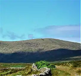
Coran of Portmark is a hill in the Rhinns of Kells, a sub-range of the Galloway Hills range, part of the Southern Uplands of Scotland. The most northerly Donald of the range, it is climbed from a number of directions; most commonly from Garryhorn near Carsphairn, often the first hill of a full traverse of the ridge.[6] An old settlement to the west lends its name to the hill.[7]
| Coran of Portmark | |
|---|---|
 | |
| Highest point | |
| Elevation | 623 m (2,044 ft)[1] |
| Prominence | 61 m (200 ft)[2] |
| Listing | Tu,Sim,D,GT,DN[3] |
| Naming | |
| English translation | Scottish Gaelic: Round Hill (or Hook) of Portmark [4][5] |
| Geography | |
| Location | Dumfries and Galloway, Scotland |
| Parent range | Rhinns of Kells, Galloway Hills |
| OS grid | NX 50930 93667 |
| Topo map | OS Landranger 77 |
References
This article is issued from Wikipedia. The text is licensed under Creative Commons - Attribution - Sharealike. Additional terms may apply for the media files.