Cut Knife, Saskatchewan
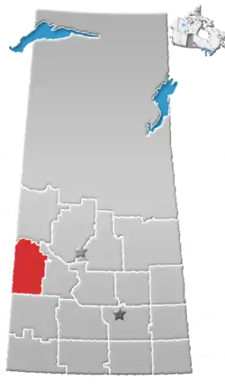
Cut Knife is a town located in the Canadian province of Saskatchewan on Highway 40, north-west of Saskatoon and 55 km (34 miles) west of North Battleford. The population of Cut Knife in 2011 was 517.
Cut Knife | |
|---|---|
Town | |
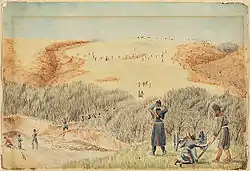 Battle of Cut Knife Creek | |
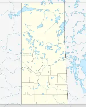  Cut Knife Location of Cut Knife in Saskatchewan | |
| Coordinates: 52°44′44″N 109°01′14″W | |
| Country | Canada |
| Province | Saskatchewan |
| Rural municipality | Cut Knife |
| Post Office established: | 1905-11-01 |
| Government | |
| • Mayor | Gwenn Kaye |
| • Administrator | Jennifer King |
| Area | |
| • Total | 1.99 km2 (0.77 sq mi) |
| Population (2016)[1] | |
| • Total | 573 |
| • Density | 259.3/km2 (672/sq mi) |
| Time zone | UTC−6 (Central Standard Time) |
| • Summer (DST) | UTC−5 |
| Postal code | S0M 0N0 |
| Highways | .svg.png.webp) Hwy 40 Hwy 40 |
| Website | Official website |
| [2][3] | |
Nearby are Poundmaker Cree Nation and Little Pine First Nation to the north in Paynton, Sweetgrass First Nation to the east, and Hillsvale Hutterite Colony located to the north-west of the town.[4]
History
Cut Knife is named after Cut Knife Hill (now called Chief Poundmaker Hill) situated on the Poundmaker reserve. The hill was named after a Sarcee chief killed nearby by the Cree in the 1840s.[4][5]
The town is located close to the site of the Battle of Cut Knife which occurred during the North-West Rebellion of 1885.
Demographics
| Canada census – Cut Knife, Saskatchewan community profile | |||
|---|---|---|---|
| 2011 | 2006 | ||
| Population: | 517 (-2.8% from 2006) | 532 (-4.3% from 2001) | |
| Land area: | 1.99 km2 (0.77 sq mi) | 1.99 km2 (0.77 sq mi) | |
| Population density: | 259.3/km2 (672/sq mi) | 266.8/km2 (691/sq mi) | |
| Median age: | 46.9 (M: 46.7, F: 47.3) | 48.2 (M: 47.0, F: 49.2) | |
| Total private dwellings: | 258 | 270 | |
| Median household income: | |||
| References: 2011[6] 2006[7] earlier[8] | |||
Attractions
At Cut Knife is the "World's Largest Tomahawk", the Poundmaker Historical Centre and the Big Bear monument. There is also now, correctly located, a cairn erected by the Historic Sites and Monuments Board of Canada upon Cut Knife Hill overlooking the Poundmaker Battle site and Battle River valley.[5][9][10]
The tomahawk is located in the Tomahawk Park next to the Clayton McLain Memorial Museum. It was built in 1971 as a symbol of unity and friendship with the First Nations of the area.[4][5] It was designed in 1970 by UMA Engineering of Saskatoon, Saskatchewan.
See also
References
- "2011 Community Profiles". Statistics Canada. Government of Canada. Retrieved 2013-11-02.
- National Archives, Archivia Net. "Post Offices and Postmasters". Archived from the original on 2006-10-06. Retrieved 2013-05-01.
- Government of Saskatchewan, MRD Home. "Municipal Directory System". Archived from the original on 2016-01-15. Retrieved 2013-05-01.
- "Town of Cut Knife website". Town of Cut Knife. Retrieved 2013-11-02.
- McLennan, David (2006). "Cut Knife". Canadian Plains Research Center University of Regina. Archived from the original on September 11, 2012. Retrieved September 20, 2009.
- "2011 Community Profiles". 2011 Canadian Census. Statistics Canada. July 5, 2013. Retrieved 2013-11-02.
- "2006 Community Profiles". 2006 Canadian Census. Statistics Canada. March 30, 2011. Retrieved 2013-11-02.
- "2001 Community Profiles". 2001 Canadian Census. Statistics Canada. February 17, 2012.
- Brown., Brian M (July 4, 2002). "Poundmaker Historical Centre and Big Bear monument". Retrieved September 20, 2009.
- Yanciw, David (August 10, 2001). "Town of Cut Knife, Saskatchewan". Big Things of Saskatchewan. Archived from the original on October 6, 2009. Retrieved September 20, 2009.
Places adjacent to Cut Knife, Saskatchewan | |
|---|---|



.svg.png.webp)