Damala Hagare
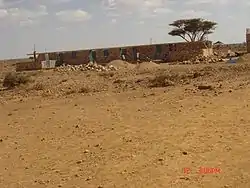
Damala Hagare (Somali: Damala Xagare) is a town in the Sanaag region of Somaliland.
Damala Hagare | |
|---|---|
Town | |
 | |
.svg.png.webp)  Damala Hagare Location in Somaliland | |
| Coordinates: 9°48′N 47°56′E | |
| Country |  Somaliland Somaliland |
| Region | Sanaag |
| District | Erigavo |
| Population (2007[1]) | |
| • Total | 1,560 |
| Time zone | UTC+3 |
Overview
The district's name is derived from the root word "Damal", which means acacia woodland in the Somali language.
Damala Xagare has a population of well over 40,000. The town is located in the Hadeed Plateau, a tract of land that covers the middle of a large area of the Sool Plateau, beginning south of Carmaale village and extending as far as the depression zone south of Hingalol town. Most of this area is covered by gypsum and gypsiferous soils with minor areas of limestone.
Because of its patches of acacia trees, the land is used for communal grazing of livestock. The local community also practices wildlife conservation.
References
- WFP Somalia (April 2007). "Puntland Food Security and Vulnerability Assessment" (PDF). Retrieved 2021-06-17.
This article is issued from Wikipedia. The text is licensed under Creative Commons - Attribution - Sharealike. Additional terms may apply for the media files.