Tamsui River
The Tamsui River (alternatively Danshui River, Chinese: 淡水河; pinyin: Dànshǔi Hé; Wade–Giles: Tan4-shui3 Ho2; Pe̍h-ōe-jī: Tām-chúi-hô; lit. 'Freshwater River') is third longest river in Taiwan after Zhuoshui River and Gaoping River, with a total length of 158.7 km (98.6 mi), flowing through Taoyuan, Taipei and New Taipei City. It is located in northern part of the island.
| Tamsui River | |
|---|---|
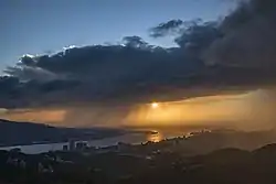 The mouth of Tamsui River | |
| Native name | 淡水河 |
| Location | |
| Country | Taiwan |
| Physical characteristics | |
| Source | |
| • location | Pintian Mountain |
| • elevation | 3,529 metres (11,578 ft) |
| Mouth | |
• location | Taiwan Strait |
• elevation | 0 metres (0 ft) |
| Length | 158.7 kilometres (98.6 mi) |
| Basin size | 2,726 square kilometres (1,053 sq mi) |
| Discharge | |
| • average | 210 cubic metres per second (7,400 cu ft/s) |
| • maximum | 13,600 m3/s (480,000 cu ft/s) |
Geography
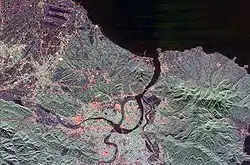
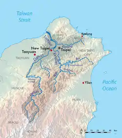
The Tamsui River begins at the confluence of Xindian River and Dahan River at the western boundary of Taipei and New Taipei City, just north of Banqiao District, and flows northward and northwestward, passing the eponymous Tamsui District, then emptying into the Taiwan Strait. Formerly known as the "Dolatok River", it is one of the few rivers in the island that flows along a north–south direction.[1]
The river's three tributaries are the Xindian River, Dahan River and Keelung River. The Dahan River is the main tributary and has its headwaters in the Pintian Mountain in Hsinchu County and flows through Hsinchu County, Taoyuan City and New Taipei City. As a river system including the Dahan River, the Tamsui River has a total length of 159 km (99 mi) and a drainage area of 2,726 km2 (1,053 sq mi).[2]
A major artificial distributary on the left bank of the Tamsui, the Erchong Floodway, was completed in 1984 as part of a flood control scheme for the Taipei Basin.
Pollution
The Tamsui River is heavily polluted by both raw sewage and industrial pollution from illegal industry. Clean up and natural river restoration is on the agenda of the Taipei City Government, Taiwan Central Government and several citizen organizations.[3][4]
Bridges
Several famous bridges run across the river, from south to north downstream:
- Zhongxing Bridge
- Zhongxiao Bridge
- Taipei Bridge
- Danshui River Bridge
- Chong Yang Bridge
- Guandu Bridge
- Danjiang Bridge (under construction)[5]
- Lover Bridge of Tamsui (incomplete crossing within Tamsui only)
See also
References
 |
Wikimedia Commons has media related to Danshui River. |
- Campbell, William (1903). "Explanatory Notes". Formosa under the Dutch: described from contemporary records, with explanatory notes and a bibliography of the island. London: Kegan Paul. p. 541. OCLC 644323041.
- "Chapter 1: Geography & Demographics". The Republic of China Yearbook 2014 (PDF). Executive Yuan, R.O.C. 2014. p. 44. ISBN 9789860423020.
- Taipei from the River - Marco Casagrande, E-Architect March, 2011
- Tamshui River Restoration Project Commercial, Taipei City Government, retrieved November 29, 2012.
- "Second phase of new Danjiang Bridge over Tamsui River begin". China Post. Retrieved 25 May 2020.
Authority control  | |
|---|---|
| General | |
| National libraries | |