Destrehan, Louisiana
Destrehan is a census-designated place (CDP) in St. Charles Parish, Louisiana, United States. At the 2020 census, its population was 11,340.[1]
Destrehan | |
|---|---|
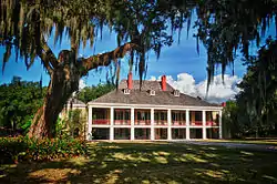 Destrehan Plantation est.1780–1790 | |
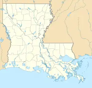  Destrehan Location of Destrehan in Louisiana | |
| Coordinates: 29°57′44″N 90°22′09″W | |
| Country | United States |
| State | Louisiana |
| Parish | St. Charles |
| Area | |
| • Total | 7.9 sq mi (20 km2) |
| • Land | 6.9 sq mi (18 km2) |
| • Water | 1.0 sq mi (3 km2) |
| Elevation | 10 ft (3 m) |
| Population (2020) | |
| • Total | 11,340 |
| • Density | 1,400/sq mi (550/km2) |
| Time zone | UTC-6 (CST) |
| • Summer (DST) | UTC-5 (CDT) |
| Area code(s) | 985 |
Destrehan Plantation, his former home, is listed on the National Register of Historic Places. The main house has been restored and is one of the attractions on the Great River Road along the Mississippi River.
Etymology
The community is named after Jean Noël Destréhan (1754–1823), who was twice President of the Orleans Territory's legislative council during his service there in 1806 and 1811. He was elected to the United States Senate when Louisiana became a state in 1812, but he resigned after a month. He served in the Louisiana State Senate from 1812 to 1817.[2]
History
George Prince tragedy
Before the Hale Boggs Memorial Bridge was completed connecting the communities of Destrehan and Luling, automobile ferries connected the towns. On October 20, 1976, one of these ferries, the George Prince, was struck by a tanker and capsized as it crossed the Mississippi River resulting in the MV George Prince ferry disaster. Seventy-eight passengers and crew died.
Gary Tyler case
Destrehan was briefly notorious in 1974 for the case of Gary Tyler, a 17 year old black student who was accused by local officials of the murder of 13 year old white student and the wounding of another, on a day of violent protests by white students at Destrehan High School. Many observers believe his conviction and trial were unfair and flawed. He was convicted and sentenced to prison. He was released from prison in 2016.[3]
Geography
Destrehan is located at 29°57′44″N 90°22′9″W (29.962307, -90.369160).[4]
According to the United States Census Bureau, the CDP has a total area of 7.9 square miles (20 km2), of which 6.9 square miles (18 km2) are land and 1.0-square-mile (2.6 km2) (12.41%) is water.
Education
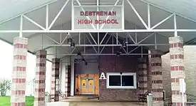
St. Charles Parish Public School System operates public schools:
- Destrehan High School (9–12)
- Harry M. Hurst Middle School (Formerly 7–8 & presently 6–8)
- Ethel Schoeffner Elementary School (Formerly 4–6 & presently 3–5)
- New Sarpy Elementary School (Formerly PK–3 & presently PK–2)
In popular culture
Destrehan Plantation was used as a set in the film 12 Years a Slave (2013).[5]
Notable people
- Paul Boudreau, assistant coach of the New Orleans Saints
- Joel Chaisson, District Attorney and Louisiana State Senate President
- Jean Noël Destréhan, U.S. Senator
- Jesse Duplantis, televangelist
- Hoffman Franklin Fuller, professor-emeritus at Tulane University Law School
- Shelley Hennig, actress and Miss Teen USA 2004
- Dalton Hilliard, NFL running back for the New Orleans Saints
- Joe Horn, NFL wide receiver for the Kansas City Chiefs, New Orleans Saints and Atlanta Falcons
- Harry J. Kember Jr., member of the Louisiana House of Representatives
- Tanner Lee, NFL quarterback for the Jacksonville Jaguars
- Gregory A. Miller, member of the Louisiana House of Representatives
- Jim E. Mora, head coach of the New Orleans Saints
- Ed Reed, NFL safety for the Baltimore Ravens
- Bum Phillips, head coach of the New Orleans Saints
- Mike Scifres, NFL punter for the San Diego Chargers
- Byron O. Thomas, known by stage name Mannie Fresh, rapper and producer
- Devon Walker, safety for Tulane University and New Orleans Saints
References
- "2020 Race and Population Totals". United States Census Bureau. Retrieved 2021-10-25.
- "Dictionary of La. Biography". Archived from the original on 2016-09-25. Retrieved 2015-03-10.
- Bob Herbert, "Gary Tyler’s Lost Decades", The New York Times, 5 February 2007
- "US Gazetteer files: 2010, 2000, and 1990". United States Census Bureau. 2011-02-12. Retrieved 2011-04-23.
- Scott, Mike (September 9, 2013). "Following in the real footsteps of '12 Years a Slave' figure Solomon Northup: Mike's Movie Mailbag". The Times-Picayune. Advance Publications. Retrieved October 25, 2013.
 |
Wikimedia Commons has media related to Destrehan, Louisiana. |
Municipalities and communities of St. Charles Parish, Louisiana, United States | ||
|---|---|---|
| CDPs | 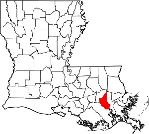 | |
| Other communities | ||
| Footnotes | ‡This populated place also has portions in an adjacent parish or parishes | |
| ||


Authority control  | |
|---|---|
| General | |
| National libraries | |