Dokri
Dokri (Sindhi: ڏوڪري D̤okrī) is a town in Larkana District, Sindh province of Pakistan and is the capital town of the Dokri Taluka.[1] The town is located at 27° 22' 29" N 68° 05' 50" E and has an elevation of 39 metres.[2] Mohenjodaro is situated 7 km away in East-South of the Dokri town. The town has been the scene of several leftist and progressive movements in the past.[3] There are girls and boys primary and secondary schools and colleges in the town. Rice Research Institute is situated in the west of the town along Mohen-jo-Daro Railway Station road. Dokri is famous for rice production in Asia due to the hot & humid climatic conditions. Dokri is taluka headquarters since 1906. Dokri is the one of the oldest town in sindh. There are many social organizations working here. In the every field of life Dokrian plays vital role.[4] Samtiya is the union Council of dokri the population of samtiya is around 3483 there are seven castes living kaandhra is major caste of samtiya and there are also 6 other castes living they are Soomra,Chana, Mashie,Khokhar,Malah and Gadhi Mola Bux Kandhro is the president of UC Samtiya There are 3 Schools in Samtiya Government Boys Primary School Samtiya, Government Girls Primary School Samtiya and Government Middle school Samtiya.
Dokri
ڏوڪري Lab-e-Darya | |
|---|---|
Town | |
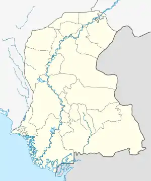  Dokri Location in Pakistan | |
| Coordinates: 27°22′29″N 68°05′50″E | |
| Country |  Pakistan Pakistan |
| Province | Sindh |
| Region | Sindh |
| District | Larkano |
| Capital | Dokri |
| Towns | 2 |
| Union Councils | 13 |
| Area | |
| • Total | 4 km2 (2 sq mi) |
| Highest elevation | 39 m (128 ft) |
| Population (2015) | |
| • Total | 522,391 |
| Time zone | UTC+5 (PST) |
| • Summer (DST) | UTC+6 (PDT) |
| Area code(s) | 074 |
Other towns near Dokri
These are the closest towns with coordinates to this town.
- Garello (4.3 miles / 7.0 km N/NW)
- Badah (6.0 miles / 9.7 km SW)
- Samtiya (10.7 miles / 17.3 km S/SW)
- Nasirabad (11.6 miles / 18.7 km W)
- Larkana (14.1 miles / 22.8 km N/NE)
- Kambar (16.0 miles / 25.7 km N/NW)
- Radhan (16.6 miles / 26.7 km S/SW)
- Warah (19.0 miles / 30.6 km W/NW)
- Sobhodero (19.2 miles / 30.9 km E/SE)
- Hingorja (22.3 miles / 36.0 km E/SE)
- Mehar (22.5 miles / 36.2 km SW)
References
- Union Administrations of Taluka Dokri Archived August 7, 2007, at the Wayback Machine
- "Location of Dokri - Falling Rain Genomics". Fallingrain.com. Retrieved 2011-07-12.
- Dokri in a shambles - Dawn Pakistan Archived July 13, 2007, at the Wayback Machine
- Wiesmann, U. N.; DiDonato, S.; Herschkowitz, N. N. (1975-10-27). "Effect of chloroquine on cultured fibroblasts: release of lysosomal hydrolases and inhibition of their uptake". Biochemical and Biophysical Research Communications. 66 (4): 1338–1343. doi:10.1016/0006-291x(75)90506-9. ISSN 1090-2104. PMID 4.