Eagle Hill (Louisiana)
Eagle Hill (French: Colline d'Aigle) is a mountain in Sabine Parish, Louisiana and is the among the highest points in Louisiana.
| Eagle Hill | |
|---|---|
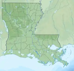  Eagle Hill Location of Eagle Hill within Louisiana | |
| Highest point | |
| Elevation | 459 feet (140 m)[1] |
| Coordinates | 31°24′00″N 93°17′02″W[1] |
| Geography | |
| Location | Sabine Parish, Louisiana, U.S. |
| Topo map | USGS Peason |
Location
Eagle Hill is located approximately 2 miles (3.2 km) south of Peason, Louisiana. It is also about 4 miles (6.4 km) west of the Kisatchie National Forest. This hill is primarily part of the foothills leading to the Ouachita Mountains in Arkansas.
References
- "Eagle Hill". Geographic Names Information System. United States Geological Survey. Retrieved 2018-09-03.
This article is issued from Wikipedia. The text is licensed under Creative Commons - Attribution - Sharealike. Additional terms may apply for the media files.