Eger (Tisza)
Eger (Hungarian: Eger-patak; "Eger Stream") is the longest watercourse in and around the city Eger in Hungary. From the area by the village of Balaton, by the Vajda well, the stream flows through the valley of Eger between the Bükk and Mátra mountains.[1] After 68 kilometers in a south-easterly direction, the stream empties into Lake Tisza (Tisza) from the right side.[2] The length of the main branch is about 40 kilometers. Almost the entire area of the districts of Eger and Bélapátfalva lies in the catchment area of the watercourse, therefore it is a crucial component in the hydrography of the region. The stream is part of the Eger–Laskó–Csincse water system.[3]
| Eger | |
|---|---|
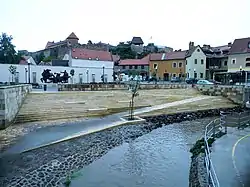 Eger Stream in Eger | |
| Location | |
| Country | Hungary |
| Physical characteristics | |
| Source | Close to the village of Balaton |
| • location | Hungary |
| • coordinates | 48.1108°N 20.2884°E |
| • elevation | 360 m (1,180 ft) |
| Mouth | |
• location | Lake Tisza |
• coordinates | 47.6788°N 20.7131°E |
• elevation | 83 m (272 ft) |
| Length | 68 km (42 mi) |
| Basin size | 1,379 km2 (532 sq mi) |
| Discharge | |
| • average | 3.237 m3/s (114.3 cu ft/s) |
| Basin features | |
| Progression | Tisza→ Danube→ Black Sea |
| Tributaries | |
| • left | Csincse-patak, Kánya-patak, Tárkányi-patak, Gilitka-patak, Recska-patak |
| • right | Almár-patak, Villói-patak, Bekölcei-patak |
The stream is known by the name Rima (Rima-patak) in the lower reaches, downstream from the village of Nagytálya.
References
- "Encircle Photos". Retrieved 23 June 2021.
- "Ahol az Eger-patak ered". Retrieved 23 June 2021.
- "Bükk és Borsodi-Mezőség tervezési alegység". Archived from the original on 2013-09-27. Retrieved 23 June 2021.
External links
 |
Wikimedia Commons has media related to Eger. |