Etna, Pennsylvania
Etna is a borough in Allegheny County in the U.S. state of Pennsylvania, along the Allegheny River, opposite Pittsburgh.
Etna, Pennsylvania | |
|---|---|
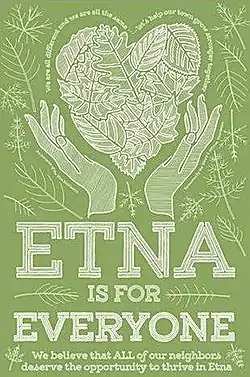 Etna’s Etna is For Everyone poster | |
| Motto(s): Etna is for Everyone | |
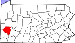
 Location in Allegheny County and the U.S. state of Pennsylvania. | |
.svg.png.webp) Location of Pennsylvania in the United States | |
| Coordinates: 40°30′1″N 79°56′56″W | |
| Country | United States |
| State | Pennsylvania |
| County | Allegheny County |
| Area | |
| • Total | 0.79 sq mi (2.06 km2) |
| • Land | 0.73 sq mi (1.89 km2) |
| • Water | 0.06 sq mi (0.17 km2) |
| Population (2010) | |
| • Total | 3,451 |
| • Estimate (2019)[2] | 3,308 |
| • Density | 4,531.51/sq mi (1,748.68/km2) |
| Time zone | UTC-5 (EST) |
| • Summer (DST) | UTC-4 (EDT) |
| ZIP code | 15223 |
| FIPS code | 42-24160 |
| Website | www |
In 2019 Etna was recognized as the first ever EcoDistrict. Etna is focused on social and environmental justice for its community, environment and neighbors through outreach and revitalization. Considered one part of the triboro EcoDistrict, Etna stands apart in its recognition of visual arts and attention to the importance of expression through art.
Etna hosts an annual Art Tour in the last two weeks of September. The Etna Art Tour features tours of local art studios in the neighborhood, local food trucks and restaurants, neighborhood shops and live music.
The Etna Riverfront Trail is set to open October 22nd 2021. The Etna segment of the Riverfront trail project will connect via bike path to a series of Riverfront Parks including Millvale, The North Shore, Sharpsburg and Aspinwall.
Etna was named after the volcano Mount Etna,[3] an allusion to blast furnaces, steel mills, galvanized-pipe works, and other manufacturers located there; historically a steel town with a blue collar community. In 1900, 5,384 people lived in Etna. In 1940, 7,223 lived there. The population was 3,451 at the 2010 census.[4]
Ecodistrict
Etna is the first ever recognized EcoDistrict in the US, focused on Equality, Social Justice and Environmental Justice. Etna has created countless rain gardens, an EcoPark, a solar charging station for electric vehicles, and a community food pantry.
Etna's motto: "Etna Is For Everyone" focuses on inclusion and solidarity as a community.
Geography
Etna is located at 40°30′1″N 79°56′56″W (40.500338, -79.948755).[5]
According to the United States Census Bureau, the borough has a total area of 0.8 square miles (2.1 km2), all of it land.
Etna Art Tour
The Etna Art Tour takes place at the end of September annually. The Etna Art Tour is a walking tour of local art studios in the neighborhood and typically features live music, food trucks, local eateries, pop up shops and quirky boutiques.
Founded in 2014, The Etna Art Tour has been featured in Artsburgh, Pittsburgh City Paper, PittsburghPost Gazette and many other local publications.
Surrounding communities
Etna is almost entirely bordered by Shaler Township with its only other border being with the borough of Sharpsburg to the southeast.
Etna is neighboring to Millvale, Pennsylvania. And just down the river from Pittsburgh, Pennsylvania.
Taxes
School tax millage rate- The Shaler School District (shared with Millvale, Shaler Township and Reserve Township) in 2017 was 23.28. This ranked 16th highest/most expensive out of Allegheny County's 45 school districts [between Cornell SD (15th highest) and Riverview SD (17th highest)].[6]
Demographics
| Historical population | |||
|---|---|---|---|
| Census | Pop. | %± | |
| 1870 | 1,447 | — | |
| 1880 | 2,334 | 61.3% | |
| 1890 | 3,707 | 58.8% | |
| 1900 | 5,384 | 45.2% | |
| 1910 | 5,830 | 8.3% | |
| 1920 | 6,341 | 8.8% | |
| 1930 | 7,493 | 18.2% | |
| 1940 | 7,223 | −3.6% | |
| 1950 | 6,750 | −6.5% | |
| 1960 | 5,519 | −18.2% | |
| 1970 | 5,819 | 5.4% | |
| 1980 | 4,534 | −22.1% | |
| 1990 | 4,200 | −7.4% | |
| 2000 | 3,924 | −6.6% | |
| 2010 | 3,451 | −12.1% | |
| 2019 (est.) | 3,308 | [2] | −4.1% |
| Sources:[7][8][9][10][11][12][13] | |||
As of the census[12] of 2000, there were 3,924 people, 1,749 households, and 981 families residing in the borough. The population density was 5,254.8 people per square mile (2,020.1/km2). There were 1,934 housing units at an average density of 2,589.9 per square mile (995.6/km2). The racial makeup of the borough was 97.78% White, 0.76% African American, 0.36% Native American, 0.15% Asian, 0.15% from other races, and 0.79% from two or more races. Hispanic or Latino of any race were 1.15% of the population.
There were 1,749 households, out of which 26.6% had children under the age of 18 living with them, 38.2% were married couples living together, 13.7% had a female householder with no husband present, and 43.9% were non-families. 38.5% of all households were made up of individuals, and 15.8% had someone living alone who was 65 years of age or older. The average household size was 2.22 and the average family size was 3.01.
In the borough the population was spread out, with 22.6% under the age of 18, 8.0% from 18 to 24, 31.7% from 25 to 44, 20.6% from 45 to 64, and 17.1% who were 65 years of age or older. The median age was 39 years. For every 100 females there were 89.1 males. For every 100 females age 18 and over, there were 84.6 males.
The median income for a household in the borough was $31,529, and the median income for a family was $41,577. Males had a median income of $31,386 versus $23,601 for females. The per capita income for the borough was $17,580. About 7.5% of families and 9.2% of the population were below the poverty line, including 12.0% of those under age 18 and 17.5% of those age 65 or over.
See also
References
- "2019 U.S. Gazetteer Files". United States Census Bureau. Retrieved July 28, 2020.
- "Population and Housing Unit Estimates". United States Census Bureau. May 24, 2020. Retrieved May 27, 2020.
- "What's in a name? For some, a bit of history". Pittsburgh Post-Gazette. May 10, 1984. p. 2. Retrieved 16 May 2015.
- "Race, Hispanic or Latino, Age, and Housing Occupancy: 2010 Census Redistricting Data (Public Law 94-171) Summary File (QT-PL), Etna borough, Pennsylvania". United States Census Bureau. Retrieved September 19, 2011.
- "US Gazetteer files: 2010, 2000, and 1990". United States Census Bureau. 2011-02-12. Retrieved 2011-04-23.
- EL. "Allegheny County Treasurer". Retrieved 1 September 2017.
- "Population of Civil Divisions Less than Counties" (PDF). 1880 United States Census. U.S. Census Bureau. Retrieved 24 November 2013.
- "Population-Pennsylvania" (PDF). U.S. Census 1910. U.S. Census Bureau. Retrieved 22 November 2013.
- "Number and Distribution of Inhabitants:Pennsylvania-Tennessee" (PDF). Fifteenth Census. U.S. Census Bureau.
- "Number of Inhabitants: Pennsylvania" (PDF). 18th Census of the United States. U.S. Census Bureau. Retrieved 22 November 2013.
- "Pennsylvania: Population and Housing Unit Counts" (PDF). U.S. Census Bureau. Retrieved 22 November 2013.
- "U.S. Census website". United States Census Bureau. Retrieved 2008-01-31.
- "Annual Estimates of the Resident Population". U.S. Census Bureau. Archived from the original on 20 November 2013. Retrieved 22 November 2013.
External links
| Counties |  Map of the Pittsburgh Tri-State with green counties in the metropolitan area and yellow counties in the combined area | |
|---|---|---|
| Major cities | ||
| Cities and towns 15k–50k (in 2010) | ||
| Airports | ||
| Topics | ||
| ||

Authority control  | |
|---|---|
| General | |
| National libraries | |