Fogo Island, Newfoundland and Labrador
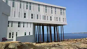
Fogo Island is a town located on Fogo Island, the largest of the offshore islands in the province of Newfoundland and Labrador, Canada.
Fogo Island | |
|---|---|
Town | |
| Town of Fogo Island | |
 | |
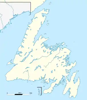  Fogo Island Location of Fogo Island in Newfoundland | |
| Coordinates: 49°40′N 54°11′W | |
| Country | Canada |
| Province | Newfoundland and Labrador |
| Incorporated[1] | March 1, 2011 |
| Population (2016)[2] | |
| • Total | 2,244 |
| Time zone | UTC-3:30 (Newfoundland Time) |
| • Summer (DST) | UTC-2:30 (Newfoundland Daylight) |
| Area code(s) | 709 |
| Highways |  MV Veteran MV Veteran Route 333 Route 333 Route 334 Route 334 |
| Website | Town of Fogo Island |
History
The Town of Fogo Island was incorporated on March 1, 2011 following the amalgamation of four towns – Fogo, Joe Batt's Arm-Barr'd Islands-Shoal Bay, Seldom-Little Seldom and Tilting – with the unincorporated balance of the Fogo Island.[1]
Demographics
In the 2016 Census of Population conducted by Statistics Canada, the Town of Fogo Island recorded a population of 2,244 living in 979 of its 1,460 total private dwellings, a -6.3% change from its 2011 population of 2,395. With a land area of 237.65 km2 (91.76 sq mi), it had a population density of 9.4/km2 (24.5/sq mi) in 2016.[2]
| Name | Former status |
Population (2016) |
Population (2011) |
Per cent change (%) |
Occupied dwellings |
Private dwellings |
Land area (km²) |
Population density |
|---|---|---|---|---|---|---|---|---|
| Fogo[3] | Town | 658 | 658 | 0.0 | 289 | 349 | 5.92 | 111.2 |
| Joe Batt's Arm-Barr'd Islands-Shoal Bay[3] | Town | 630 | 685 | -8.0 | 282 | 399 | 26.02 | 24.2 |
| Seldom-Little Seldom[4] | Town | 386 | 427 | -9.6 | 151 | 180 | 14.60 | 26.4 |
| Tilting[4] | Town | 173 | 204 | -15.2 | 84 | 152 | 17.63 | 9.8 |
| Balance of Fogo Island[5] | Unincorporated | 397 | 421 | -5.7 | 979 | 1,460 | 173.48 | 2.3 |
| Fogo Island[5] | 2,244 | 2,395 | -6.3 | 979 | 1,460 | 237.65 | 9.4 | |
Transportation
Fogo Island is accessible by ferry or air.[6] The local airstrip is the Fogo Aerodrome.[6]
References
- "Interim List of Changes to Municipal Boundaries, Status, and Names From January 2, 2011 to January 1, 2012 (Table 1 - Changes to census subdivisions in alphabetical order by province and territory)" (XLSX). Statistics Canada. November 14, 2012. Retrieved December 3, 2012.
- "Population and dwelling counts, for Canada, provinces and territories, and census subdivisions (municipalities), 2016 and 2011 censuses – 100% data (Newfoundland and Labrador)". Statistics Canada. February 8, 2017. Retrieved February 11, 2017.
- "Census Profile, 2016 Census: Fogo, Town [Dissolved census subdivision], Newfoundland and Labrador and Joe Batt's Arm-Barr'd Islands-Shoal Bay, Town [Dissolved census subdivision], Newfoundland and Labrador". Statistics Canada. August 9, 2019. Retrieved September 25, 2021.
- "Census Profile, 2016 Census: Seldom-Little Seldom, Town [Dissolved census subdivision], Newfoundland and Labrador and Tilting, Town [Dissolved census subdivision], Newfoundland and Labrador". Statistics Canada. August 9, 2019. Retrieved September 25, 2021.
- "Census Profile, 2016 Census: Fogo Island Region (Part), Region [Dissolved census subdivision], Newfoundland and Labrador and Fogo Island, Town [Census subdivision], Newfoundland and Labrador". Statistics Canada. August 9, 2019. Retrieved September 25, 2021.
- "Travel to Fogo Island". Town of Fogo Island. Retrieved September 25, 2021.