Regional District of Fraser-Fort George
The Regional District of Fraser–Fort George (RDFFG) is a regional district located in the Central Interior of British Columbia. It is bounded by the Alberta border to the east, the Columbia-Shuswap and Thompson-Nicola Regional Districts to the south/southeast, Cariboo Regional District to the southwest, the Regional District of Bulkley-Nechako to the west, and the Peace River Regional District to the north/northeast. As of the Canada 2011 Census, the Regional District had a population of 91,879, and a land area of 51,083.73 km2 (19,723.54 sq mi). The offices of the Regional District are located at Prince George.
Fraser–Fort George | |
|---|---|
| Regional District of Fraser–Fort George | |
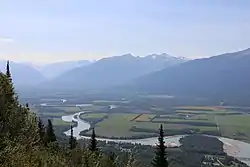 Upper Fraser River | |
 Logo | |
Major communities | |
 Location in British Columbia | |
| Country | Canada |
| Province | British Columbia |
| Administrative office location | Prince George |
| Government | |
| • Type | Regional district |
| • Body | Board of directors |
| • Chair | Art Kaehn (E) |
| • Vice chair | Lara Beckett (C) |
| • Electoral areas |
|
| Area | |
| • Land | 50,676.10 km2 (19,566.15 sq mi) |
| Population (2016)[2] | |
| • Total | 94,506 |
| • Density | 1.86/km2 (4.8/sq mi) |
| Website | rdffg.bc.ca |


Communities
Cities
District Municipality
Regional District Electoral Areas
- Fraser–Fort George A - Salmon River–Lakes
- Fraser–Fort George C - Chilako River–Nechako
- Fraser–Fort George D - Tabor Lake–Stone Creek
- Fraser–Fort George E - Woodpecker–Hixon
- Fraser–Fort George F - Willow River–Upper Fraser
- Fraser–Fort George G - Crooked River–Parsnip
- Fraser–Fort George H - Robson Valley–Canoe
Indian Reserves
NB Indian Reserves are not part of municipal or regional district governance and are outside the regional district's jurisdiction, and also counted separately in the census figures.
- Fort George (Shelley) Indian Reserve No. 2
- McLeod Lake Indian Reserve No. 1
- Parsnip Indian Reserve No. 5
Designated Places
Demographics
| Ethnic groups in Fraser–Fort George RD (2016) Source: | Population | % | |
|---|---|---|---|
| Ethnic group | European | 69,660 | 75% |
| Aboriginal | 13,785 | 14.8% | |
| South Asian | 2,640 | 2.8% | |
| Filipino | 1,180 | 1.3% | |
| Chinese | 965 | 1% | |
| Black | 755 | 0.8% | |
| Southeast Asian | 280 | 0.3% | |
| Latin American | 275 | 0.3% | |
| Japanese | 255 | 0.3% | |
| Korean | 170 | 0.2% | |
| Arab | 130 | 0.1% | |
| West Asian | 85 | 0.1% | |
| Multiple minorities | 150 | 0.2% | |
| Visible minority, n.i.e. | 90 | 0.1% | |
| Total population | 94,506 | 100% | |
(Statistics Canada, 2011)
- Population: 91,879 (39,237 private dwellings)
References
- "Board of Directors". Retrieved 2019-07-09.
External links
 |
Wikimedia Commons has media related to Regional District of Fraser-Fort George. |
Places adjacent to Regional District of Fraser-Fort George | |
|---|---|


Subdivisions of British Columbia | ||
|---|---|---|
| Subdivisions | 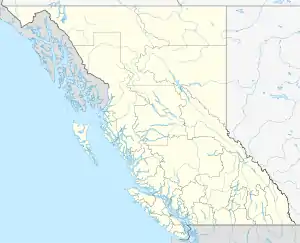 | |
| Communities | ||
| Metro areas and agglomerations | ||
| Regional districts |
| |
| ||


