Hahnville, Louisiana
Hahnville is a census-designated place (CDP) in and the parish seat of St. Charles Parish, Louisiana, United States.[1] The population was 2,792 at the 2000 census and 2,959 in 2020.[2] For information on the origin of Hahnville, see Michael Hahn (1830–1886).
Hahnville, Louisiana | |
|---|---|
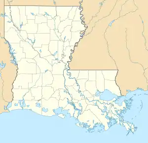  Hahnville, Louisiana Location of Hahnville in Louisiana | |
| Coordinates: 29°58′01″N 90°24′36″W | |
| Country | United States |
| State | Louisiana |
| Parish | St. Charles |
| Area | |
| • Total | 8.8 sq mi (23 km2) |
| • Land | 7.8 sq mi (20 km2) |
| • Water | 1.0 sq mi (3 km2) |
| Elevation | 13 ft (4 m) |
| Population (2020) | |
| • Total | 2,959 |
| • Density | 340/sq mi (130/km2) |
| Time zone | UTC-6 (CST) |
| • Summer (DST) | UTC-5 (CDT) |
| ZIP Code | 70057 |
| Area code(s) | 504 |
Geography
Hahnville is located at 29°58′1″N 90°24′36″W (29.967081, -90.410129).[3]
According to the United States Census Bureau, the CDP has a total area of 8.8 square miles (23 km2), of which 7.8 square miles (20 km2) is land and 1.0 square mile (2.6 km2) (11.79%) is water.
Education
St. Charles Parish Public School System operates public schools:
- Hahnville High School in Boutte, on the west bank of the Mississippi River.[4]
Notable people
- LaRon Byrd – NFL wide receiver
- Mutt Carey – American jazz trumpeter
- Michael Hahn – 19th-century State Judge, Governor and U.S. Representative
- Mary Ann Vial Lemmon – Federal judge
- Herb Simpson, Negro league and minor league baseball player
References
- "Find a County". National Association of Counties. Retrieved 2011-06-07.
- "2020 Race and Population Totals". United States Census Bureau. Retrieved 2021-10-25.
- "US Gazetteer files: 2010, 2000, and 1990". United States Census Bureau. 2011-02-12. Retrieved 2011-04-23.
- "Hahnville High School" (Archive). AdvancED. p. 4/9. Retrieved on December 3, 2016. "Hahnville High School services all students on the west bank of the Mississippi River in St. Charles Parish, including the communities of Ama, Boutte, Hahnville, Luling, Paradis, Des Allemands.
Municipalities and communities of St. Charles Parish, Louisiana, United States | ||
|---|---|---|
| CDPs | 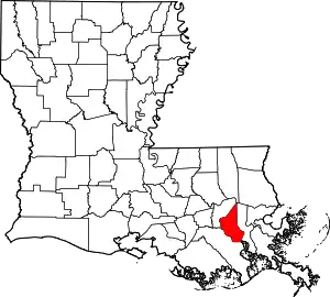 | |
| Other communities | ||
| Footnotes | ‡This populated place also has portions in an adjacent parish or parishes | |
| ||
Authority control  | |
|---|---|
| General | |
| National libraries | |
This article is issued from Wikipedia. The text is licensed under Creative Commons - Attribution - Sharealike. Additional terms may apply for the media files.