Hang Nam Sakhon
Hang Nam Sakhon (Thai: หางน้ำสาคร, pronounced [hǎːŋ náːm sǎː.kʰɔ̄ːn]) is a tambon (sub-district) of Manorom District, Chainat Province, central Thailand.

History
Originally, Hang Nam Sakhon was a deserted forest with a waterway running through it, no inhabitants. Later, there were people from Ban Nong Pho in neighbouring Takhli District, Nakhon Sawan Province, herds of cattle came to drink here in dry season. When it was rainy season, they returned to their original place. Later they considered that this place was fertile enough to settle for living and sustenance, therefore persuaded other people in the vicinity to migrate to settle at the Hang Nam Sakhon. The Hang Nam Sakhon residents have two lineage ancestors, one was from Ban Nong Pho and the another came from Ban Khao Thong, Phayuha Khiri District.
The first settlement of Hang Nam Sakhon located on the confluence of three khlongs (canal), foamed a Hang Nam Sakhon Stream that empties into the Chao Phraya River. Over time, there are more immigrants to join. As a result, the community here has expanded accordingly. The locals have a traditional occupation of farming and raising livestock. Hang Nam Sakhon in those days can be divided into 14 mubans (village) with a total area of 55,524 rais (21,946 acres).[1]
Geography
The landscape of the area can be divided into two parts. The first part is the left side (west side) of the Asian Highway 1 (AH1). It is a lowland area, so it is suitable for rice farming. While the other part is on the right side of the AH1. It is an upland, so it is suitable for industry and farming.
Hang Nam Sakhon is about 25 km (15.5 mi) north of Mueang Chai Nat District and 10 km (6.2 mi) east of downtown Manorom.
The area bounded by other tambons (from the north clockwise): Wat Khok (Khlong Bang Ta Lai is a borderline), Rai Phatthana and U Taphao in its district, Khao Tha Phra and Thammamun in Mueang Chai Nat District, and Khung Samphao in its district, respectively.[1]
Administration
The entire area of Hang Nam Sakhon is governed by Hang Nam Sakhon Sub-district Municipality (เทศบาลตำบลหางน้ำสาคร). It was graded from sukhaphiban (sanitary district) on May 25, 1999. The local government governs the five mubans to some parts of neighbouring U Taphao.
The logo of sub-district municipality features Phra Mae Thorani (earth goddess squeezes her bun).
Demography
It has a total population of 6,226 (3,014 men, 3,212 women) in 2,824 households. 80% of the population is engaged in rice farming. Most of them are Buddhists up to 97%, only 3% Christian.[1]
Places
- Manorom Hospital
- Hang Nam Sakhon Provincial Police Station
Local festivals
- Songkran (April 13-14-15)
- Worshiping Phi rong (tutelary deity/ held about four years at a time around May)
- Vassa (July)
- Loy Kratong (November)
Transportation
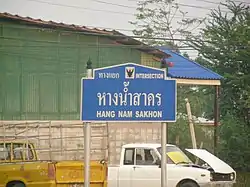
Hang Nam Sakhon Intersection is a four-way intersection of AH1 (section Highway 32) and Highway 3212 (Khung Samphao–Nong Pho Route) located in the area. AH1 after passing here, will enter the Nakhon Sawan Province area. The intersection can be considered very busy, especially during festivals such as Songkran or New Year.[2]
References
- "ประวัติความเป็นมา" [Historical]. Hangnamsakorn.go.th (in Thai).
- "สายเหนือรถแน่น 'แยกหางน้ำสาคร' ติดหนึบหางแถวยาวกว่า 2 กิโลเมตร". www.naewna.com (in Thai). 2018-12-28. Retrieved 2021-10-08.