Hveravellir
Hveravellir (Icelandic pronunciation: [ˈkʰvɛːraˌvɛtlɪr̥]) is a central volcano, as well as a geothermal field of the Oddnýjarhnjúkur-Langjökull subglacial volcanic system in the north of Langjökull glacier.
| Hveravellir | |
|---|---|
.jpeg.webp) Bláihver - blue hot spring | |
| Highest point | |
| Elevation | 650 m (2,130 ft) |
| Coordinates | 64°51′55.1″N 19°33′24.0″W |
| Geography | |
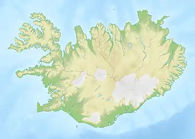  Hveravellir Map of Iceland showing the location of Hveravellir. | |
| Location | Húnavatnshreppur, Iceland |
| Geology | |
| Mountain type | Subglacial volcano |
Description
Hveravellir is located in west-central Iceland in the north of Langjökull glacier.[1] It is part of the Oddnýjarhnjúkur-Langjökull volcanic system.[2] The central volcano, Hveravellir, lies beneath a massive ice sheet to the east of Erikskökull.[1]
Northeast of the volcano, at the northern end of the Kjalhraun lava field, is the 2.5 km² Hveravellir geothermal field with numerous hot springs, fumaroles and hot mud.[2] The oldest mention of Hveravellir dates back to 1752 when Icelandic travelers Eggert Ólafsson (1726–1768) and Bjarni Pálsson (1719–1779) described the field in their travel report on the island.[3][4] The geothermal field is a tourist attraction; a bath can be taken in the pool created by damming the hot water stream in 1950.[3] Hveravellir was declared a natural monument.[5]
Climate
| Climate data for Hveravellir, Iceland (1965-2004) | |||||||||||||
|---|---|---|---|---|---|---|---|---|---|---|---|---|---|
| Month | Jan | Feb | Mar | Apr | May | Jun | Jul | Aug | Sep | Oct | Nov | Dec | Year |
| Record high °C (°F) | 8.6 (47.5) |
7.8 (46.0) |
7.7 (45.9) |
10.0 (50.0) |
15.7 (60.3) |
21.6 (70.9) |
22.7 (72.9) |
22.4 (72.3) |
16.8 (62.2) |
12.0 (53.6) |
8.6 (47.5) |
9.1 (48.4) |
22.7 (72.9) |
| Average high °C (°F) | −3.3 (26.1) |
−3.1 (26.4) |
−2.7 (27.1) |
−0.1 (31.8) |
4.1 (39.4) |
9.1 (48.4) |
11.5 (52.7) |
10.6 (51.1) |
6.3 (43.3) |
1.5 (34.7) |
−1.7 (28.9) |
−2.8 (27.0) |
2.4 (36.4) |
| Daily mean °C (°F) | −6.4 (20.5) |
−6.2 (20.8) |
−5.9 (21.4) |
−3.2 (26.2) |
0.9 (33.6) |
5.1 (41.2) |
7.3 (45.1) |
6.6 (43.9) |
2.9 (37.2) |
−1.1 (30.0) |
−4.4 (24.1) |
−5.9 (21.4) |
−0.9 (30.5) |
| Average low °C (°F) | −10.0 (14.0) |
−9.7 (14.5) |
−9.2 (15.4) |
−6.1 (21.0) |
−1.8 (28.8) |
1.9 (35.4) |
4.2 (39.6) |
3.7 (38.7) |
0.5 (32.9) |
−3.6 (25.5) |
−7.5 (18.5) |
−9.4 (15.1) |
−3.9 (25.0) |
| Record low °C (°F) | −30.4 (−22.7) |
−27.2 (−17.0) |
−26.3 (−15.3) |
−27.9 (−18.2) |
−17.1 (1.2) |
−6.9 (19.6) |
−2.0 (28.4) |
−6.3 (20.7) |
−12.1 (10.2) |
−18.2 (−0.8) |
−22.1 (−7.8) |
−28.5 (−19.3) |
−30.4 (−22.7) |
| Average precipitation mm (inches) | 63.3 (2.49) |
75.8 (2.98) |
65.4 (2.57) |
45.7 (1.80) |
38.2 (1.50) |
56.0 (2.20) |
53.4 (2.10) |
73.0 (2.87) |
62.6 (2.46) |
79.3 (3.12) |
55.6 (2.19) |
67.9 (2.67) |
736.2 (28.95) |
| Average relative humidity (%) | 85.2 | 85.4 | 85.5 | 84.8 | 83.4 | 80.5 | 81.7 | 83.7 | 85.2 | 87.7 | 86.5 | 85.3 | 84.6 |
| Mean monthly sunshine hours | 14.8 | 44.4 | 92.6 | 146.8 | 194.4 | 178.1 | 154.4 | 139.2 | 101.5 | 61.3 | 21.2 | 4.5 | 1,153.2 |
| Percent possible sunshine | 10 | 20 | 26 | 33 | 34 | 29 | 26 | 28 | 27 | 22 | 13 | 4 | 26 |
| Source: IMO[6] | |||||||||||||
See also
References
- Department of Mineral Sciences · National Museum of Natural History Smithsonian Institution. "Langjökull". Global Volcanism Program. Retrieved 2020-04-28.
- "Informacje o systemie wulkanicznym Langjökull". Catalogue of Icelandic Volcanoes. Retrieved 2020-04-28.
- Regína Hrönn Ragnarsdóttir. "Hveravellir - the beautiful Oasis in the Highlands of Iceland". Guide to Iceland. Retrieved 2020-04-28.
- The Environment Agency of Iceland. "Monuments". Retrieved 2020-04-28.
- "Hveravellir á Kili". The Environment Agency of Iceland (in Icelandic). Retrieved 2020-04-28.
- "Monthly averages for station 892 - Hveravellir". Icelandic Meteorological Office. Retrieved August 7, 2021.
Authority control  |
|---|