Kangra Valley
Kangra Valley is situated in the Western Himalayas.[1] Administratively, it predominantly lies in the state of Himachal Pradesh in India. It is a popular tourist destination, with the peak season around March and April. The Kangri dialect is spoken there. Dharamshala, the headquarters of Kangra district, lies on the southern spur of Dhauladhar in the valley.[2] It is home of Masroor Rock Cut Temple, also known as "Himalayan Pyramids", a possible contender for nomination as a UNESCO World Heritage Site.
| Kangra Valley | |
|---|---|
 An aerial view of Bir in Kangra valley | |
| Floor elevation | 2,000 ft (610 m) |
| Geology | |
| Type | River Valley |
| Geography | |
| Location | Himachal Pradesh, India |
| Population centers | Baijnath, Dharamshala, Kangra, McLeodGanj, Palampur, Bhawarna, Sidhbari |
| Coordinates | 32°10′N 76°30′E |
| Rivers | Beas River |
Geography
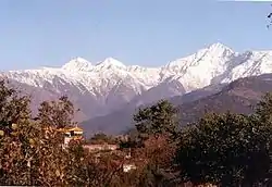
The valley is filled with numerous perennial streams, which irrigate the valley, and the river Beas flows through this valley. The valley has an average elevation of 2000 ft. Kangra Valley is a strike valley and extends from the foot of the Dhauladhar range to the south of river Beas. The highest peak on the Dhauladhar, White Mountain, marks the boundary between the valley and Chamba, and reaches 15,956 feet (4,863 m). The peaks of the range are approximately 13,000 feet (4,000 m) above the valley floor, rising sharply from its base with no low hills in between.[2]
Climate
_Dhauladhar_Ranges_in_Kangra_velley.jpg.webp)
Most of the valley has a humid subtropical climate (Cwa). Summer starts in early April and peaks in May. From June to mid-September is the monsoon season, when the valley receives very high amounts of rainfall. Autumn is mild and lasts from October to the end of November. Winters are cold and last till late February. Snowfall is common in the hills and higher reaches of the valley during this time. Snow in the lower elevations of the valley is rare, but has been recorded occasionally. Western disturbances cause winter precipitation. Winters are followed by a short, pleasant spring.
| Month | Jan | Feb | Mar | Apr | May | Jun | Jul | Aug | Sep | Oct | Nov | Dec | Year |
|---|---|---|---|---|---|---|---|---|---|---|---|---|---|
| Record high °C (°F) | 24.7 (76.5) |
28.0 (82.4) |
31.6 (88.9) |
35.6 (96.1) |
38.6 (101.5) |
38.6 (101.5) |
42.7 (108.9) |
37.8 (100.0) |
34.8 (94.6) |
34.6 (94.3) |
26.6 (79.9) |
27.2 (81.0) |
42.7 (108.9) |
| Average high °C (°F) | 15.7 (60.3) |
17.1 (62.8) |
21.5 (70.7) |
26.5 (79.7) |
30.3 (86.5) |
31.2 (88.2) |
27.3 (81.1) |
26.6 (79.9) |
26.6 (79.9) |
25.2 (77.4) |
21.7 (71.1) |
17.8 (64.0) |
24.0 (75.2) |
| Average low °C (°F) | 6.0 (42.8) |
7.3 (45.1) |
10.9 (51.6) |
15.4 (59.7) |
19.1 (66.4) |
20.9 (69.6) |
20.0 (68.0) |
19.7 (67.5) |
18.0 (64.4) |
14.3 (57.7) |
10.3 (50.5) |
7.2 (45.0) |
14.1 (57.4) |
| Record low °C (°F) | −1.9 (28.6) |
−1.6 (29.1) |
2.4 (36.3) |
7.3 (45.1) |
8.8 (47.8) |
12.6 (54.7) |
14.3 (57.7) |
14.1 (57.4) |
11.2 (52.2) |
8.0 (46.4) |
4.8 (40.6) |
−1.0 (30.2) |
−1.9 (28.6) |
| Average rainfall mm (inches) | 80.2 (3.16) |
123.5 (4.86) |
125.2 (4.93) |
65.4 (2.57) |
80.2 (3.16) |
241.2 (9.50) |
765.4 (30.13) |
787.4 (31.00) |
354.1 (13.94) |
56.3 (2.22) |
26.1 (1.03) |
50.9 (2.00) |
2,755.8 (108.50) |
| Average rainy days | 4.5 | 6.1 | 6.4 | 5.2 | 5.2 | 9.8 | 20.6 | 22.4 | 13.0 | 2.8 | 1.4 | 2.8 | 100.2 |
| Average relative humidity (%) (at 17:30 IST) | 66 | 63 | 54 | 47 | 45 | 53 | 80 | 86 | 78 | 63 | 62 | 65 | 63 |
| Source: India Meteorological Department[3][4] | |||||||||||||
Important towns
The cantonment town of Yol is located at 32.17°N 76.2°E in Kangra district. It has an average elevation of 1,221 m (4,006 ft).
Transport
Road
National highways 154 and 503 are the national highways that pass through the valley, connecting it with other parts of Himachal Pradesh and the neighbouring state of Punjab. Several state highways also connect the valley.
Railway
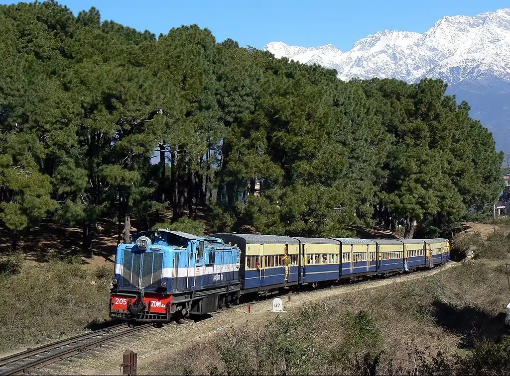
Kangra Valley Railway is a 164 km long narrow gauge railway line that connects the valley with Pathankot, the nearest railhead on 5 ft 6 in (1,676 mm) broad gauge railway network.
Airport
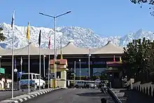
Gaggal Airport, alternatively known as Kangra Airport or Dharamsala-Kangra Airport, is an airport located at Gaggal in Kangra valley. It is located 14 km southwest of Dharamshala.
Tourism
.jpg.webp)
The main town in the valley and the capital of the district, Dharamshala, is one of the most visited hill stations in Himachal Pradesh and India. It also acts as a base for several Himalayan treks in the Dhauladhars, including Triund, which is one of the most famous treks in India. Mcleodganj is the current residence of the Dalai Lama and the centre of Tibetan community in exile in India, and draws tourists from all over the world. Palampur and Dharamshala are also famous for their tea gardens where Kangra tea is grown. Bir is well known for adventure sports, particularly paragliding.
1905 earthquake
The valley witnessed a devastating 7.8 magnitude earthquake at 6:19 am on 4 April 1905, as a result of which about 19,800 people were killed and thousands were injured in the Kangra area. Most buildings in towns of Kangra, Mcleodganj and Dharamshala were destroyed.[1][6][7]
References
- Earthquakes The Imperial Gazetteer of India, v. 1, p. 98.
- Dhaula Dhar The Imperial Gazetteer of India, v. 11, p. 287.
- "Station: Dharamshala Climatological Table 1981–2010" (PDF). Climatological Normals 1981–2010. India Meteorological Department. January 2015. pp. 243–244. Archived from the original (PDF) on 5 February 2020. Retrieved 15 February 2020.
- "Extremes of Temperature & Rainfall for Indian Stations (Up to 2012)" (PDF). India Meteorological Department. December 2016. p. M68. Archived from the original (PDF) on 5 February 2020. Retrieved 15 February 2020.
- "Himachal Pradesh Kangri Language", India Mapped - Languages in India, accessed 18 April 2015
- Dharamshala Earthquake 1905 - Images
- History Archived 21 December 2007 at the Wayback Machine Kangra district Official website.
Further reading
- Hutchinson, J. & J. PH Vogel (1933). History of the Panjab Hill States, Vol. I. 1st edition: Govt. Printing, Punjab, Lahore, 1933. Reprint 2000. Department of Language and Culture, Himachal Pradesh. Chapter IV Kangra State, pp. 98–198.
External links
 |
Wikimedia Commons has media related to Kangra Valley. |
- "Kangra Valley", Kangra District official website.


Authority control  |
|---|