Kentucky's congressional districts
Kentucky is currently divided into 6 congressional districts, each represented by a member of the United States House of Representatives. The number of congressional districts has been set at 6 since the 1990 redistricting cycle.
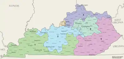
Kentucky's congressional districts since 2013[1]
Current districts and representatives
List of members of the Kentuckian United States House delegation, their terms, their district boundaries, and the districts' political ratings according to the CPVI. The delegation has a total of 6 members, including 5 Republicans and 1 Democrat.
| District | Representative | Party | CPVI | Incumbency | District map |
|---|---|---|---|---|---|
| 1st |  James Comer (R-Tompkinsville) |
Republican | R+26 | November 8, 2016 – present | .tif.png.webp) |
| 2nd |  Brett Guthrie (R-Bowling Green) |
Republican | R+22 | January 3, 2009 – present | .tif.png.webp) |
| 3rd |  John Yarmuth (D-Louisville) |
Democratic | D+8 | January 3, 2007 – present | .tif.png.webp) |
| 4th |  Thomas Massie (R-Garrison) |
Republican | R+19 | November 13, 2012 – present | .tif.png.webp) |
| 5th |  Hal Rogers (R-Somerset) |
Republican | R+33 | January 3, 1981 – present | .tif.png.webp) |
| 6th |  Andy Barr (R-Lexington) |
Republican | R+8 | January 3, 2013 – present | .tif.png.webp) |
Historical and present district boundaries
Table of United States congressional district boundary maps in the State of Kentucky, presented chronologically.[2] All redistricting events that took place in Kentucky between 1973 and 2013 are shown.
.gif)
| Year | Statewide map | Louisville highlight |
|---|---|---|
| 1973–1982 | 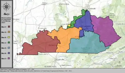 |
%252C_1973_%E2%80%93_1982.tif.png.webp) |
| 1983–1992 | 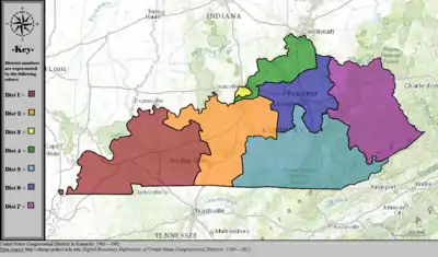 |
%252C_1983_%E2%80%93_1992.tif.png.webp) |
| 1993–1996 |  |
%252C_1993_%E2%80%93_2002.tif.png.webp) |
| 1997–2002 |  |
|
| 2003–2013 |  |
%252C_2003_%E2%80%93_2013.tif.png.webp) |
| Since 2013 | 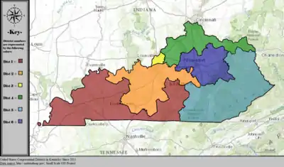 |
%252C_since_2013.tif.png.webp) |
Obsolete districts
The following are former districts of Kentucky:
- 7th district, obsolete since 1993
- 8th district, obsolete since 1963
- 9th district, obsolete since 1953
- 10th district, obsolete since 1933
- 11th district, obsolete since 1933
- 12th district, obsolete since 1843
- 13th district, obsolete since 1843
- At-large district, obsolete since 1935
References
- "The national atlas". nationalatlas.gov. Archived from the original on February 22, 2014. Retrieved February 2, 2014.
- "Digital Boundary Definitions of United States Congressional Districts, 1789–2012". Retrieved October 18, 2014.
This article is issued from Wikipedia. The text is licensed under Creative Commons - Attribution - Sharealike. Additional terms may apply for the media files.