Kongur Tagh
Kongur Tagh or Kongkoerh (Kyrgyz: Коңур Тоо; Uyghur: قوڭۇر تاغ, Коңур Тағ, meaning "Brown Mountain"; Mongolian: Хонгор Таг, (Хонгор/Kongur/Kongur is Mongolian word for the color Mongolians use for Buckskin colored horse) Hongor Tag; simplified Chinese: 公格尔峰; traditional Chinese: 公格爾峰; pinyin: Gōnggé'ěr Fēng; also referred to as Kongur), is at 7,649 m, the highest peak in the Pamir Mountains, and also the highest mountain wholly within the Xinjiang Uyghur Autonomous Region, China.
.jpg.webp)
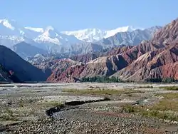
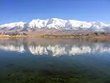
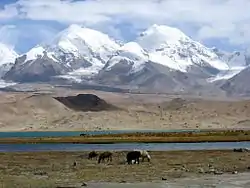
| Kongur Tagh | |
|---|---|
| Kongkhoerh | |
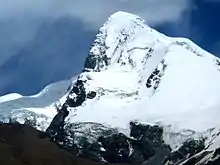
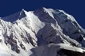 South face of Kongur Tagh | |
| Highest point | |
| Elevation | 7,649 m (25,095 ft)[1] Ranked 37th |
| Prominence | 3,585 m (11,762 ft)[1] Ranked 49th |
| Isolation | 240 km (150 mi)  |
| Listing | Ultra |
| Coordinates | 38°35′39″N 75°18′48″E[1] |
| Geography | |
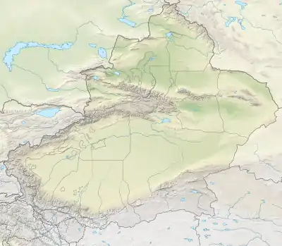  Kongur Tagh Location in Xinjiang | |
| Location | Akto County, Xinjiang, China |
| Parent range | Pamir Mountains |
| Climbing | |
| First ascent | 1981 by British team |
| Easiest route | Rock/snow/ice climb |
This is the highest mountain outside of the Hindu Kush/Karakoram and Himalayan ranges.
Geography
Kongur Tagh is within a range called the Kongur Shan (Chinese: 公格尔山; pinyin: Gōnggé'ěr Shān.) Kongur Tagh is located just north of Muztagh Ata and visible from Karakul Lake. Some sources use "Kongur Shan" mistakenly to refer to the peak itself. The Kongur Shan range, including Muztagh Ata, is separated by the major Yarkand River valley from the Kunlun Mountains and thus is included in the "Eastern Pamirs".[2] Kongur Tagh is the highest peak in the Pamirs. Due to its remoteness and being hidden by nearby peaks, Kongur was not discovered by Europeans until 1900. However, the building of the Karakoram Highway from Pakistan to China, which runs past nearby Tashkurgan and Karakul Lake, has now made it more accessible.
Administratively, the Kongur Range is within Akto County.
Climbing history
The first attempt to climb Kongur Tagh was made in 1956 but the party aborted the attempt when it realized it was beyond their abilities.
The first ascent of Kongur Tagh was completed in 1981 by a British expedition consisting of Chris Bonington, Al Rouse, Peter Boardman and Joe Tasker.[3]
Elevation
Kongur Tagh is 7,649 meters high. Some sources list the peak's elevation as 7,719 meters, but this is likely incorrect. The main summit is close enough in height to the 7,625-meter-high northeastern summit that climbers standing on the main summit could not tell which was taller, thus it can not be 7,719 meters high.[4]
Kongur Tiube
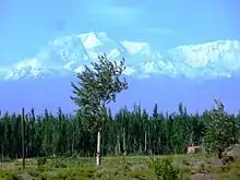
Kongur Tagh, which means "a brown mountain" in Uyghur language, has a significant subpeak known as Kongur Tiube (Chinese: 公格尔九别峰 which means in the local language "the mountain with a white cap",[5] also Kongur Tiubie / Jiubie and Kungur Tjube Tagh), 38°36′57″N 75°11′44″E; elevation = 7,530 m (24,705 ft).Ranked 47th[6] It is moderately independent, with a topographic prominence of 840 m (2,756 ft). It was first climbed in 1956.
Footnotes
- "China II: Sinkiang - Xinjiang". Peaklist.org. Retrieved 2014-05-26.
- N. O. Arnaud; M. Brunel; J. M. Cantagrel; P. Tapponnier (1993). "High cooling and denudation rates at Kongur Shan, Eastern Pamir (Xinjiang, China)". Tectonics. 12 (3): 1335–1346. doi:10.1029/93TC00767.
- Ward (1983), pp. 146-148.
- "Summit Elevations: Frequent Internet Errors". www.viewfinderpanoramas.org. Retrieved 2021-09-20.
- Kongur Jiubie Peak Archived 2013-12-15 at the Wayback Machine (in Chinese)
- Kongur Tagh-Muztagh Ata Topographic Map, 1:100,000, by the Lanzhou Institute of Glaciology and Geocryology, Chinese Academy of Sciences, ISBN 7-80545-148-6.
See also
References
- Ward, Michael. (1983). "The Kongur Massif in Southern Sinkiang." The Geographical Journal, Vol. 149, No. 2 (Jul., 1983), pp. 137–152.
External links
 |
Wikimedia Commons has media related to Kongur. |
- "Kongkoerh, China". Peakbagger.com. Retrieved May 23, 2008.
Authority control | |
|---|---|
| General | |
| National libraries | |