Kwakéa
Kwakéa (or Pakea, or Qakea [k͡pʷakea]) is an islet located east of Vanua Lava in the Banks Islands, Vanuatu. According to the 2009 census, it has a population of only 29.[1]
Kwakéa | |
|---|---|
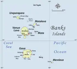 Location of Kwakéa (Qakea) off Vanua Lava in Banks Islands | |
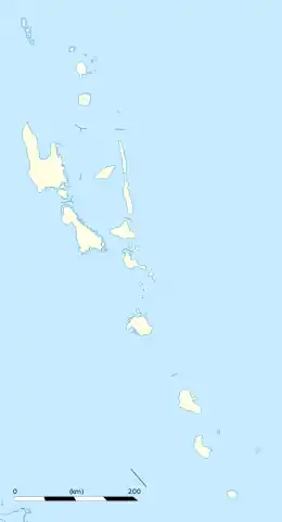  Kwakéa Location in Vanuatu | |
| Coordinates: 13°52′59″S 167°35′59″E | |
| Country |  Vanuatu Vanuatu |
| Province | Torba Province |
| Population (2009) | |
| • Total | 26 |
| Time zone | UTC+11 (VUT) |
Geography
The island of Kwakéa has a monsoon climate. The average temperature is 22 °C. The warmest month is March (23 °C), and the coldest month is September (22 °C). The average annual rainfall is 3337 millimeters.
The channel that flows between Kwakea and Vanua Lava is known as Dudley Channel. Islet Nawila lies 500 m west of Kwakéa.
Name
The spellings Kwakéa (or Kwakea) and Pakea represent two different attempts at transcribing the form [k͡pʷakea], which is the island's name in the Mota language. This form is rendered as Qakea in Mota's orthography.
The same island is known under slightly different names in the vernacular languages of the region: Qakē (IPA: [k͡pʷakɪ]) in Vurës;[2] Qeke (IPA: [k͡pʷɛkɛ]) in Mwesen; Aqke (IPA: [ak͡pʷkɛ]) in Mwotlap.[3]
All of these names can be derived from a Proto-Torres-Banks *ᵐBwaᵑgea.
History
The islet was once settled by migrants from nearby Mota.
In the mid-1890s, English settlers Frank and Alice Whitford purchased the island from the native title owners, who were from Mota. The Whitfords created palm plantations, but a hurricane on November 25, 1939, wiped out the island, and nothing was ever redeveloped. The only thing that remains is the Whitford family cemetery.
References
- 2009 Census Summary release final Archived 2013-12-21 at the Wayback Machine - Government of Vanuatu
- Entry “Qakē” in C. Vurës’ Online Vurës dictionary.
- Entry “Aqke” in A. François’ Online Mwotlap dictionary.