Les Cèdres, Quebec
Les Cèdres is a municipality located north of the Saint Lawrence River in the Montérégie of Quebec, Canada, near Vaudreuil-Dorion. The population as of the Canada 2016 Census was 6,777. The name means "The Cedars" in French.
Les Cèdres | |
|---|---|
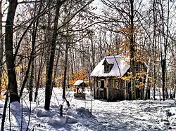 | |
.svg.png.webp) Coat of arms | |
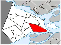 Location within Vaudreuil-Soulanges RCM | |
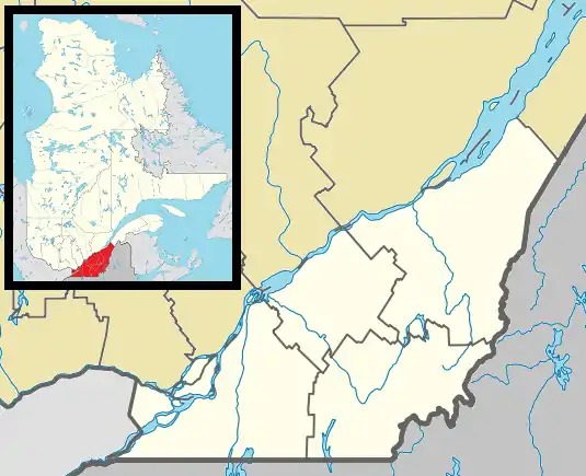  Les Cèdres Location in southern Quebec | |
| Coordinates: 45°18′N 74°03′W[1] | |
| Country | Canada |
| Province | Quebec |
| Region | Montérégie |
| RCM | Vaudreuil-Soulanges |
| Constituted | March 9, 1985 |
| Government | |
| • Mayor | Bernard Daoust |
| • Federal riding | Vaudreuil-Soulanges |
| • Prov. riding | Soulanges |
| Area | |
| • Total | 88.50 km2 (34.17 sq mi) |
| • Land | 77.71 km2 (30.00 sq mi) |
| Population (2016)[4] | |
| • Total | 6,777 |
| • Density | 87.2/km2 (226/sq mi) |
| • Pop 2011-2016 |  11.5% 11.5% |
| • Dwellings | 2,693 |
| Time zone | UTC−5 (EST) |
| • Summer (DST) | UTC−4 (EDT) |
| Postal code(s) | |
| Area code(s) | 450 and 579 |
Highways  A-20 A-20  A-30 A-30 |  Route 338 Route 338  Route 340 Route 340 |
| Website | www |
There is an extensive rapid on the St. Lawrence River at this location.[5] During the American Revolution, the Battle of the Cedars was fought in the vicinity. In 1959-1960 Swedish writer, Stig Claesson, lived in the village at a place called Point Charlie and later wrote a book about it called My friend Charlie.
History
This location was already notable in the late 17th century because of the large rapids on the St. Lawrence River, marked by tall cedars (French: les cèdres) that grew there in abundance. Hence, the location was originally known as Cedars Rapids, or as mentioned by cartographer Deshayes in 1695, as Rapide du Costeau des Cèdres. Subsequently, it was also known as Coteau-des-Cèdres, Portage-du-Coteau-des-Cèdres, or just Les Cèdres. Numerous explorers and military expeditions passed there to portage around the rapids. It was first settled in 1715.[1]
In 1845, the Parish Municipality of Saint-Joseph-de-Soulanges was created (named in honour of Joseph-Dominique-Emmanuel Le Moyne de Longueuil, Seigneur of Soulanges), followed by the Village Municipality of Soulange in 1852.[1]
In 1967, the Village Municipality of Soulange was renamed to Les Cèdres. In 1985, Les Cèdres and Saint-Joseph-de-Soulanges were merged to form the current Municipality of Les Cèdres.[1]
Demographics
| Canada census – Les Cèdres, Quebec community profile | |||
|---|---|---|---|
| 2016 | 2011 | 2006 | |
| Population: | 6,777 (+11.5% from 2011) | 6,079 (+6.1% from 2006) | 5,732 (+11.8% from 2001) |
| Land area: | 77.71 km2 (30.00 sq mi) | 77.85 km2 (30.06 sq mi) | 77.85 km2 (30.06 sq mi) |
| Population density: | 87.2/km2 (226/sq mi) | 78.1/km2 (202/sq mi) | 73.6/km2 (191/sq mi) |
| Median age: | 39.5 (M: 39.6, F: 39.4) | 38.8 (M: 38.6, F: 39.1) | 37.0 (M: 37.3, F: 36.8) |
| Total private dwellings: | 2,693 | 2,408 | 2,165 |
| Median household income: | $81,829 | $76,394 | $65,228 |
| References: 2016[6] 2011[7] 2006[8] earlier[9] | |||
|
| |||||||||||||||||||||||||||||||||
| Population amounts prior to 1985 are total of Les Cèdres (VL) and Saint-Joseph-de-Soulanges (P). Source: Statistics Canada[10] | ||||||||||||||||||||||||||||||||||
Language
| Canada Census Mother Tongue - Les Cèdres, Quebec[10] | ||||||||||||||||||
|---|---|---|---|---|---|---|---|---|---|---|---|---|---|---|---|---|---|---|
| Census | Total | French |
English |
French & English |
Other | |||||||||||||
| Year | Responses | Count | Trend | Pop % | Count | Trend | Pop % | Count | Trend | Pop % | Count | Trend | Pop % | |||||
2011 |
6,045 |
5,360 | 3.6% |
88.67% | 470 | 34.3% |
7.78% | 80 | 14.3% |
1.32% | 135 | 8.0% |
2.23% | |||||
2006 |
5,720 |
5,175 | 11.3% |
90.47% | 350 | 27.3% |
6.12% | 70 |  41.7% 41.7% |
1.22% | 125 | 78.6% |
2.19% | |||||
2001 |
5,115 |
4,650 | 10.1% |
90.91% | 275 | 3.8% |
5.38% | 120 | 166.7% |
2.34% | 70 | 26.3% |
1.37% | |||||
1996 |
4,630 |
4,225 | n/a | 91.25% | 265 | n/a | 5.72% | 45 | n/a | 0.97% | 95 | n/a | 2.05% | |||||
Local government
List of former mayors (since formation of current municipality):[11]
- Joseph Adolphe Jean Paul Séguin (1985–1987)
- Joseph Osie Armand Levac (1987–1994)
- Lucien Daoust (1994–2002)
- Géraldine Tremblay Quesnel (2002–2013)
- Raymond Larouche (2013–2021)
- Bernard Daoust (2021–present)
Transportation
The west end of Quebec Autoroute 30, a Montreal Island bypass route, runs through this area to link up with Autoroute 20. Montréal/Les Cèdres Airport, a single-runway general aviation airport, is located north of Quebec Autoroute 20 in the Les Cèdres area.
Education
Commission Scolaire des Trois-Lacs operates Francophone schools.[12]
- École Marguerite-Bourgeoys
- Some areas are served by École Du Papillon-Bleu (pavillons Saint-Jean-Baptiste and Sainte-Trinité) in Vaudreuil-Dorion and by École Des Étriers in Saint-Lazare[13]
Lester B. Pearson School Board operates Anglophone schools. It is zoned to Birchwood Elementary School and Evergreen Elementary School in Saint-Lazare and St. Patrick Elementary School in Pincourt.[14]
See also
References
- Reference number 148078 of the Commission de toponymie du Québec (in French)
- "Ministère des Affaires Municipales et Regions Quebec: Les Cèdres". Archived from the original on 2014-02-23. Retrieved 2012-03-11.
- "Parliament of Canada Federal Riding History: VAUDREUIL--SOULANGES (Quebec)". Archived from the original on 2009-06-18. Retrieved 2009-03-22.
- "(Code 2471050) Census Profile". 2016 census. Statistics Canada. 2017.
- . . 1914.
- "2016 Community Profiles". 2016 Canadian Census. Statistics Canada. February 21, 2017. Retrieved 2021-11-26.
- "2011 Community Profiles". 2011 Canadian Census. Statistics Canada. July 5, 2013. Retrieved 2014-02-02.
- "2006 Community Profiles". 2006 Canadian Census. Statistics Canada. March 30, 2011. Retrieved 2014-02-02.
- "2001 Community Profiles". 2001 Canadian Census. Statistics Canada. February 17, 2012.
- 1996, 2001, 2006, 2011 census
- "Répertoire des entités géopolitiques: Les Cèdres (municipalité) 9.3.1985 - ..." www.mairesduquebec.com. Institut généalogique Drouin. Retrieved 26 November 2021.
- "Les écoles et les centres". Commission Scolaire des Trois-Lacs. Retrieved 18 January 2013.
- "Liste des bassins desservis par les écoles en 2017-2018." Commission Scolaire des Trois-Lacs. Retrieved on September 30, 2017.
- "School Board Map." Lester B. Pearson School Board. Retrieved on September 28, 2017.
External links
 Media related to Les Cèdres, Quebec at Wikimedia Commons
Adjacent Municipal Subdivisions | |
|---|---|


| Cities & towns | |
|---|---|
| Municipalities | |
| Villages | |
| |
Authority control | |
|---|---|
| General | |
| National libraries | |