Liamone (river)
| Liamone | |
|---|---|
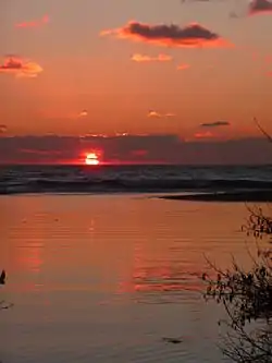 The mouth of Liamone at sunset | |
| Location | |
| Country | France |
| Region | Corsica |
| Physical characteristics | |
| Source | Monte Cimatella |
| • elevation | 1,850 m (6,070 ft) |
| Mouth | Mediterranean Sea |
• coordinates | 42.078°N 8.7169°E |
| Length | 40.6 km (25.2 mi) |
The Liamone (Corsican: Liamonu, Latin: Circidius) river is a river of Corsica, France. The length of its course is 40.6 kilometres (25.2 mi), entirely within the French department of Corse-du-Sud.[1] The river gave its name to the former French department of Liamone. In antiquity, it bore the Latin name Circidius.[2]
The Liamone has its source on the western slope of Monte Cimatella (2,099 meters (6,886 ft)), on the territory of the municipality of Letia, at an elevation of 1,850 meters (6,070 ft).[3] In its upper course, it forms a waterfall (called Piscia) between elevations 546 meters (1,791 ft) and 514 meters (1,686 ft). After a course of 40.9 kilometres (25.4 mi), it flows into the Gulf of Sagone north of Ajaccio, between the two towns of Coggia and Casaglione.
It flows through ten communes:[1] Letia, Murzo, Vico, Rosazia, Arbori, Lopigna, Arro, Ambiegna, Coggia and Casaglione.
History
Pliny the Elder recorded the town of Charax (Ancient Greek: Χάραξ) as being to the West above the Liamone.[4] This name is no longer in use, and it is possible that he recorded a fortification as a town.[5]
References
- Sandre. "Fiche cours d'eau - Fleuve u Liamone (Y81-0400)". Retrieved 24 August 2020.
- "Corsica". The Encyclopaedia Britannica. 7 (8th ed.). Edinburgh: Adams and Charles Black. 1854. p. 417.
- Géoportail - IGN. "Géoportail" (in French). Retrieved 4 October 2011.
- William Hazlitt (1851). The Classical Gazetteer. p. 106.
- Gregorovius, Ferdinand (1855). Corsica: Picturesque, Historical, and Social: With a Sketch of the Bonaparte, Paoli, Pozzo Di Borgo, and Other Principal Families. John E. Potter.