List of motorways in the Netherlands

These are the Netherlands' motorways by their national number, listed with the most important towns at or near the roads. The numbers start with 'A' for 'autosnelweg' (motorway in Dutch). Some of these also carry one or more European E-road numbers on (sections of) their trajectory. Although E-roads in the Netherlands are virtually all motorway, the trajectories are frequently not the same.

Motorways in the Netherlands
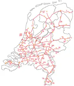
Motorways in the Netherlands highlighted in red
System information
Maintained by Rijkswaterstaat[1]
Highway names
System links

Motorways
Number Length (mi)[2] Length (km) Southern or western terminus Northern or eastern terminus Formed Removed Notes
A 1 157.73398.011 E 35/A10 in AmsterdamE 30/A30 at Germany country line east of De Lutte Amsterdam - Hilversum - Amersfoort - Apeldoorn - Deventer - Hengelo - Germany (Bad Bentheim)
A 2 217.098134.898 E 19/E 35/A10 & S110 in AmsterdamE 25/A25 at Belgium country line south of Eijsden Amsterdam - Utrecht - 's-Hertogenbosch - Eindhoven - Weert - Geleen - Maastricht - Belgium (Visé)
A 4 E 19/E 22/A10 in AmsterdamA15 in Hoogvliet Amsterdam - Schiphol - Hoofddorp - Leiden - The Hague - Delft - Schiedam - Vlaardingen - Hoogvliet
A 4 A29/A59 northeast of HeijningenA12 at Belgium country line southeast of Ossendrecht Heijningen - Bergen op Zoom - Belgium (Antwerp)
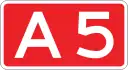
A 5 18.83011.700 E 22/A10 in AmsterdamE 19/A4 east of Hoofddorp Hoofddorp - Amsterdam
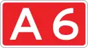
A 6 102.55763.726 E 231/A1 south of MuiderbergE 22/A7 southeast of Joure from A1 - Almere - Lelystad - Emmeloord - Joure
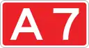
A 7 240.969149.731 S151 & S155 in ZaandamE 22/A280 at Germany country line south of Nieuweschans Zaanstad - Purmerend - Hoorn - (Afsluitdijk) - Sneek - Heerenveen - Drachten - Groningen - Hoogezand - Winschoten - Nieuweschans - Germany (Bunde)
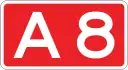
A 8 9.9666.193 E 22/E 35/A10 in AmsterdamN8 & N246 & S154 north of Westzaan Amsterdam - Zaanstad
A 9 95.67359.448 E 231/A1 motorway (Netherlands) & S114 in DiemenN9 & N242 south of Alkmaar from A1 - Amsterdam Zuidoost - Amstelveen - Badhoevedorp - Haarlem - Beverwijk - Alkmaar
A 10 32.06719.926 E 22/A8 in AmsterdamE 22/E 35/A8 in Amsterdam Amsterdam ring
A 12 136.81885.015 N44 & S101 in The HagueE 35/A3 at Germany country line east of Babberich Germany (Oberhausen) - Zevenaar - Arnhem - Ede - Utrecht - Gouda - Zoetermeer - The Hague
A 13 16.75510.411 E 19/E 25/A20 & S113 in RotterdamE 19/E 30/A4 in The Hague The Hague - Rotterdam
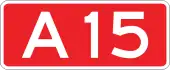
A 15 204.150126.853 N15 south of RozenburgA325 & N325/S110 west of Het Hoog Europoort - Rotterdam - Dordrecht - Gorinchem - Tiel - Nijmegen
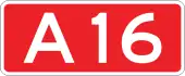
A 16 58.09836.100 E 19/E 25/A20 motorway (Netherlands) in RotterdamE 19/A1 road (Belgium) in Hazeldonk Rotterdam - Dordrecht - Breda - Belgium (Antwerp)
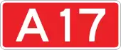
A 17 26.59316.524 E 19/A16 motorway (Netherlands)/A59 motorway (Netherlands) east of MoerdijkE 312/A58 motorway (Netherlands) in Roosendaal Moerdijk - Roosendaal
A 18 E 35/A12 northeast of BabberichN18 northwest of Varsseveld Zevenaar - Doetinchem - Varsseveld
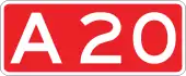
A 20 38.86224.148 N213 & E 25/N220 in MaasdijkE 25/E 30/A12 east of Gouda Gouda - Rotterdam - Vlaardingen - Maassluis
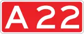
A 22 8.3485.187 A9 east of VelserbroekA9 east of Beverwijk Velsen - Beverwijk
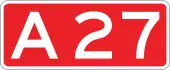
A 27 108.72867.560 E 19/E 312/A58 northeast of RijsbergenA6 east of Almere Breda - Gorinchem - Utrecht - Hilversum - Huizen - Almere
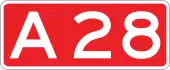
A 28 187.471116.489 E 30/A27 east of UtrechtE 22/N7 in Groningen Utrecht - Amersfoort - Harderwijk - Zwolle - Meppel - Hoogeveen - Assen - Groningen
A 29 13.4108.333 A15 & S103 in BarendrechtA4 & A59 northeast of Heijningen Rotterdam - Dinteloord
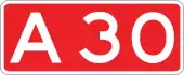
A 30 18.20411.311 E 35/A12 east of EdeE 30/A1 northwest of Barneveld Barneveld - Ede
A 31 64.57740.126 E 22/A7 southwest of HarlingenE 22/A7 & N381 west of Drachten Harlingen - Leeuwarden
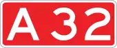
A 32 65.93640.971 E 232/A28 south of MeppelN31 south of Leeuwarden Meppel - Steenwijk - Heerenveen - Akkrum - Leeuwarden
A 35 35.65922.157 N35 & N350 south of WierdenN35 in Enschede Enschede - Hengelo - Almelo - Wierden
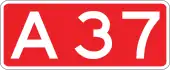
A 37 42.09226.155 E 232/A28 & N48 south of HoogeveenE 233/B402 at Germany country line east of Zwartemeer Hoogeveen - Emmen - Zwartemeer
A 38 E 19/A15/A16 in RidderkerkS105 in Ridderkerk from A15 - A16 - Ridderkerk
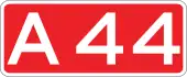
A 44 27.85017.305 N44 east of WassenaarE 19/A4 & N207 northwest of Leimuiden Wassenaar - Leiden - Nieuw Vennep
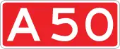
A 50 159.59199.165 E 25/A2 north of EindhovenE 232/A28 & N50 north of Hattemerbroek Eindhoven - Oss - Wijchen - Arnhem - Apeldoorn - Zwolle
A 58 136.91685.076 N288 in VlissingenE 25/A2 northeast of Eindhoven Eindhoven - Tilburg - Breda - Roosendaal - Bergen op Zoom - Goes - Middelburg - Vlissingen
A 59 121.09575.245 A4 & A29 northeast of HeijningenA50 southeast of Oss Willemstad - Moerdijk - Waalwijk - 's-Hertogenbosch - Oss
A 65 21.64313.448 E 312/A58 & N269 southeast of TilburgN65 south of Berkel-Enschot Tilburg - Berkel-Enschot
A 67 77.88148.393 E 34/A21 at Belgium country line southwest of EerselE 34/A40 at Germany country line east of Venlo Belgium (Turnhout) - Eindhoven - Venlo - Germany (Duisburg)
A 73 105.71365.687 E 25/A2 north of EchtE 31/A50 & N322 west of Beuningen from A50 - Nijmegen - Venlo -Roermond - A2 near Maastricht
A 74 1.8931.176 A61 at Germany country line east of HeideA73 east of Tegelen Venlo - Germany (Kaldenkirchen)
A 76 27.00816.782 E 314/A2 at Belgium country line southwest of SteinE 314/A4 at Germany country line east of Bocholtz Belgium (Genk) - Stein - Geleen - Heerlen - Germany (Aachen)
A 77 10.1356.298 E 31/A73 northeast of RijkevoortE 31/A57 east of Heijen Boxmeer - Germany (Goch)
A 79 17.73111.018 E 25/A2 northeast of MaastrichtE 314/A76 southwest of Heerlen Maastricht - Heerlen
A 200 11.8667.373 N200/R106 east of HaarlemN200 north of Zwanenburg Zwanenburg-East - Haarlem-East (former A5)
A 208 1.5220.946 from A5 - Velsen - Haarlem
A 256 E 312/A58 southwest of GoesN256 & N664 west of Goes from A5 - Goes
A 270 N270 northwest of EindhovenN270 southeast of Nuenen Eindhoven - Helmond
A 325 A15 & S110 west of Het HoogN225 & N325 in Arnhem Arnhem - Nijmegen (former A52)
A 326 A50 west of WijchenS103 north of Wijchen Wijchen - Nijmegen
A 348 E 35/A12 & N325 in ArnhemN348 & N317 south of Dieren Arnhem - Dieren (former A48)

Former motorways
The following routes lost their motorway-status:

See also

References

  1. "Wat voor wegen zijn er in Nederland en wie is de wegbeheerder". De Rijksoverheid. Archived from the original on 15 March 2014. Retrieved 21 December 2014.
  2. "Archived copy" (PDF). Archived from the original (PDF) on 2015-09-24. Retrieved 2015-06-30.CS1 maint: archived copy as title (link)
This article is issued from Wikipedia. The text is licensed under Creative Commons - Attribution - Sharealike. Additional terms may apply for the media files.