Mianwali District
The Mianwali District (Urdu: ضِلع مِيانوالى), is a district located in Sargodha Division of Punjab province, Pakistan. It has border with Chakwal, Attock,[2][3] Kohat,[4] Karak,[5] Lakki Marwat,[6] Dera Ismail Khan,[7] Bhakkar[8][9] and Khushab[10][11] Districts.[12] According to the 2017 census of Pakistan, the district had a population of 1,540,000, of which 22% resided in urban settlements.[1]
Mianwali
ضِلع مِيانوالی | |
|---|---|
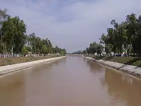
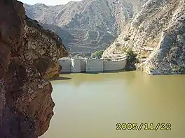
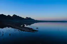 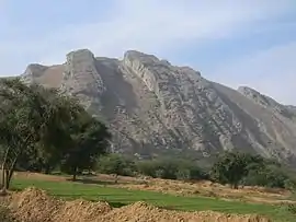 Clockwise from top: Namal Lake, Jinnah Barrage, Chashma Barrage, Namal Institute, Salt Range, Chashma Nuclear Power Plant | |
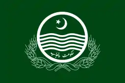 Flag  Seal | |
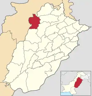 Mianwali District highlighted within Punjab Province | |
| Country |  Pakistan Pakistan |
| Province | Punjab |
| Division | Sargodha Division |
| Headquarters | Mianwali |
| Government | |
| • Type | District Administration |
| • Deputy Commissioner | N/A |
| • District Police Officer | Captain Mustan Froze |
| • District Health Officer | N/A |
| Area | |
| • Total | 5,840 km2 (2,250 sq mi) |
| Population (2017)[1] | |
| • Total | 1,546,094 |
| • Density | 260/km2 (690/sq mi) |
| Time zone | UTC+5 (PST) |
| Postal Code | 42200 |
| Area code(s) | 0459 |
| Number of tehsils | 3 |
Administration
The district is administratively divided into three tehsils 7 Municipal Committees and 51 union councils:[13][14]
| Name of tehsils | No. of union councils | No. of municipal committees | Parent tehsil |
|---|---|---|---|
| Isakhel | 13 | 3 | Mianwali |
| Mianwali | 26 | 2 | Mianwali |
| Piplan | 12 | 2 | Mianwali |
| Total | 51 | 7 |
Geography
Mianwali district covers an area of 5,840 square kilometres (2,250 sq mi).[15] The area in north is a continuation of the Pothohar Plateau[16] and the Kohistan-e-Namak.[17][18] Southern side of the district is a part of Thal Desert.[19] Indus River flows through the district.[20]
Climate
Mianwali district has an extreme climate, with a long, hot summer season and cold, dry winters. Summer lasts from May to September and winter lasts from November till February.[21] June is the hottest month with average temperatures of 42 °C (highest recorded temperature 52 °C); in winter, December and January monthly average temperatures can be as low as 3 to 4 °C. The average rainfall in the district is about 385 mm.[22][23]
| Month | Jan | Feb | Mar | Apr | May | Jun | Jul | Aug | Sep | Oct | Nov | Dec | Year |
|---|---|---|---|---|---|---|---|---|---|---|---|---|---|
| Average High Temperatures °C (°F) | 19° (66.2 °) | 21° (69.8 °) | 26° (78.8 °) | 33° (91.4 °) | 38° (100.4 °) | 42° (107.6 °) | 39° (102.2 °) | 37° (98.6 °) | 37° (98.6 °) | 33° (91.6 °) | 28° (82.4 °) | 21° (69.8 °) | 31° (87.8 °) |
| Average Low Temperatures °C | 3 | 6 | 12 | 17 | 22 | 27 | 27 | 26 | 23 | 16 | 9 | 4 | 16 |
| Rainfall in. (cm) | 1.6 | 2.1 | 4.1 | 2.4 | 1.9 | 1.8 | 7.6 | 11 | 4.5 | 0.7 | 0.1 | 0.9 | 38.5 |
| Source: Weatherbase | |||||||||||||
History
The main impact is of the Miana family which came from Baghdad, Iraq, and settled in Mianwali. So they preached Islam and spread awareness therein. Mianwali name is derived from Sufi saint Mian Ali's name (See the book "Maratib-e-Sultani). Mian Ali Mianwali was a known settlement and an agricultural region with forests during the Indus Valley Civilization (c.3300 – c.1300 BCE). Then later Vedic Civilization took place. In 997 CE, Sultan Mahmud Ghaznavi took over the Ghaznavid dynasty empire established by his father, Sultan Sebuktegin. In 1005 he conquered the Shahis in Kabul and followed it by the conquests of the Punjab region. The Delhi Sultanate and later Mughal Empire ruled the region. The population of the Punjab region became majority Muslim, following the conquests by various Muslim dynasties from Central Asia. The real historical representation of the Mianwali Region is older than 900 AD but the true accuracy is traced to the arrival of Qutb Shah in 1090 AD in this region who in later years of his conquest allowed his sons to settle and further rule the region. Their Lineage still exists to date in Mianwali District as well as in Pakistan and are known as Awan Tribe. Historically, all major rulers of South Asia governed this area in their turn. Mughal emperor Babur mentioned Isakhel while he was fighting against the Malik Awans and Niazi Pakhtuns as part of his campaign to conquer the Punjab during the 1520s (ref. Baburnama). Prior to the invasion of Nadir Shah in 1738, there is little to relate concerning the history of the northern part of the district. The upper half of the district was ruled by the Gakhars, who became feudatories of the Mughal Empire, of which the district continued to form a part until the invasion of Nadir Shah. In 1738 a portion of his army entered Chashma, and by its atrocities so cowed the Bannuchis and Marwats that a heavy tribute was raised from them. Another portion of the army crossed the Darra Pezu and worked its way down to Dera Ismail Khan. Contingents raised from the neighbourhoods of Bannu and Dera Ismail Khan marched under Nadir Shah's banner to the sack of Delhi. In 1739 the area west of the Indus was surrendered by the Emperor of Delhi to Nadir Shah and passed after his death to Ahmad Shah Abdali. The primary historical representation of this region dates back to Alexander the Great where his Conquest bought him during his journey from the Mianwali district and apart from his conquest adds various other conquests to the stream. In 1748 a Durrani army under one of Ahmad Shah's generals crossed the Indus at Kalabagh, and drove out the Ghakkars, who still ruled in the cis-Indus tracts of the district, owing nominal allegiance to the Emperor at Delhi. Their stronghold, Muazzam Nagar, was razed to the ground, and with their expulsion was swept away the last vestige of the authority of the Mughal Emperor in these parts. During British Raj Mianwali District was also among the states of British Punjab where regional offices of East India Company were in position until winter of 1883 when the regional office of East India Company in Mianwali was Shutdown due to civil unrest and hostile conditions.[24]
People
- Mian Sultan Zikria (R.A.) - Famous Saint
- Nawab Malik Amir Mohammad Khan - Chief of the Awan tribe,Nawab of Kalabagh ,Former Governor of West Pakistan.
- Tilok Chand Mehroom – Urdu poet
- Jagannath Azad – Urdu-Speaking poet of Hindu academic.
- Imran Khan – Former captain of the Pakistan cricket team who won the 1992 Cricket World Cup and has been elected twice the member of National Assembly of Pakistan from Mianwali and the 22nd Prime minister of Islamic Republic Of Pakistan .[25]
- Attaullah Khan Esakhelvi – Folk Singer[26]
- Abdul Sattar Khan Niazi – religious and political leader of Pakistan
- Misbah-ul-Haq – Pakistani Cricketer
- Sher Afgan Niazi – The Ex-Minister of Law and Member of Parliament
- Sardar Khan Niazi – Chief Editor and Publisher of Daily Pakistan, Daily The Patriot, Daily Pak Watan, Daily Action, Daily Nawa-e-Nawabshah, Monthly Naya Rukh, and also Chairman of Pakistan Group of Publications.
- Shadab Khan – Pakistani Cricketer.
- Aqeela Asifi – Afghan refugee and teacher who has educated thousands of other Afghan refugee children in Mianwali
- General Amir Abdullah Khan Niazi - Ex. Commandent Eastern Command Bengal.
Places of interest
.jpg.webp)
- Mari Indus railway station
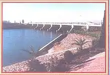 Chashma barrage near Kundian (Mianwali)
 - Kalabagh Dam
- Jinnah Barrage
- Chashma Barrage
- Namal Lake
- Kundian Railway Station
- Daud Khel Railway Station
- Mari Indus Railway Station
Further reading
- "Manaqib-E-Sultani" By Mian Alamgir
- "Wichara Watan" By Harish Chander Nakra, New Delhi, India
References
- "DISTRICT WISE CENSUS RESULTS CENSUS 2017" (PDF). www.pbscensus.gov.pk. Archived from the original (PDF) on 29 August 2017.
- "Punjab Portal".
- http://www.pbs.gov.pk/sites/default/files/bwpsr/punjab/ATTOCK_SUMMARY.pdf
- "Kohat | Pakistan".
- http://www.pbs.gov.pk/content/district-glance-karak
- http://www.pbs.gov.pk/content/district-glance-lakki-marwat
- http://www.pbs.gov.pk/content/district-glance-d-i-khan
- bhakkar.dc.lhc.gov.pk/PublicPages/HistoryOfDistrict.aspx
- http://www.pbs.gov.pk/content/district-glance-bhakkar
- "Punjab Portal".
- http://www.pbs.gov.pk/content/district-glance-khushab
- "Mianwali | Punjab Portal".
- Tehsils & Unions in the District of Mianwali - Government of Pakistan Archived 2008-06-11 at the Wayback Machine
- "District Overview | DPO Mianwali".
- "Mianwali Map | Pakistan Google Satellite Maps".
- https://www.researchgate.net/figure/A-map-of-Punjab-Province-Pakistan-showing-Potohar-Plateau-consisting-of-four-Districts_fig2_234140568
- "PAKISTan's SALT MINES - Luke Duggleby Photography".
- "Visura | Discover the world's top freelance visual storytellers".
- "Thal | region, Pakistan".
- "Indus River | Definition, Length, Map, History, & Facts".
- http://www.myweather2.com/City-Town/Pakistan/Mianwali/climate-profile.aspx
- "Climate & Weather Averages in Mianwali, Pakistan".
- en.climate-data.org/एश-य/प-क-सत-न/पज-ब/mianwali-28948/
- http://mianwali.dc.lhc.gov.pk/PublicPages/HistoryOfDistrict.aspx
- "Imran Khan".
- "Atta Ullah Eesakhelvi and the Cassette Revolution". 22 November 2008.
External links
 |
Wikimedia Commons has media related to Mianwali District. |
- Early history of Niazi tribe
- Niazi Chiefs in the Mughal empire
- http://www.mianwalionline.com/
- "Kundian – Welcome to Global Kundian". Archived from the original on 11 January 2020. Retrieved 1 February 2021.
- "Welcome to Global Kundian". Archived from the original on 30 June 2020. Retrieved 1 February 2021.
Provincial capital: Lahore | ||
| Bahawalpur | 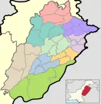 | |
| Dera Ghazi Khan | ||
| Faisalabad | ||
| Gujranwala | ||
| Lahore | ||
| Multan | ||
| Rawalpindi | ||
| Sahiwal | ||
| Sargodha | ||
Authority control  | |
|---|---|
| General | |
| National libraries | |