Mizur Formation
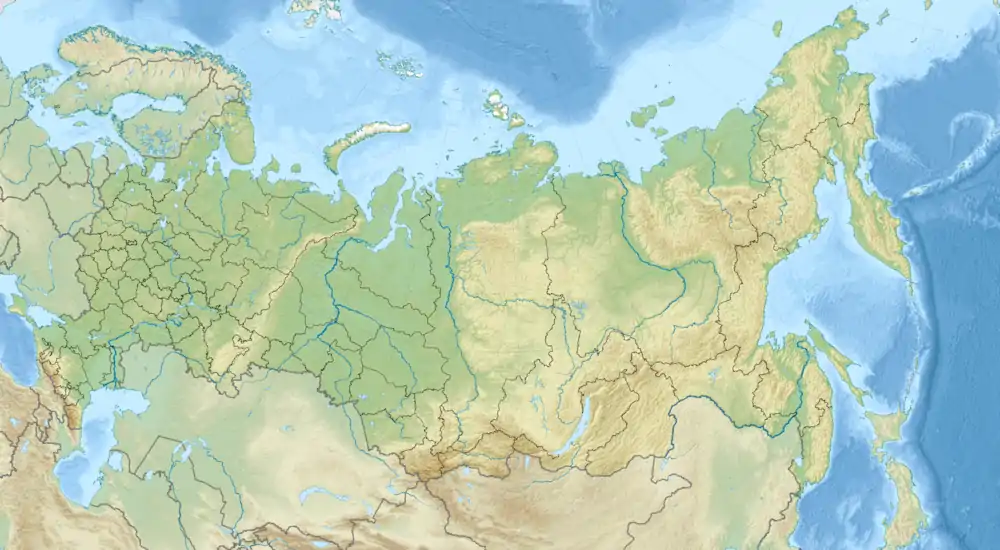
The Mizur Formation is a geological formation that outcrops in the North Ossetia–Alania (North Caucasus), representing a series of marginal marine to coastal layers, with terrestrial influence of Late Pliensbachian (Lower Jurassic) age.[2] This unit has gained reputation due to be the only major unit with preserved dinosaur footprints of various orders, yet not ascribed to any concrete ichnogenus.[3]
| Mizur Formation Stratigraphic range: Late Pliensbachian ~Domerian Substage | |
|---|---|
_-_51353719347.png.webp) Ardon River, where exposed layers of the formation are recovered | |
| Type | Geological Formation |
| Sub-units | Fytyn, Faraskat and Mizur members |
| Underlies | Unnamed Toarcian-Aalenian Layers |
| Overlies | Sadon Formation |
| Lithology | |
| Primary | Sandstone |
| Other | Kaolinite, conglomerates, gravelstones, quartzsandstones |
| Location | |
| Coordinates | 42°51'02.1"N 44°03'25.3"E |
| Region |  North Ossetia–Alania North Ossetia–Alania |
| Country |  Russia Russia |
| Type section | |
| Named for | The Town of Mizur |
| Named by | Beznosov[1] |
  Mizur Formation (Russia) | |
Stratigraphy
Fytyn Member
The Fytyn member represent the older layers of the formation, and depending of the outcrop, it is found liying on the eroded sur-face of Paleozoic granites or crystalline schists or over the Sinemurian–lower Pliensbachian volcanosedimentary rocks of the Sadon Formation.[4] This member if composed mostly by the derived product of the regiona erosion of older layers: conglomerates, gravelstones, quartzsandstones, and others, that where deposited on a mostly continental setting and extends it´s thickness a few docens of meters.[4]
Faraskat Member
In some outcrops the Fytyn Member is absent, as result of a regional uplift, with the sedimentary material transported from this area to central parts of the Greater Caucasus, ended accumulated on the Kistin Formation (Sinemurian–lower Pliensbachian), unit that underlies in some sections the Faraskat member.[4] The Faraskat section starts it´s deposition when the local layers was accompanied bya slow subsidence of the land and sedimentation on the previously denudated area.[5] The Faraskat sequence represents the first proper coastal deposit in the unit, and is composed by a mixture of coarse material, as well wood fragments and siderite, with some layers being hisgly bioturbated.[4]
Mizur Member
The transition between the Faraskat and Mizur members is gradual, forming a large sedimentary cycle from the clayey to sandstone dominated rocks.[2] This layer represents the last unit of the formation, and is dominated by fine grained sandstone horizons, often low angle crossbedding and scarce fine ripple marks, in contrast to the abundant large wave ripples.[2] This layers have abundant fragments of Tererstrial vegetation in a highly oxidized state. The sedimentation peculiarities of the Mizur layers indicate their accumulation within a relatively wideand shallow shelf.[2] This layer is the only one that has provided Dinosaur Footprints, as well ammonites and other invertebrates.[3]
Environment
The Mizur member contain numerous fragments of plants: stems, wood, and leaves, suggesting a clear influence of nearby emerged settings. The vegetation in the coeval exposures along the Caucasus and adjacent regions were covered by Coniferous forests with abundant underliying Bennettitales.[6] The spore-pollen association in the Domerian sediments are dominated by bennettitales, that likely grown on nearshore low-lands.[7] The region hosts Pollen of several plant groups, notably the Pinaceae, Podocarpaceae, Araucariaceae, with other such as Ginkgoaceae being less common. Beyond trees, the lowlands were covered by thermophilic ferns (Cibitium, Mattonia, Coniopteris), Lycophytes (Selaginella), and horsetails (Neocalamites).[7] Invertebrate faunas recovered locally are linked with the mediterranean faunal region, with some specimens (Belemnnite isotopes and brachiopods) allowing to calculate the anual temperatures in the North Caucasian-Transcaucasian, estimated within 21.4–23.5°C, that is, subtropical humid climate.[8][9]
Fossil content
Ammonites
| Genus | Species | Location | Section | Material | Notes | Images |
|---|---|---|---|---|---|---|
|
|
|
|
An Ammonite, type member of the family Amaltheidae inside Ammonitida. This genus is the main used to measure the depositional age of the local layers, as well is related with the mediterranean region fauna |
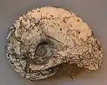 Example of Amaltheus margaritatus specimen | |
Dinosauria
| Genus | Species | Location | Section | Material | Notes | Images |
|---|---|---|---|---|---|---|
|
Dinosauropedida[3] |
Dinosauropedida ichnog. indeterminate |
|
|
Footprints |
Dinosaur Footprints, non assigned to any concrete ichnogenus. A poorly preserved trackway compsed by 3 tracks whose apperance is completely different tha any other speciment recovered on the unit. |
|
|
Sauropodomorphidia[3] |
Sauropodomorphidia ichnog. indeterminate |
|
|
Footprints |
Possible Sauropodomorph Footprints, non assigned to any concrete ichnogenus. A clear tridactyl track 12 cm wide is distinguished among several hollows. The shape of footprints indicates the direction of dinosaur movement. |
 Sauropodomorphs similar to Mussaurus may have left the local Footprints |
|
Theropodipedia[3] |
Theropodipedia ichnog. indeterminate |
|
|
Footprints |
Possible Theropod Footprints, non assigned to any concrete ichnogenus. Theropod tracks inclde several types, from small to medium specimens. Some alteration near the tracks has been interpreted as derived from displaced sediments moved by the dinosaur upper limb in order to search for borrowing organisms. |
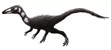 Small theropods similar to Procompsognathus may have left the local Footprints |
|
Carnosauripodoidei[3] |
Carnosauripodoidei ichnog. indeterminate |
|
|
Footprints |
Possible Tetanuran Footprints, non assigned to any concrete ichnogenus. A relatively large single dinosaur track (35‒40 cm wide), it´s distinctive fingerprints diverging at an angle of 30°‒35° are characteristic of large Jurassic predatory theropods. |
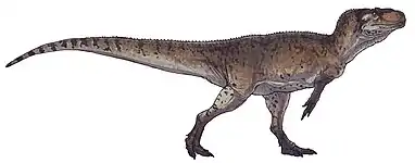 Medium theropods similar to Piatnitzkysaurus may have left the local Footprints |
|
Ornithischipida[3] |
Ornithischipida ichnog. indeterminate |
|
|
Footprints |
Possible Ornithischian Footprints, non assigned to any concrete ichnogenus. A series of tracks whose relatively small size (15 cm), and the close position ofthe left and right limbs suggest they belong to a small herbivorous ornithopod |
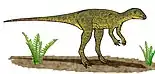 Small Ornithischians similar to Lesothosaurus may have left the local Footprints |
See also
- List of fossiliferous stratigraphic units in Russia
- Sorthat Formation, Denmark
- Neringa Formation, Lithuania
- Pliensbachian formations
- Blanowice Formation, Southern Poland
- Clarens Formation, South Africa
- Fernie Formation, Canada
- Hasle Formation, Denmark
- Kota Formation, India
- Los Molles Formation, Argentina
- Mawson Formation, Antarctica
- Rotzo Formation, Italy
- Whiteaves Formation, British Columbia
- Navajo Sandstone, Utah
- Kandreho Formation, Madagascar
- Kota Formation, India
- Cattamarra Coal Measures, Australia
References
- Beznosov, N.V.; Kazakova, V.P.; Leonov, Yu.G.; Pan-ov, D.I. (1960). "Stratigraphy of the Lower and Middle Jurassicrocks in the central North Caucasus". in Materialy po geologiigazonosnykh raionov SSSR (Materials on the Geology of Gas-Bearing Regions in the Soviet Union. 18 (2): 109–191.
- Gavrilov, Yu. O (1994). "Lower and Middle Jurassic deltaic sedi-mentary complex in the NE Caucasus: Communication 1.Sedimentological aspects of the deltaic complex formation". Litol. Polezn. Iskop. 4 (1): 77–104.
- Gavrilov, Yuri O. (2020). "Dinosaur Footprints in Terrigenous Sediments on the Early Jurassic Shelf of the Central North Caucasus: Sedimentological and Paleoecological Settings". Lithology and Mineral Resources. 55 (5): 345–354. Retrieved 12 December 2021.
- Panov, D.I. (1997). "Stratigraphy of the Lower and Middle Jurassicrocks in the central North Caucasus (Digor–Ossetia zone)". Byull. Mosk. O-va Ispyt. Prir., Otd. Geol. 72 (5): 46–55.
- SSSR, Paleogeografiya (1975). Ob"yasnitel’naya zapiska k atlasu li-tologo-paleogeograficheskikh kart SSSR (Paleogeography of the Soviet Union: Explanatory Note to the Atlas of Litho-logic–Paleogeographic Maps of the Soviet Union). Moscow: Nedra.
- Vakhrameev, V.A.; Vasina, R.A. (1959). "The Lower Jurassic and Aalenian f lora in the North Caucasus". Paleontolog. Zh. 3 (1): 125‒133.
- Vakhrameev, V.A.; Krasilov, V.A. (1961). "The Domerian f lorain the North Caucasus". Paleontolog. Zh. 3 (1): 103–108.
- Yasamanov, N.A. (1973). "Temperatures in the habitat of Jurassic–Cretaceous brachiopods, cephalopods, and bivalve mol-luscs in the western Transcaucasian basin". Geokhimiya. 5 (2–3): 746‒754.
- Yasamanov, N.A . (1978). Landshaftno-klimaticheskie usloviyayury, mela i paleogena Yuga SSSR (Jurassic, Cretaceous,and Paleogene Landscape-Climate Conditions in theSouthern Soviet Union),. Moscow: Nedra.