Moose Mountain Creek
Moose Mountain Creek is a river[3] in the province of Saskatchewan, Canada. Its source is the Chapleau Lakes near Montmartre and it is a tributary of the Souris River, which, in turn, is a tributary of the Assiniboine River. The whole system is part of the Red River watershed, which is part of the Hudson Bay drainage basin and in a region called the Prairie Pothole Region of North America, which extends throughout three Canadian provinces and five U.S. states. It is also within Palliser's Triangle and the Great Plains ecoregion.[4]
| Moose Mountain Creek | |
|---|---|
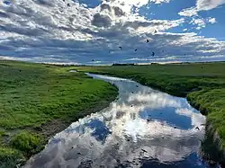 Moose Mountain Creek | |
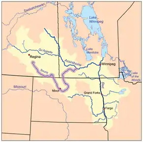 The Red River drainage basin, with the Souris River highlighted | |
| Location | |
| Countries |
|
| Provinces | |
| Communities | |
| Physical characteristics | |
| Source | Chapleau Lakes, near Montmartre |
| • location | Saskatchewan |
| • elevation | 668m |
| Mouth | Souris River |
• location | south-west of Oxbow, Saskatchewan |
• coordinates | 49°12′55″N 102°11′47″W |
• elevation | 512m |
| Discharge | |
| • location | Souris River, west of Oxbow |
| Basin features | |
| River system | Red River drainage basin |
| Tributaries | |
| • left | Wolf Creek, Crooked Creek, Swift Creek |
| • right | Morrison Creek, Cowper Creek, Shepherd Creek |
| [1][2] | |
The entirety of Moose Mountain Creek is in Census Division No. 1. The river passes through two Indian reserves, Ocean Man and Pheasant Rump, and eight rural municipalities including the RMs of Montmartre, Chester, Golden West, Tecumseh, Brock, Moose Mountain, Moose Creek, and Enniskillen.[5] While there are no communities along the banks of the river, there are four within two kilometres of its banks: Montmartre, Kisbey, Alameda, and Oxbow. The original location of Carlyle, NW 26-07-03 W2, was located near confluence of Moose Mountain, Swift, and Morrison Creeks.
Moose Mountain Creek flows generally in a south-easterly direction, starting north-west of Moose Mountain Upland and ending up at the Souris River near Oxbow. The western and southern regions of Moose Mountain fall within the river's watershed, which is part of the Upper Souris watershed. The northern most point of Moose Mountain Creek's watershed is near McLean, which is only 41 kilometres away from Saskatchewan's capital, Regina.[6][7]
There are two major dams along the river. The first one is Moose Mountain Dam and the second is Grant Devine Dam, both of which created large reservoirs along the course. Both reservoirs have parks; Lost Horse Hills is on Moose Mountain Lake and Moose Creek Regional Park[8] is on Grant Devine Reservoir.
Course
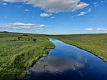
The Chapleau Lakes[9] are a chain of two lakes that run diagonally in a valley north to east. The northern most of the two lakes is the source of Moose Mountain Creek. From the out-flow of that lake near Highway 48 and Highway 606, the river travels in a south-easterly direction until passes through the Saint Clair National Wildlife Area and Highway 711. From there, it empties into Moose Mountain Lake, which is a man-made reservoir.[10] Moose Mountain Dam is at the south-east corner of the lake, near Lost Horse Hill. From there, the river continues to flow south-east through Ocean Man Indian Reserve then Pheasant Rump Indian Reserve until it crosses Highway 13 about half-way between Forget and Kisbey, where it takes a more easterly route. It's around this area, west, south, and east of Kisbey, that the river's course flattens out creating a broad floodplain. Dykes and culverts were built south of Kisbey to protect the village and control the river's flow. South of Forget, there were also culverts and other flood control measures built to control surface water before it reaches the river. From south of Kisbey, the river roughly parallels Highway 13 towards Arcola where it leaves the floodplain and flows into a valley, the Moose Mountain Creek Spillway. It continues east until it crosses Highway 9, at which point it takes a more southerly route and flows into a Grant Devine Reservoir. In 1994, the Alameda Dam was built along Moose Mountain Creek's course, near the point where it meets the Souris River, creating a large reservoir called Alameda Reservoir. In 2017, the name of the reservoir and dam were changed to Grant Devine Dam and Grant Devine Reservoir, in honour of the premier of Saskatchewan who was responsible for its construction, Grant Devine. Moose Mountain Creek is the primary inflow and outflow of the reservoir and meets the Souris River[11] about 3 miles south of the dam in the Souris River Valley, near the town of Oxbow.
Moose Mountain Creek Spillway
Moose Mountain Creek Spillway is a valley that was formed during the last ice age as the path taken by melting glacial waters between two glacial lobes, the Weyburn Lobe and the Moose Mountain Lobe, en route to the Souris Spillway. On the southern side of Moose Mountain Upland, in the interlobate area, a short lived glacial lake named Lake Arcola formed along the current path of Moose Mountain Creek. Glacial moraines can be found throughout the area.[12]
Tributaries
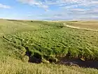
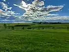
- Gooseberry Lake, via an un-named creek that flows into Moose Mountain Lake.
- Wolf Creek, starts on the north-west side of Moose Mountain Upland and heads west. Then it turns sharply south before Highway 47 and crosses Highway 711 near Corning. Wolf Creek meets up with James Creek and Moose Mountain Creek downstream from Moose Mountain Dam.[13]
- James Creek, starts on the north-west side of Moose Mountain Upland, on the north side of Highway 711. From there, it travels south-west until it meets up with Wolf Creek.[14]
- Crooked Creek, starts on the south side of Moose Mountain Upland and flows south across Highway 13 and past Arcola and on to Moose Mountain Creek.[15]
- Swift Creek, starts at Big Marsh Lake on the White Bear Indian Reserve and flows south, west of Carlyle, and meets up with Moose Mountain Creek just upstream from where Morrison Creek meets it.[16]
- Morrison Creek, also starts on the White Bear Indian Reserve near Ess Lake. From there it heads south to Carlyle where it runs along the west side of town though West Park and on to Moose Mountain Creek.[17]
- Cowper Creek, starts on the south-east side of Moose Mountain Upland and flows south towards Manor then south-west where it joins Moose Mountain Creek.[18]
- Shepherd Creek, starts on the plains west of Moose Mountain Creek where it flows west until it crosses Highway 9 then it drops south and flows into Grant Devine Reservoir.[19]
Saint Clair National Wildlife Area
Saint Clair National Wildlife Area is one of 28 Prairie National Wildlife Areas in Saskatchewan.[20] The park is at the northern end of Moose Mountain Lake, on the north side of Highway 711, about three miles west of the Highway 47 and 711 intersection. Moose Mountain Creek cuts through the park from the north-east to the south-west corner at which point it goes under Highway 711 and into the lake. It is about one square mile in size and sits in the valley at the confluence of Moose Mountain and an un-named creek that comes in from the west.[21]
Moose Mountain Lake and Dam
Moose Mountain Dam is an earthen dam built in 1937. It is owned and operated by the Saskatchewan Water Security Agency (WSA).[22] The building of the dam created a reservoir called Moose Mountain Lake, located at 49°55′0″ N, 103°5′2″W. The lake runs at a diagonal in a north to east direction and is about 7 miles long while less than a mile wide and holds about 11.5 million cubic metres of water. The total surface area is 392 hectares and the shoreline measures 28 kilometres. It is situated in the Moose Mountain Creek valley, which was formed during the last ice age. The reservoir is used for irrigation, flood control, recreation, and as a wildlife and fish habitat. Near the dam, along the lake, there is a small park with a picnic area and boat launch called Lost Horse Hills Heritage Park. It is named after the nearby Lost Horse Hills. In 2012, the WSA spent more than $1.7 million in upgrades to the dam. Part of the upgrade was to build a fish passageway to allow migrating fish access to the reservoir. On 26 September 2012, the minister responsible for the Saskatchewan Watershed Authority, Ken Cheveldayoff said,
"Maintaining our water infrastructure is key to our government's vision for resource management in Saskatchewan. This investment will help safeguard the health, safety, and reliability of this watershed now and years to come." [23]
Gallery
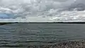 Moose Mountain Lake
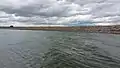 Moose Mountain Dam
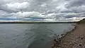 Moose Mountain Lake and Dam
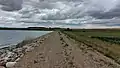 Moose Mountain Dam
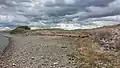 Moose Mountain Dam spillway
Gooseberry Lake
Gooseberry Lake is a shallow, natural lake to the north-west of Moose Mountain Lake and is located at 49°57′0″N, 103° 12′2″W (11,12-9W2).[24] The lake has a large catchment area and flows into Moose Mountain Lake via an east flowing, un-named creek. The area around the lake has a knob and kettle landscape with poor drainage that, during years with heavy spring run-off or rains, is known to flood.
In 2017, then Environment Minister and now Premier of Saskatchewan, Scott Moe, announced the Dry Lake Drainage Project in the Gooseberry Lake watershed.
"The whole goal of these systems is to be able to control and organize the water flow with gates and gated culverts and such, which start, quite frankly, at the farm gate,” said Scott Moe.
Dry Lake is a small, shallow lake north of Gooseberry Lake. Its watershed is north of Gooseberry Lake and west Moose Mountain Creek. A small arroyo creek flows from Dry Lake south to Gooseberry Lake. This project gives more control to local farmers regarding flood control and drainage in the Dry Lake area of the Gooseberry Lake watershed.
"They’d had some issues in the past and they were ready to co-operate … to solve them and it’s very encouraging. It’s good for agriculture. It’s good for the province, good for the environment, good for downstream, other producers and waterways,” said Agriculture Minister Lyle Stewart.
The project involves more than 73,000 hectares of land and is the largest single agricultural drainage approval project in the province's history. It gives farmers control over thirty gated culverts that will help funnel excess water off fields and into Moose Mountain Creek. The culverts can also hold water back when the river levels are high.[25][26] The project also restored 14 hectares of wetland on existing drainage and almost 9 hectares of wetland retention on new drainage.[27]
See also
References
- "Natural Resources Canada-Canadian Geographical Names (Moose Mountain Creek)". Retrieved 29 August 2014.
- "Atlas of Canada Toporama". Retrieved 29 August 2014.
- Government of Canada, Natural Resources Canada. "Place names - Moose Mountain Creek". www4.rncan.gc.ca.
- "Drought in Palliser's Triangle | the Canadian Encyclopedia".
- "Members Map « SARM | Saskatchewan Association of Rural Municipalities".
- http://www.uppersouriswatershed.ca/
- "Watershed Information | Caring for our watersheds".
- "Moose Creek".
- Government of Canada, Natural Resources Canada. "Place names - Chapleau Lakes". www4.rncan.gc.ca.
- "Place names - Moose Mountain Lake".
- "The Encyclopedia of Saskatchewan | Details". esask.uregina.ca.
- "The Encyclopedia of Saskatchewan | Details".
- Government of Canada, Natural Resources Canada. "Place names - Wolf Creek". www4.rncan.gc.ca.
- Government of Canada, Natural Resources Canada. "Place names - James Creek". www4.rncan.gc.ca.
- Government of Canada, Natural Resources Canada. "Place names - Crooked Creek". www4.rncan.gc.ca.
- Government of Canada, Natural Resources Canada. "Place names - Swift Creek". www4.rncan.gc.ca.
- Government of Canada, Natural Resources Canada. "Place names - Morrison Creek". www4.rncan.gc.ca.
- Government of Canada, Natural Resources Canada. "Place names - Cowper Creek". www4.rncan.gc.ca.
- Government of Canada, Natural Resources Canada. "Place names - Shepherd Creek". www4.rncan.gc.ca.
- "Prairie National Wildlife Area". 24 November 2011.
- "St. Clair National Wildlife Area, Corning SK".
- "WSA Owned Dams".
- "MOOSE MOUNTAIN DAM RECEIVES $1.7 MILLION REHABILITATION | News and Media".
- Government of Canada, Natural Resources Canada. "Place names - Gooseberry Lake". www4.rncan.gc.ca.
- "Saskatchewan landowners sign project to better control water, reduce flooding | Globalnews.ca".
- https://www.cbc.ca/news/canada/saskatchewan/farmers-drainage-project-southeast-sask-1.3986658
- "Dry Lake Drainage Project".

.svg.png.webp)