Cerro Champaquí
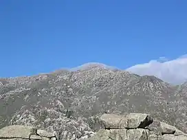
Cerro Champaquí, is a mountain located in the western province of Argentina, Córdoba. It is the highest peak in the province, with a height of 2770m. Cerro Champaquí, is located in the westernmost part of the Sierras de Cordoba known as the Sierras Grandes. Immediately east of the mountain is the Valle de Calamuchita while extending west of the mountian is the Valle de Traslasierra. The mountain and its surroundings belong to the Monumento Natural Champaquí.
| Champaquí | |
|---|---|
 | |
| Highest point | |
| Elevation | 2,770 m (9,090 ft)[1] |
| Coordinates | 31°59′S 64°56′W |
| Geography | |
| Location | Argentina |
| Parent range | Sierras de Córdoba |
Topography
This mountain has moderately steep slopes to the west, with more gentle slopes on its eastern foothills. In the vicinity of the summit there is a small lake that freezes from about late April to early August, it is believed that this has given rise to the name of the hill which means, in the language of the Indian comechingón: Water-in-the-head / Water at the top of the hill
On the eastern slope of this mountain is the town of Santa Rosa de Calamuchita. On the western side is the town of Villa de Las Rosas.[2]
The normal route to climb the mountain begins at Villa Alpina on the east slopes of the mountain.[3]
See also
External links
 |
Wikimedia Commons has media related to Champaquí. |
- http://esfa.iua.edu.ar/wordpress/actividades/expedicion-al-cerro-champaqui-23-10-2010.html (Fuerza Aérea Argentina - Argentine Air Force)
- https://web.archive.org/web/20130906055830/http://www.villayacanto.gov.ar/contenidos/champaqui.html Villa Yacanto Official Website
References
- "PeakList".
- Atlas de Rutas. Megamapa S.R.L. 2013. p. 33. ISBN 978-987-27505-2-7.
- "Andes Handbook : Cerro Champaqui".