Opheusden
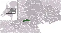
Opheusden is a town in the Dutch province of Gelderland. It is a part of the municipality of Neder-Betuwe, and lies some 5 km south-west of Wageningen.
Opheusden | |
|---|---|
Village | |
 | |
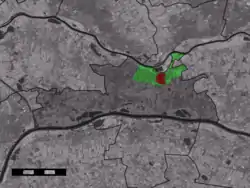 The village centre (red) within the statistical district (green) of Opheusden and municipality (dark grey) of Neder-Betuwe | |
| Coordinates: 51°55′59″N 5°37′47″E | |
| Country | Netherlands |
| Province | Gelderland |
| Municipality | Neder-Betuwe |
| Area | |
| • Total | 2.2 km2 (0.8 sq mi) |
| Population (1 January 2018) | |
| • Total | 5,630 |
| • Density | 2,600/km2 (6,600/sq mi) |
| Time zone | UTC+1 (CET) |
| • Summer (DST) | UTC+2 (CEST) |
Opheusden (or "Heusden", as it was known then) was a separate municipality until 1818, when it was merged with Kesteren.[1]
The town was devastated in October 1944 during the failed German counterattack against the Nijmegan salient after Operation Market Garden had failed.
The Opheusden statistical area, which includes the village centre, its outskirts, and the surrounding countryside, covers an area of 220 hectares. It had a resident population on 1 January 2018 of 5,630, living in 1,960 households.[2] The built-up area of the village covers 73 hectares.[3]
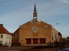
This 2850-seater church in Opheusden is the largest in the Netherlands
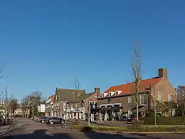
A view of Dorpsstraat in Opheusden
Transport
- Opheusden is served by a railway station on the Elst to Dordrecht line.
References
- Ad van der Meer and Onno Boonstra, Repertorium van Nederlandse gemeenten, KNAW, 2011.
- AlleCijfers.nl Informatie over Opheusden
- Statistics Netherlands (CBS), Statline: Kerncijfers wijken en buurten 2003-2005. As of 1 January 2005.
External links
- J. Kuyper, Gemeente Atlas van Nederland, 1865-1870, "Opheusden". Map of the former municipality, around 1868.
This article is issued from Wikipedia. The text is licensed under Creative Commons - Attribution - Sharealike. Additional terms may apply for the media files.