Ramata Parish
Ramata Parish (Latvian: Ramatas pagasts) is an administrative unit of Mazsalaca Municipality, Latvia. It was an administrative unit of Valmiera District. The administrative center is Ramata village.
Ramata Parish | |
|---|---|
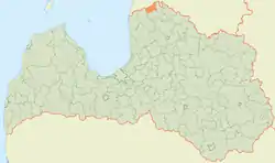 | |
| Country | Latvia |
| Area | |
| • Total | 171.03 km2 (66.04 sq mi) |
| • Land | 165.27 km2 (63.81 sq mi) |
| • Water | 5.76 km2 (2.22 sq mi) |
| Population (1 January 2021)[2] | |
| • Total | 357 |
| • Density | 2.1/km2 (5.4/sq mi) |

Towns, villages and settlements of Ramata parish
- Kundziņi
- Nuķis
- Ramata
- Talcis
- Vērsis
References
- https://data.stat.gov.lv/pxweb/lv/OSP_PUB/START__ENV__DR__DRT/DRT010/; Central Statistical Bureau of Latvia; retrieved: 26 February 2021.
- https://data.stat.gov.lv/pxweb/lv/OSP_PUB/START__POP__IR__IRS/IRD060/; Central Statistical Bureau of Latvia; retrieved: 15 June 2021.
This article is issued from Wikipedia. The text is licensed under Creative Commons - Attribution - Sharealike. Additional terms may apply for the media files.