Salawati
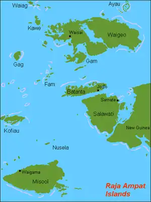
Salawati is one of the four major islands in the Raja Ampat Islands in West Papua (formerly Irian Jaya), Indonesia. Its area is 1,623 km2. Salawati is separated from New Guinea to the southeast by the Sele Strait (a.k.a. Galowa Strait, Revenges Strait), and from Batanta to the north by the Pitt Strait (a.k.a. Sagewin Strait).
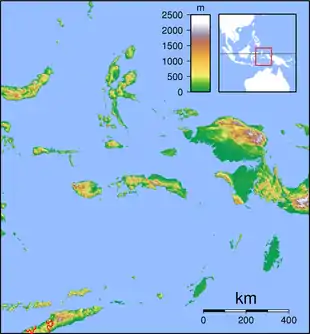  Salawati Location in eastern Indonesia | |
| Geography | |
|---|---|
| Coordinates | 1°6′24″S 130°51′59″E |
| Archipelago | Raja Ampat Islands |
| Area | 1,623 km2 (627 sq mi) |
| Administration | |
| Province | West Papua |
History
By the 17th century, the Tidore kingdom had close economic ties with the island. Around 1705, it was reported that local chiefs had adopted Islam.[1]
Pulau Salawati Utara Nature Reserve
| Pulau Salawati Utara Nature Reserve | |
|---|---|
| Cagar Alam Pulau Salawati Utara | |
| Area | 57,000 ha (220 sq mi) |
| Operator | Balai Besar Konservasi Sumber Daya Alam Papua Barat |
Pulau Salawati Utara Nature Reserve covers much of the northern portion of the island, with an area of 570 km2 on the northern portion of the island. It protects part of the island's native lowland rain forest.[2]
References
- Slama, Martin (2015), "Papua as an Islamic Frontier: Preaching in 'the Jungle' and the Multiplicity of Spatio-Temporal Hierarchisations", From 'Stone-Age' to 'Real-Time': Exploring Papuan Temporalities, Mobilities and Religiosities, ANU Press, pp. 243–270, ISBN 978-1-925022-43-8
- "Pulau Salawati Utara". Protected Planet. Accessed 8 August 2021.
Authority control  |
|---|
This article is issued from Wikipedia. The text is licensed under Creative Commons - Attribution - Sharealike. Additional terms may apply for the media files.