Mystery Lake, Manitoba
Mystery Lake is a local government district (LGD) in northern Manitoba. It surrounds the city of Thompson, although most of its territory lies to the southwest and south of the city. It is named after Mystery Lake (55°50′50″N 97°43′40″W), a lake located in the northeast section of the LGD, northeast of Thompson.
Mystery Lake | |
|---|---|
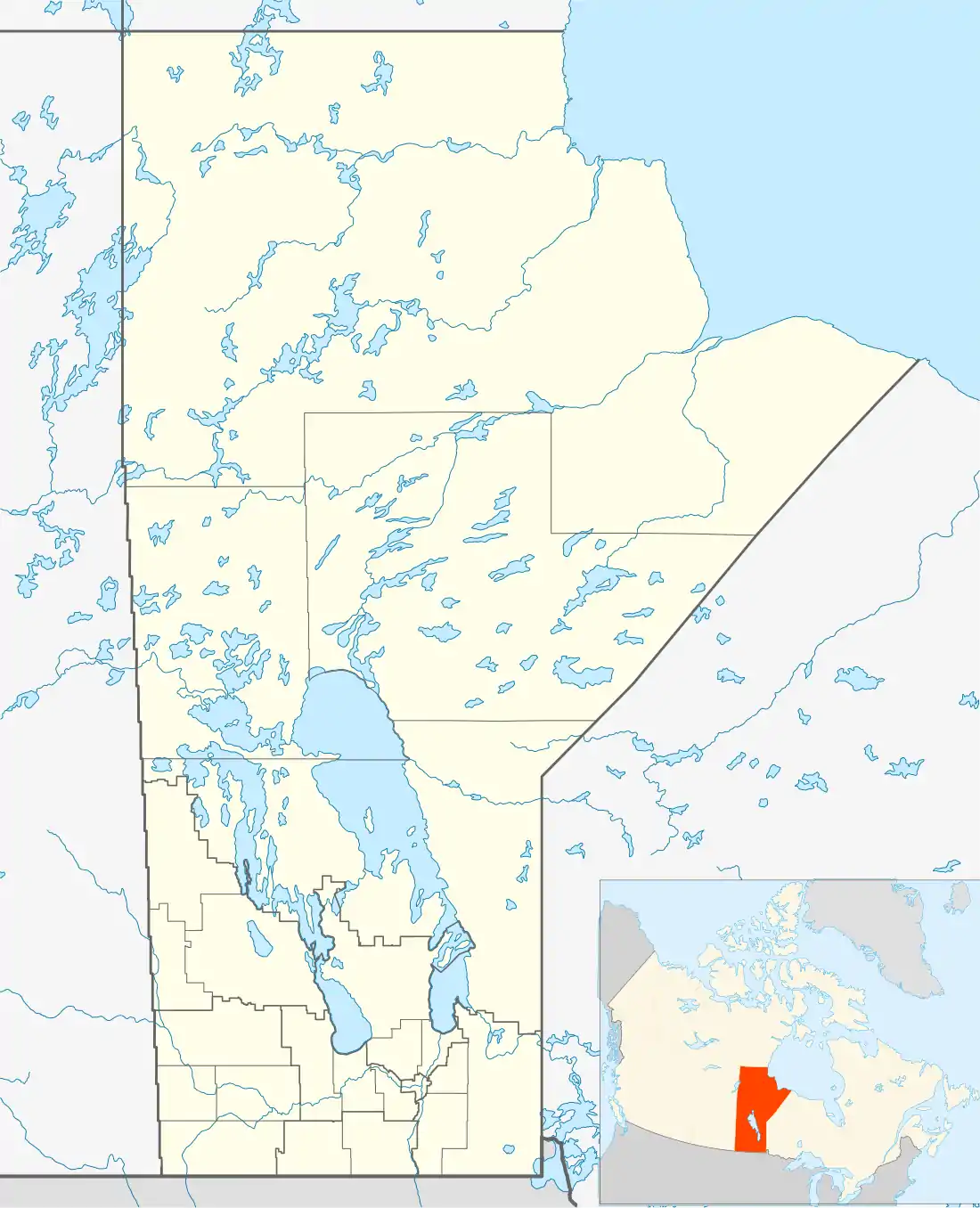  Mystery Lake Location of Mystery Lake in Manitoba | |
| Coordinates: 55°33′N 98°00′W | |
| Country | .svg.png.webp) Canada Canada |
| Province |  Manitoba Manitoba |
| Region | NorMan |
| Census division | No. 22 |
| Established | December 5, 1956[1] |
| Government | |
| • (Thompson) | Steve Ashton (NDP) |
| • MP (Churchill) | Niki Ashton (NDP) |
| Area | |
| • Land | 3,460.46 km2 (1,336.09 sq mi) |
| Population | |
| • Total | 0 |
| • Density | 0.0/km2 (0/sq mi) |
| Time zone | UTC−6 (CST) |
| • Summer (DST) | UTC−5 (CDT) |
| Postal code | R8N |
| Area code(s) | 204 |
| Highways | PR 280 |
Communities
- Moak Lake
Demographics
In 2011, according to Statistics Canada census data, Mystery Lake had a population of 10 living in 3 dwellings, up from 0 in 2006. The LGD has a land area of 3,464.06 km2 (1,337.48 sq mi) and a population density of 0.0/km2 (0/sq mi).[3]
References
- "Manitoba Communities: Mystery Lake (Local Government District)". Manitoba Historical Society. Retrieved 28 August 2021.
- "Census Profile, 2016 Census Mystery Lake, Local government district [Census subdivision], Manitoba and Manitoba [Province]". Statistics Canada. Retrieved 28 August 2021.
- "Population and dwelling counts, for Canada, provinces and territories, and census subdivisions (municipalities), 2011 and 2006 censuses (Manitoba)". Statistics Canada. January 30, 2013. Retrieved September 26, 2013.
External links
| Cities |  | |
|---|---|---|
| Local government districts | ||
| First Nations | ||
| Indian reserves | ||
| Indian settlements | ||
| Unorganized areas | ||
| Unincorporated communities | ||
This article is issued from Wikipedia. The text is licensed under Creative Commons - Attribution - Sharealike. Additional terms may apply for the media files.