Special routes of U.S. Route 14
At least 12 special routes of U.S. Route 14 have existed.
 | |
|---|---|
| Highway system | |
Existing
Wyoming alternate route
U.S. Highway 14 Alternate | |
|---|---|
| Location | Cody–Burgess Junction, Wyoming |

U.S. Highway 14 Alternate is an alternate route for U.S. Highway 14 between Cody and Burgess Junction known as the Medicine Wheel Passage.[1]
South Dakota alternate route
U.S. Highway 14A | |
|---|---|
| Location | Spearfish–Sturgis, South Dakota |
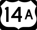
U.S. Highway 14A is an alternate route for U.S. Highway 14 between Spearfish and Sturgis located mostly south of the I-90/US 14 overlap. The route begins at the I-90/US 14/US 85 overlap at Exit 14 which serves 27th Street. It briefly runs south and then turns west along East Colorado Boulevard (BL 90), which is used as a frontage road along the south side of I-90. In between the Alt. US 14 and I-90 is the Spearfish Recreational Trail. BL 90/US 14A moves away from I-90 just before the intersection with Sandstone Hills Drive. At Spearfish Canyon Highway, US 14A leaves the overlap with BL 90 and turns south. A spur of the Spearfish Recreational Trail leave US 14A at Winterville Road, and in the vicinity of the southern trailhead of the Spearfish Path, the route begins to wind around Spearfish Creek and Spearfish Canyon running through the North Hills of the Black Hills National Forest, which includes scenic areas for both cars and hikers, and unincorporated communities and ghost towns such as Maurice, Victoria, and Elmore.
In Cheyenne Crossing, the road turns left and begins the first of two overlaps with US 85. The two routes form a concurrency from there to Lead, then are separated where it continues north also overlapping U.S. Truck Route 85, only to turn east as the routes run through Center City and Backtail. The route meets US 85 again in Deadwood. The routes run together through Deadwood before splitting again, and US 14A turns east along Boulder Canyon Highway. US Highway 14A ends in Sturgis at the I-90/US 14 interchange at Exit 30, but the road continues as another Business Loop of I-90 with an overlap of SD 34 and 79.
Pierre truck route
U.S. Highway 14 Truck | |
|---|---|
| Location | Pierre, South Dakota |
U.S. Highway 14 Truck is a truck route of US 14. Trucks and overheight vehicles follow the truck route to avoid colliding with a low-clearance railroad overpass.[2]
Huron business loop
U.S. Highway 14 Business | |
|---|---|
| Location | Huron, South Dakota |

Brookings bypass route
U.S. Highway 14 Bypass | |
|---|---|
| Location | Brookings, South Dakota |

U.S. Route 14 Bypass is a bypass route of US 14 along the northern edge of Brookings, South Dakota.
Dodge Center business loop
U.S. Highway 14 Business | |
|---|---|
| Location | Dodge Center, Minnesota |
Janesville business loop
Business U.S. Highway 14 | |
|---|---|
| Location | Janesville, Wisconsin |
U.S. Route 14 Business is a business route of US 14 in Janesville, Wisconsin.
Former
Sheridan business loop
U.S. Highway 14 Business | |
|---|---|
| Location | Sheridan, Wyoming |
Rapid City business loop
U.S. Highway 14 Business | |
|---|---|
| Location | Rapid City, South Dakota |
Madison business loop
Business U.S. Highway 14 | |
|---|---|
| Location | Madison, Wisconsin |
| Existed | 1952–early 1970s |
| History | Signed as City US 14 before 1963 |
Janesville city route
City U.S. Highway 14 | |
|---|---|
| Location | Janesville, Wisconsin |

.svg.png.webp)
Woodstock business loop
U.S. Route 14 Business | |
|---|---|
| Location | Woodstock, Illinois |
| Existed | 1963–1971[3][4] |
U.S. Route 14 Business was a business route of US 14. In 1963, US 14 was realigned south of downtown Woodstock. The former alignment that ran through Woodstock was designated as a business route.[5] It lasted until 1971 when its designation was removed.[3][4]
See also
 United States portal
 Illinois portal
 U.S. roads portal
- List of special routes of the United States Numbered Highway System
References
- Medicine Wheel Passage (America's Scenic Byways)
- Google (August 30, 2020). "Street View of an 11' 3" overpass in Pierre, SD" (Map). Google Maps. Google. Retrieved August 30, 2020.
- Illinois Department of Transportation (1972). Illinois Official Highway Map (Map). [1:772,500]. Springfield: Illinois Department of Transportation – via Illinois Digital Archives.
- "Routes in Illinois (1-20)".
- Illinois Division of Highways; H.M. Gousha (1963). Illinois Official Highway Map (Map). [1:790,00]. Springfield: Illinois Division of Highways – via Illinois Digital Archives.