St. Rose, Louisiana
Saint Rose (usually written as St. Rose) is a census-designated place (CDP) in St. Charles Parish, Louisiana, United States. St. Rose is on the east bank of the Mississippi River, two miles (3 km) north of the Jefferson Parish border and is part of the Greater New Orleans metropolitan area. The population was 6,540 in the 2000 census, and 7,504 in 2020.[1]
St. Rose, Louisiana
Saint Rose | |
|---|---|
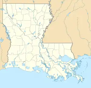  Location of St. Rose in Louisiana | |
| Coordinates: 29°57′38″N 90°18′47″W | |
| Country | United States |
| State | Louisiana |
| Parish | St. Charles |
| Area | |
| • Total | 5.0 sq mi (13 km2) |
| • Land | 4.0 sq mi (10 km2) |
| • Water | 1.0 sq mi (3 km2) |
| Elevation | 10 ft (3 m) |
| Population (2020) | |
| • Total | 7,504 |
| • Density | 1,500/sq mi (580/km2) |
| Time zone | UTC-6 (CST) |
| • Summer (DST) | UTC-5 (CDT) |
| Area code(s) | 504 |
History
The LaBranche Plantation Dependency House is located in St. Rose. It is a surviving building of the LaBranche Plantation. The main house was the plantation home built by the Zweig family in 1792. The plantation was based on the cultivation and processing of sugar cane and was dependent on slave labor. The big house was destroyed during the Civil War. One of the few buildings left on the property after the Civil War was the dependency house, also called a garconnière (French for bachelor quarters). The property also has a preserved slave quarters building.[2]
In 1873, Palmer Elkins purchased property in St. Rose. In 1880, Elkins invited freedman and their families to move onto his property to receive training. He established what became known as "Elkinsville" or "Freetown".
Geography
St. Rose is located at 29°57′38″N 90°18′47″W (29.960421, -90.313094).[3]
According to the United States Census Bureau, the CDP has a total area of 5.0 square miles (13.0 km2), of which 4.0 square miles (10.5 km2) is land and 1.0 square mile (2.6 km2) (19.88%) is water.
Education
St. Charles Parish Public School System operates public schools, including:
- St. Rose Elementary School (PK-5)
- Albert Cammon Middle School
- Destrehan High School in Destrehan[4]
Notable people
- Burnell Dent, NFL linebacker for the Green Bay Packers and New York Giants
- Snooks Eaglin, guitarist and singer
- Roy Ebron, Basketball player in the ABA
- Shelley Hennig, Miss Teen USA 2004 and actress
- Jordan Jefferson, NFL quarterback for the Tampa Bay Buccaneers
- Justin Jefferson, NFL wide receiver for the Minnesota Vikings
- Curtis Johnson, Head football coach at Tulane University and NFL assistant coach
- Beulah Levy Ledner, Dessert and pastry chef
- Ed Reed, College Football Hall of Fame and NFL Hall of Fame safety for the Baltimore Ravens, Houston Texans and New York Jets
- Darryl Richard, NFL defensive tackle for the New England Patriots
- Margaret Taylor-Burroughs, Co-founder of the DuSable Museum of African American History in Chicago, was born in St. Rose
- Gary Tyler, who is believed to have been wrongly convicted of murder in 1974. He was released in 2016.
- Josh Victorian, NFL cornerback for the Baltimore Ravens, Detroit Lions, Houston Texans, New England Patriots, New Orleans Saints, New York Giants and Pittsburgh Steelers
- Darius Vinnett, NFL cornerback for the St. Louis Rams and Atlanta Falcons
Gallery
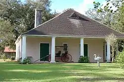
.jpg.webp) LaBranche Plantation Dependency historical marker
LaBranche Plantation Dependency historical marker.jpg.webp) Elkinsville-Freetown historical marker
Elkinsville-Freetown historical marker
 |
Wikimedia Commons has media related to Saint Rose, Louisiana. |
References
- "2020 Race and Population Totals". United States Census Bureau. Retrieved 2021-10-25.
- "LaBranche Plantation Dependency House". experienceneworleans.com. Retrieved 2017-04-07.
- "US Gazetteer files: 2010, 2000, and 1990". United States Census Bureau. 2011-02-12. Retrieved 2011-04-23.
- "Destrehan High School" (Archive). AdvancED. p. 4. Retrieved on December 3, 2016. "The school pulls from the five communities which make up the East Bank of St. Charles Parish: Destrehan, Montz, New Sarpy, Norco, and St. Rose."
Municipalities and communities of St. Charles Parish, Louisiana, United States | ||
|---|---|---|
| CDPs | 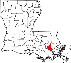 | |
| Other communities | ||
| Footnotes | ‡This populated place also has portions in an adjacent parish or parishes | |
| ||
Authority control  |
|---|