Uttara (Town)
Uttara Model Town or simply Uttara (Bengali: উত্তরা) is a suburb of Dhaka, the capital of Bangladesh. The name derives from the Bengali word ut'tar meaning "north". It lies on the road to Gazipur, and adjoins Hazrat Shahjalal International Airport.
Uttara
উত্তরা | |
|---|---|
| Uttara Model Town | |
.jpg.webp) Skyline of Uttara, Dhaka | |
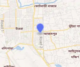
Expandable map of Uttara | |
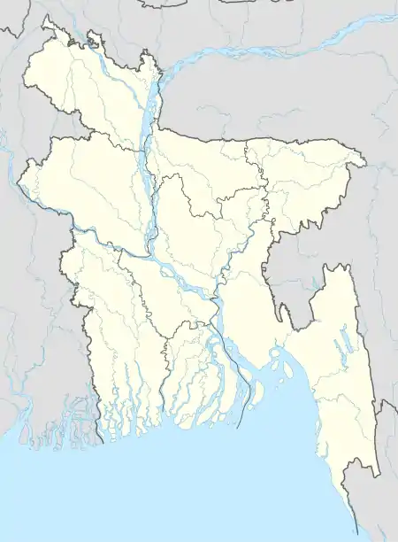  Uttara Location of Uttara | |
| Coordinates: 23.8667°N 90.4042°E | |
| Country |  Bangladesh Bangladesh |
| Division | Dhaka Division |
| District | Dhaka District |
| City Corporation | Dhaka North City Corporation |
| Establishment | 1988[1] |
| Government | |
| • Ward Commissioner | Dr. Hafizul Islam Kusum[2] |
| Area | |
| • Total | 36.91 km2 (14.25 sq mi) |
| Elevation | 23 m (75 ft) |
| Population (2001) | |
| • Total | 345,097 |
| • Density | 9,350/km2 (24,200/sq mi) |
| Time zone | UTC+6 (BST) |
| Postal code | 1230 |
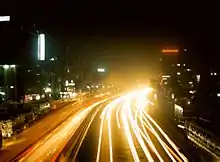
Night view of Uttara
Demographics
At the 2001 Bangladesh census, Uttara had a population of 345,097.[4] According to 1991 figures, males constitute 54.41% of the population and females 45.59%, and about 60% of the Uttara's population are adults. Uttara has an average literacy rate of 61% (7+ years).[5]
Thanas
The town of Uttara has two thanas (police stations).
Education
Just like any other residential area in Dhaka, Uttara has a high number of educational institutions. They include:[8]
- Aeronautical Institute of Bangladesh
- Rangon Academy
- Armed Police Battalion High School
- Aeronautical College of Bangladesh
- Aga Khan School, Dhaka
- Asian University
- Atish Dipankar University of Science and Technology
- BGMEA Institute of Fashion & Technology
- Bangladesh International Tutorial (BIT)
- Blooming Flower School
- Belmont International School
- Child Plan School
- DPS STS School
- Don Bosco School and College
- Heritage International College
- Euro International School
- International Turkish Hope School, Dhaka
- Rangon Art School
- International University of Business Agriculture and Technology
- Heritage International College of Aviation Science and Management
- Life Preparatory School
- MaHaad International School
- Mastermind School
- Mastermind Play School
- Medical College for Women and Hospital
- Mileshium School
- Milestone College
- Moajjem Hossain Ideal School & College
- Nabab Habibullah School
- Oxford International School Uttara campus[9]
- Peace International School (PIS)
- RAJUK Uttara Model College
- Red Brick School
- Scholastica school
- Shaheed Monsur Ali Medical College
- Shanto Mariam University of Creative Technology
- South Breeze School
- Sunbeams School
- Sunnydale
- Time International Academy
- Uttara High School and College
- Uttara Town College
- Uttara University
- Uttara Model College
- Uttara Model School
- The Headway School
- Kids Campus School
- Green Lawn School and College
- Sky Touch School-STS
See also
References
- "Uttara Thana". Banglapedia.
- Dhaka South City Corporation: SiteMap. Dhakacity.org.
- "Geographic coordinates of Dhaka, Bangladesh". DATEANDTIME.INFO. Retrieved 7 July 2016.
- "Bangladesh – Dhaka Statistical Metropolitan Area". Retrieved 6 July 2011.
- "Population Census Wing, BBS". Archived from the original on 27 March 2005. Retrieved 10 November 2006.
- "Uttara east thana has low crime rate". Bangla Tribune.
- "Uttara gets new police station". The Daily Star.
- English-Medium Schools. Student-wish.com.
- "Contact Details." Oxford International School. Retrieved 20 September 2015. "Uttara Campus House-40, Gausul Azam Avenue, Sector-13, Uttara, Dhaka-1230"
External links
- Farooque, Abu Hasan (2012). "Uttara Thana". In Islam, Sirajul; Jamal, Ahmed A. (eds.). Banglapedia: National Encyclopedia of Bangladesh (Second ed.). Asiatic Society of Bangladesh.
 |
Wikimedia Commons has media related to Uttara. |
This article is issued from Wikipedia. The text is licensed under Creative Commons - Attribution - Sharealike. Additional terms may apply for the media files.