Wattle Downs
Wattle Downs is a suburb of South Auckland, New Zealand.
Wattle Downs | |
|---|---|
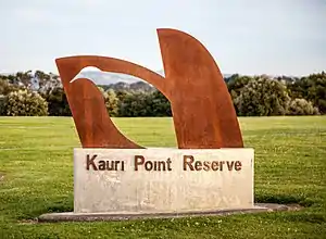 Kauri Point Reserve | |
| |
| Country | New Zealand |
| City | Auckland Council |
| Electoral ward | Manurewa-Papakura Ward |
| Local board | Manurewa Local Board |
| Population (2018) | |
| • Total | 8,496 |
| Postcode(s) | 2103 |
| Clendon Park | Manurewa | Manurewa East |
| Weymouth |
  Wattle Downs Wattle Downs  |
(Pahurehure Inlet) Conifer Grove |
| (Pahurehure Inlet) Kingseat |
(Pahurehure Inlet) Karaka |
(Pahurehure Inlet) Takanini |
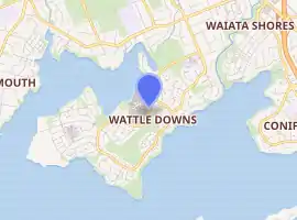
The suburb is located in the Mahia Park peninsula of the Manukau Harbour. It also includes the area of Wattle Cove.
It is 25 kilometres south of the Auckland CBD and 10 kilometres south of Manukau city centre. The closest town centre is Manurewa.
Development
History
Wattle Downs gets its name from the Wattle trees planted in the area by its farmer/owner, Mr White, for an extract from the bark that was used in the tanning of skins [1]
Wattle Downs history dates back to 1933 when the Kimptons, Campbell and Clements families purchased the 460 acre dairy farm on the peninsula. The first homes were built on the peninsula around 1970, after the farm was acquired for development.[2]
Housing
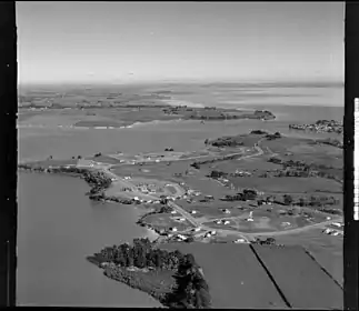
- The original Wattle Downs development takes place in the 1970's, it was developed in phases, most houses were single-detached and were built on the southern side of the Wattle farm peninsula that featured predominantly bungalow, art deco and many 70's style housing, however houses were also built on the Mahia Downs precinct near Mahia Road that included mostly state housing.
- Wattle Cove, a significant development by Fletcher Building, was a $300 million subdivision that built 900 houses on the peninsula's west side throughout 2005-2016. A school & early learning centre was also built[3]
- Acacia Cove, a retirement village, was built in the 2000s and currently has 217 villas and 15 self-contained apartments.[4] Wattle Downs Care Home, operated by Bupa, is a further retirement community situated opposite Acacia Cove. It includes 60 rest homes, a medical and geriatric hospital and Bupa Short Stay services.[5]
- Mahia Park, another significant development, built houses on the peninsulas east side adjacent to Papakura Stream, the houses were built over the course of the 2000's.[1]
- An large greenfield land holding on the western waterfront side of the Wattle Cove precinct is currently zoned as Mixed Housing Suburban as per the Auckland Unitary Plan. However, the land currently remains as privately owned open space following the adjacent development of Wattle Cove between 2005 and 2016.
- Wattle Park, a recent development that started construction in 2019, is a 112 terraced home subdivision located off Mahia Road opposite the established peninsula's housing.[6]
- A small housing development situated on the waterfront of Carnoustie Drive is proposed.
Landscaping
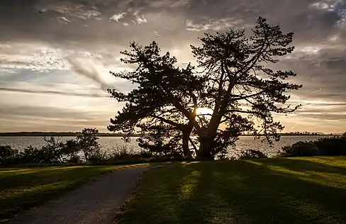
Most streets in Wattle Downs are tree-lined, and the majority of the trees are non-native. However the reserves in the suburb have been planted mainly with native trees to New Zealand.
| Native | Exotic |
| Pohutukawa | European Ash |
| Titoki | Magnolia Grandiflora |
| Puriri | Red alder |
| Karaka | Monterey Pine |
| Kowhai | Golden Elm |
| Totara | Boxelder maple |
| Ngaio | Indian bean tree |
| Cabbage Tree | Cherry |
| Queensland Box |
Wetlands
During the development of the suburb, several artificial wetlands were constructed in reserves for stormwater management and creating habitats for wildlife, many native birds can be found in these areas.
Demographics
| Year | Pop. | ±% p.a. |
|---|---|---|
| 2006 | 6,813 | — |
| 2013 | 7,458 | +1.30% |
| 2018 | 8,496 | +2.64% |
| Source: [7] | ||
Wattle Downs, comprising the statistical areas of Wattle Downs West, Wattle Downs North and Wattle Downs East, had a population of 8,496 at the 2018 New Zealand census, an increase of 1,038 people (13.9%) since the 2013 census, and an increase of 1,683 people (24.7%) since the 2006 census. There were 2,589 households. There were 4,095 males and 4,401 females, giving a sex ratio of 0.93 males per female, with 2,004 people (23.6%) aged under 15 years, 1,638 (19.3%) aged 15 to 29, 3,606 (42.4%) aged 30 to 64, and 1,245 (14.7%) aged 65 or older.
Ethnicities were 53.1% European/Pākehā, 25.0% Māori, 22.8% Pacific peoples, 16.6% Asian, and 2.6% other ethnicities (totals add to more than 100% since people could identify with multiple ethnicities).
The proportion of people born overseas was 29.7%, compared with 27.1% nationally.
Although some people objected to giving their religion, 38.6% had no religion, 43.8% were Christian, 4.2% were Hindu, 1.4% were Muslim, 0.8% were Buddhist and 4.8% had other religions.
Of those at least 15 years old, 1,161 (17.9%) people had a bachelor or higher degree, and 1,290 (19.9%) people had no formal qualifications. The employment status of those at least 15 was that 3,489 (53.7%) people were employed full-time, 657 (10.1%) were part-time, and 237 (3.7%) were unemployed.[7]
Education
Clayton Park School and Reremoana Primary School are coeducational full primary schools (years 1–8) with rolls of 299 and 420 students, respectively.[8][9] Clayton Park opened in 1979.[10] Reremoana opened on 7 February 2006. It has been built to cater for the rapidly growing population in the local area.[11]
Rolls are as of March 2021.[12]
ELCM Wattle Cove is an early learning centre (6 months – 5 years old). It is situated next-door to Reremoana School
Recreation
Wattle Downs Golf Course is a 9-hole golf course nestled in the middle of the suburb.[13] It was opened in 1979 during the early stages of the suburb's development and was designed by New Zealand professional golfer Sir Bob Charles.[14]
The Wattle Downs Walkway is a shared path that follows the waterfront around the peninsula and links several reserves in the area.[15] The path includes views over Waimahia Creek & the Pahurehure Inlet towards Conifer Grove, Weymouth and Karaka.
Reserves in the area include Wattle Farm Ponds Reserve, Tington Wetlands Reserve, Tington Park and Kauri Point Reserve.
A footbridge across the Papakura Stream linking Wattle Downs to the newly established suburb of Waiata Shores has been proposed and approved by the local board.[16]
There are 4 playgrounds scattered around the suburb.
Wattle Farm Ponds Reserve
The ponds at Wattle Farm Ponds Reserve were established in the 1960’s. They were previously sewage treatment ponds that were decommissioned after the construction of the Mangere Treatment Plant. The two ponds now act as a fresh water cleansing system to take the silt from the runoff of the Papakura and Waimahia streams before it is released into the Manukau Harbour. The main pond is between 0.6m deep at the jetty end, to 1.6m at the far end by the tide gate.[17] A $3.5 million improvement project of the reserve commenced throughout 2017-2018 and improved water quality and sediment management, new recreational facilities were also built.[18] The ponds are used for radio-controlled boating, model yachting, and waka ama racing.
Shopping
There are two small shopping complexes located in the suburb - one closer to the entrance at the corner of Tington and McQuarrie Avenues (opposite Clayton Park School) and another on Moor Park near Kauri Point Reserve.
The Tington shops include a dairy, two takeaways, a bakery and a hair salon.
The Moor Park shops include a dairy and a takeaway.
The under construction Waiata Shores local centre opening in 2022 will provide the suburb further amenities.
References
- "Manurewa". NZ Herald. Retrieved 13 December 2021.
- "Fletcher Residential". 23 December 2014. Archived from the original on 23 December 2014. Retrieved 14 September 2021.
- Gibson, ANNE GIBSON, Anne (11 January 2005). "Fletchers in $425m buy-up". NZ Herald. ISSN 1170-0777. Retrieved 10 June 2020.
- "Retirement latest development for Cross". NZ Herald. Retrieved 31 August 2021.
- "Wattle Downs Care Home". Ministry of Health NZ. Retrieved 31 August 2021.
- "Wattle Park - Property Development & Investment in Wattle Downs, Auckland". www.neighbourly.co.nz. Retrieved 10 June 2020.
- "Statistical area 1 dataset for 2018 Census". Statistics New Zealand. March 2020. Wattle Downs West (161100), Wattle Downs North (161200) and Wattle Downs East (161500). 2018 Census place summary: Wattle Downs West 2018 Census place summary: Wattle Downs North 2018 Census place summary: Wattle Downs East
- Education Counts: Clayton Park School
- Education Counts: Reremoana Primary School
- "Welcome to Clayton Park School". Clayton Park School. Retrieved 19 September 2020.
- "About Us". Reremoana School. Retrieved 19 September 2020.
- "New Zealand Schools Directory". New Zealand Ministry of Education. Retrieved 27 April 2021.
- "Wattle Downs Golf Course". Wattle Downs Golf Course. Retrieved 1 December 2021.
- "THE CLUB". Wattle Downs Golf Course. Retrieved 31 August 2021.
- "Wattle Downs Walkway". Auckland Council. Retrieved 1 December 2021.
- "Bridging communities across the Papakura Stream". Bike Auckland. 19 May 2019. Retrieved 1 December 2021.
- "WattlefarmSailing". www.wattlefarmsailing.nz. Retrieved 18 October 2021.
- "Planting day for major stormwater project". OurAuckland. Retrieved 18 October 2021.