Whitechapel High Street
Whitechapel High Street is a street in the Borough of Tower Hamlets in the East End of London. It is about 0.2 miles (350 m) long, making it “one of the shortest high streets in London”.[1] It links Aldgate High Street to the south-west with Whitechapel Road to the north-east, and includes junctions with Commercial Street to the north and Commercial Road to the east.
For motorists, it is the start of the A11 from London to Norwich. For cyclists, it is the start of Cycleway 2 from Aldgate to Stratford. For pedestrians, it is a route from Aldgate tube station to Brick Lane.
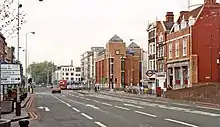
“Whitechapel High Street provides a transition between the commercial development pressures from the City and the historic east end communities.”[2] The street has many narrow plots with 3-5 storey buildings, rebuilt and enlarged at different times in different styles. It was designated a conservation area in 2007.[3]
In 2015 it was named by the Royal Society for Public Health as London’s most unhealthy high street, having the highest concentration of fast-food outlets, payday lenders, bookmakers and tanning salons.[4]
History
Whitechapel High Street follows part of a Roman road, presumed to have continued to Colchester. A major Roman cemetery was located along the street.[5]
In the medieval period the street was known as Algatestreet. It was a major thoroughfare to and from the City of London. Settlement in the area probably began in the 13th century.[6]
The name “Whitechapel” refers to a chapel of ease in the parish of Stepney that was built in the mid-13th century in the area that is now Altab Ali Park on Whitechapel Road. The church was named St Mary Matfelon, but commonly known as the “White Chapel”, referring to the colour of its white chalk rubble walls.[7]
Early maps such as the Agas map show that by the mid-16th century the street had a continuous frontage of mostly 2-storey timber-framed houses with fields behind. Remains of the Boar’s Head Inn, which included the site of the Boar's Head Theatre from 1598-1616, were found beneath the Unite Students building (No 141-143).[5]
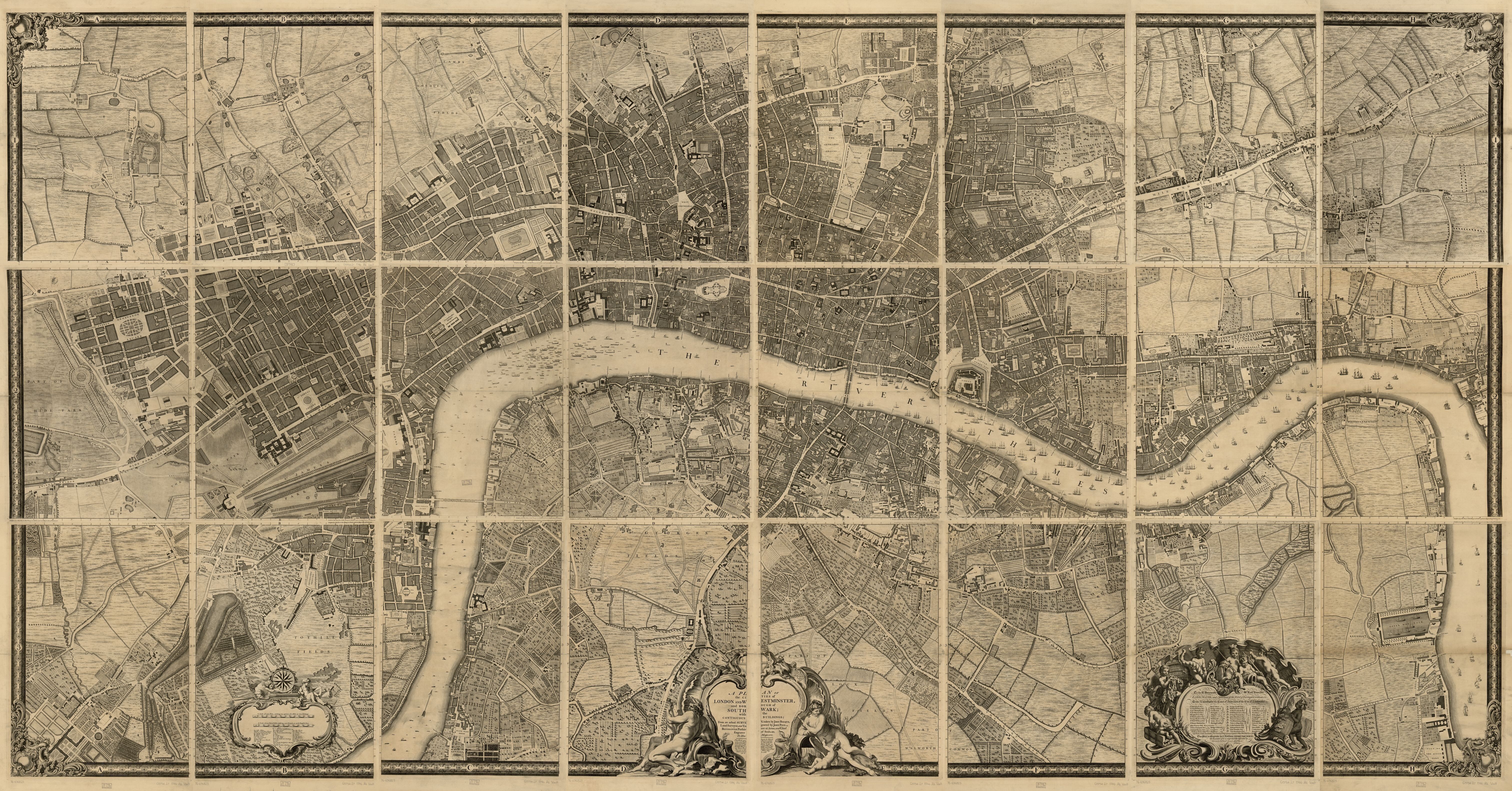
Stow’s Survey of London in 1603 complained that the street was “pestered” with cottages and alleys, concluding that the “unsavoury” passage to Aldgate was “no small blemish to so famous a city”.[8] Morgan’s map of 1682 shows “White Chapel Street” extending from Aldgate to St Mary’s Church, with numerous narrow alleys leading to courtyards or fields behind the street.[9] Some still remain, such as Angel Alley (No 84) and Gunthorpe Street (No 88). While no buildings survive from this period, later buildings such as No 85 and Nos 91-93 reused their extremely narrow plots, preserving their cramped character. By 1746, Roque’s map shows the land behind the street was entirely built up.[10]
In contrast to the buildings, the street itself was wide. Maitland’s Survey of London of 1756 describes it as “a spacious Street for Entrance into the City Eastward … accommodated with good Inns for the Reception of Travellers, Horses, Coaches, Waggons, &c [and] a great many Butchers, who carry on a great Trade, both Wholesale and Retail”.[11] The oldest remaining inn is the White Hart (No 89) from 1721.
_-_High_Street%252C_Whitechapel_-_2465_-_Fitzwilliam_Museum.jpg.webp)
Carey’s map of 1795 introduced the modern name “White Chapel High Street” for the part of the street outside the City of London boundary; Whitechapel Road for the western part beginning at St Mary’s Church; and Aldgate High Street for the eastern part between the city boundary and the old roman wall.[12] By 1810 there were 148 numbered buildings.[13]
“Whitechapel High Street was lined with coaching inns; the road was full of traffic, carts with garden produce, market women with baskets of fruit, flocks of sheet, herds of cattle, brewers’ drays and hay wains for the hay market.”[14] From at least 1665 until 1928, in the Whitechapel hay market, farmers sold animal fodder from large carts in the street.[15]
In the late 18th and early 19th century the street was lined with 4-storey brick shop-houses, still visible at Nos 65-68, 74-76 and 128-129. It became a traffic intersection. Commercial Road was created in 1802-4 to link the docks with the City.[3] The southern section of Commercial Street was created in 1843–5 as part of a slum clearance programme, and to connect Whitechapel High Street with Spitalfields Market.[16] The Whitechapel to Bow tramway opened in 1870.[15] In 1884 the District Railway extended its underground service through Aldgate East to Whitechapel station.
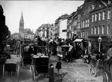
As London’s population increased during the 19th century,and Whitechapel as a whole suffered poverty and overcrowding, the high street remained relatively prosperous. It shows as a narrow strip of “middle class – well-to-do” housing on Booth’s poverty map of 1889. Victorian era, philanthropic improvements included the ornate Passmore Edwards Library and the Whitechapel Gallery. Grand Edwardian era buildings remain at No 90, 102-5 and 126-7.
Many Jewish refugees from Eastern Europe to Whitechapel during 1880-1914 found work in the clothing industry, and the high street became their shop window. Clothing and footwear accounted for one-third of the 144 businesses listed on the street in 1921.[17] The last remaining ones are at No 65a, 88 and 102-5. The largest was Gardiner's department store (No 31-35), which opened in the 1870s and was destroyed by fire in 1972.[18] The traffic intersection became known as Gardiner’s Corner. In 1936 a fascist march into the East End was blocked there in the Battle of Cable Street. One of the few remaining signs of the Jewish presence is a Star of David on the former Jewish Daily Post building (No 88).
Like much of the East End, Whitechapel High Street was extensively damaged by the blitz during World War II. Some buildings were repaired in their original style; others were rebuilt during the 1950s in plain utilitarian style, such as No 83, 87 and 94. Some sites, such as No 97, remained empty for decades. Rising property prices have encouraged repair and rebuilding, and few signs of the blitz remain. One notable absence is St Mary’s Church, which was gutted by a fire bomb in 1940 and demolished in 1952.[7]
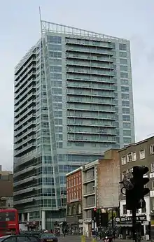
In the 1960s the street became one-way as part of the Aldgate Gyratory, isolating the buildings on the south side as far as Gardiner’s department store in the centre of a large roundabout with return flow along Braham Street. Large concrete and glass office buildings occupied this area, creating a “sense of desolation and insecurity for pedestrians”.[2] The gyratory system was removed in 2008, and Whitechapel High Street became two-way again. Tall office and apartment buildings were combined with attempts to improve the street level environment.
References
- Glinert, Ed (2012). The London Compendium. Penguin Books. p. 322.
- Aldgate Masterplan (PDF). London Borough of Tower Hamlets. 2006. Retrieved 11 December 2021.
- Whitechapel High Street Conservation Area Character Appraisal and Management Guidelines (PDF). London Borough of Tower Hamlets. 2007. Retrieved 11 December 2021.
- Lydall, Ross (26 March 2015). "Revealed: London's 'unhealthiest' high streets - Whitechapel tops capital's list of shame". Evening Standard. Retrieved 12 December 2021.
- Archaeological Impact Assessment: 4-6 & 16-22 Middlesex Street, and 3-11 Goulston Street, Aldgate, London E1. CGMS Heritage. 2019.
- "Whitechapel High Street". Survey of London. Retrieved 11 December 2021.
- "The Church of St Mary Matfelon". Survey of London. Retrieved 11 December 2021.
- Stow, John (1908). A Survey of London. Reprinted From the Text of 1603. Oxford: Clarendon. p. 69-91. Retrieved 11 December 2021.
- "London actually surveyed by Wm Morgan 1682". Wikimedia Commons.
- "John Rocque's map of London and Westminster 1746". Wikimedia Commons.
- "The London Wards - Portsoken Ward in 1756". Londonwiki. Retrieved 11 December 2021.
- "Cary's New And Accurate Plan Of London And Westminster 1795". MAPCO. Retrieved 11 December 2021.
- "John Lockie, a descriptive London Street Directory in 1810". Londonwiki. Retrieved 11 December 2021.
- Weinreb, Ben; Hibbert, Christopher; Keay, Julia; Keay, John. The London Encyclopaedia (3rd ed.). London: Macmillan. p. 1016.
- "Whitechapel hay market". Survey of London. Retrieved 11 December 2021.
- Cruickshank, Dan (2016). Spitalfields: The History of a Nation in a Handful of Streets. London: Random House. p. 443.
- "London Street Directory in 1921". Londonwiki. Retrieved 11 December 2021.
- "Death of a Landmark". Mick's Muses. Retrieved 11 December 2021.