Yamagata, Iwate
Yamagata (山形村, Yamagata-mura) was a village located in Kunohe District, Iwate Prefecture, Japan.
Yamagata
山形村 | |
|---|---|
Former municipality | |
 Flag | |
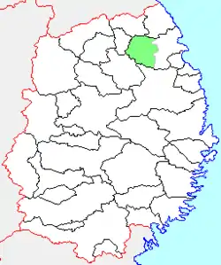 Location of Yamagata in Iwate Prefecture | |
  Yamagata Location in Japan | |
| Coordinates: 40°08′55″N 141°31′18″E | |
| Country | Japan |
| Region | Tōhoku |
| Prefecture | Iwate Prefecture |
| District | Kunohe |
| Merged | April 1, 2005 (now part of Kuji) |
| Area | |
| • Total | 295.49 km2 (114.09 sq mi) |
| Population (March 1, 2006) | |
| • Total | 3,121 |
| • Density | 7.89/km2 (20.4/sq mi) |
| Time zone | UTC+09:00 (JST) |
| Symbols | |
| Bird | Copper pheasant |
| Flower | Japanese azalea |
| Tree | Japanese white birch |
The village of Yamagata was created on April 1, 1889 within Kita-Kunohe District with the establishment of the municipality system. Kita-Kunohe District and Minami-Kunohe Districts merged to form Kunohe District on April 1, 1897. The mountainous area was formerly known for a number of mines, especially ironsand. On March 6, 2006, Yamagata was merged into the expanded city of Kuji.
As of March 1, 2006, the village had an estimated population of 3,121 and a population density of 7.89 persons per km². The total area was 295.49 km².

This article is issued from Wikipedia. The text is licensed under Creative Commons - Attribution - Sharealike. Additional terms may apply for the media files.