Arfak Mountains Regency
Arfak Mountains Regency (Kabupaten Pegunungan Arfak) is a regency of the West Papua Province of Indonesia. It was formed in 2013 from the western districts of Manokwari Regency. The areas now comprised in the new regency had a population of 23,877 at the 2010 Census, which rose to 38,941 at the 2020 Census.[2] The administrative centre is the town of Anggi.
Arfak Mountains Regency
Kabupaten Pegunungan Arfak | |
|---|---|
 Coat of arms | |
| Motto(s): Bhaktiku Negeriku (My Devotion My Country) | |
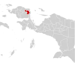 Location in Indonesian Papua | |
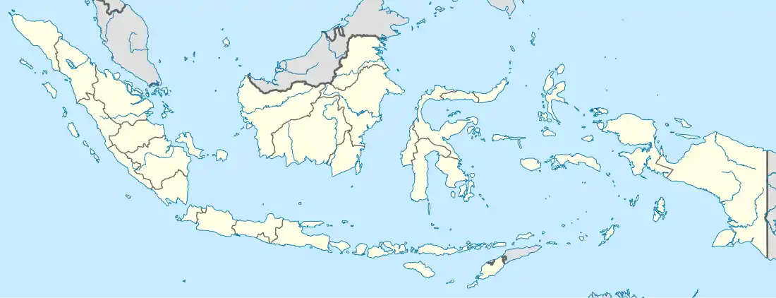  Arfak Mountains Regency Location in Indonesia | |
| Coordinates: 0.9352°S 133.8959°E | |
| Country | Indonesia |
| Province | West Papua |
| Capital | Anggi |
| Government | |
| • Regent | Yosias Saroy |
| • Vice Regent | Marinus Mandacan |
| Area | |
| • Total | 2,774.73 km2 (1,071.33 sq mi) |
| Population (2020 Census)[1] | |
| • Total | 38,941 |
| • Density | 14/km2 (36/sq mi) |
| Time zone | UTC+9 (Indonesia Eastern Time) |
| Area code | (+62) 986 |
| Website | pegafkab |
Geography
Geographical Location of Arfak Mountains Regency, as follows: Part North : 0º55' South Latitude; Southern Part: 1º40' South Latitude; Part West : 133º10' East Longitude; East: 134º05' East Longitude. The altitude of the Arfak Mountains Regency is 300 – 1,800 meters above sea level. In terms of area by district, Testega is the district with the largest area (75,515 ha or 19.65%). of the total area of Pegaf Regency), followed by Catubouw District (72,237 ha or 18.80% of the total area of Pegaf Regency); while the sub-district with an area of the narrowest area is Membey (10,370 ha or 2.37% of the total area Pegaf District), followed by Anggi district (14,114 ha or 3.67% of the total area Pegaf District).[3]
Administration
The Arfak Mountains Regency is divided into ten districts (distrik), listed below with their areas and their populations at the 2010 Census[4] and the 2020 Census.[5] The table also includes the location of the district administrative centres, the number of administrative villages (rural desa and urban kelurahan) in each district, and its post code.
| Name | Area in km2 | Population Census 2010[6] | Population Census 2020[7] | Admin centre | Number of villages | Post code |
|---|---|---|---|---|---|---|
| Didohu | 176.06 | 1,550 | 2,070 | Iranmeba | 14 | 98359 |
| Sururey | 403.16 | 2,500 | 2,954 | Sururey | 12 | 98358 |
| Anggi Gida | 191.56 | 1,279 | 1,969 | Tombrok | 8 | 98356 |
| Membey | 57.45 | 1,055 | 1,834 | Membey | 6 | 98354 |
| Anggi | 256.79 | 2,006 | 3,149 | Ullong | 13 | 98355 |
| Taige | 112.12 | 1,290 | 3,526 | Taige | 11 | 98357 |
| Hingk | 367.07 | 5,353 | 7,210 | Uncep | 29 | 98353 |
| Menyambaouw | 192.58 | 6,181 | 7,807 | Menyambouw | 37 | 98351 |
| Catubouw | 367.07 | 1,838 | 4,807 | Catubouw | 21 | 98352 |
| Testega | 493.34 | 825 | 3,615 | Testega | 15 | 98350 |
| Total | 2,774.73 | 23,877 | 38,941 | Anggi | 166 |
References
- Badan Pusat Statistik, Jakarta, 2021.
- Badan Pusat Statistik, Jakarta, 2021.
- Direktorat Jendral Cipta Karya Kementerian Pekerjaan Umum dan Perumahan Rakyat, Jakarta, 2021
- Biro Pusat Statistik, Jakarta, 2011.
- Badan Pusat Statistik, Jakarta, 2021.
- Biro Pusat Statistik, Jakarta, 2011.
- Badan Pusat Statistik, Jakarta, 2021.
External links
Regencies and cities of West Papua | ||
|---|---|---|
Capital: Manokwari | ||
| Regencies |  | |
| Cities | ||