Aurad
Aurad is a town and municipal council in Bidar district of the Indian state of Karnataka. [7] It is the birthplace of Shri Bhagwanth Khuba, Member of Parliament, Lok Sabha and Minister of State for Chemicals - Fertilizers & New - Renewable Energy in the Government of India.
Aurad | |
|---|---|
Town | |
| Aurad (B) | |
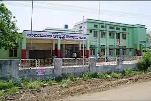 Government Hospital Aurad | |
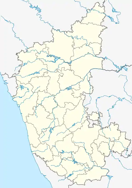  Aurad Location in Karnataka, India  Aurad Aurad (India)  Aurad Aurad (Asia) | |
| Coordinates: 18.25°N 77.43°E | |
| Country |  India India |
| State |  Karnataka |
| Region | Kalyana-Karnataka |
| District | Bidar District |
| Lok Sabha Constituency | Bidar (Lok Sabha constituency) |
| Named for | 10th Inscriptions |
| Government | |
| • Type | Town Municipal |
| • Body | Aurad Town Panchayath |
| • President of the Municipal Council | Ambika Kerba[1] |
| • Chief officer of the Municipal Council | Ravi Sukumar[2] |
| • MLA | Prabhu Chauhan |
| • Tahsildar | Chandrashekar[3] |
| Area | |
| • Total | 7 km2 (3 sq mi) |
| Elevation | 542 m (1,778 ft) |
| Highest elevation | 610 m (2,000 ft) |
| Population (2015)[4] | |
| • Total | 33,419[5] |
| • Density | 15,211/km2 (39,400/sq mi) |
| Language | |
| • Official | Kannada[6] |
| Time zones | UTC+5:30 (IST) |
| UTC+5:30 (IST summer) | |
| PIN | 585326 |
| STD Code | 08485 |
| Vehicle registration | KA 38 |
| Major Highways |  NH 161A NH 161A |
| Website | auradtown |
Geography
Aurad is located at 18.25°N 77.43°E.[8] It has an average elevation of 542 metres (1,778 ft). Aurad is 840 kilometres (520 mi) from Bengaluru and 42 kilometres (26 mi) from District Headquarters Bidar. The area of Aurad is 1,227.20 km2 having 6 circles, 149 villages and 177 thandas. It is located 542–610 metres (1,778–2,001 ft) above sea level. Aurad taluka is one of the five talukas of the Bidar District. It is bounded by Maharashtra on the North-west, Bhalki taluka on the south and Andhra Pradesh in the east. This is the largest taluka in the district.
River
Manjra is the tributary of Godavari, which enters into Aurad at Horandi and flows as taluka boundary through Sonal, Kalgapur, Hulsur, Khed, Halalli, Nidoda, Nittur, Babli, Bachepalli. Ladha, Koutha(B), Khanapur and at the end it leaves Aurad at Kandgul village.
Climate
The climate is generally dry and healthy. The average rainfall of the taluka is 840 mm. Average number of rainy days are about 51 days. Though the climate is dry throughout the year, summer months become very hot and the temperature goes as high as 40-43-degree Celsius. The minimum temperature during winter goes as low as 15-10-degree Celsius.
Demographics
As of 2011 Indian Census, Aurad had a total population of 19,849, of which 10,058 were males and 9,791 were females. Population within the age group of 0 to 6 years was 2,769. The total number of literates in Aurad was 12,226, which constituted 61.6% of the population with male literacy of 68.7% and female literacy of 54.3%. The effective literacy rate of 7+ population of Aurad was 71.6%, of which male literacy rate was 79.8% and female literacy rate was 63.2%. The Scheduled Castes and Scheduled Tribes population was 6,066 and 1,207 respectively. Aurad had 3810 households in 2011.[9]
Places of interest
- Sri Amareshwar Temple.[10]
Notable people
- Bhagwanth Khuba, serving Member of Parliament of the Bidar Lok Sabha constituency since 2014.
- Narsingrao Suryawanshi, former Member of Parliament from Bidar.
- Vaijnath Patil, member of the Indian National Congress.
- Prabhu Chauhan, serving Minister of Animal Husbandry and Fisheries and Minority Welfare in Government of Karnataka since 2019
References
- http://auradtown.mrc.gov.in/
- http://auradtown.mrc.gov.in/
- http://auradtown.mrc.gov.in/
- "AURAD(TP), Bidar | Village | GeoIQ".
- "AURAD(TP), Bidar | Village | GeoIQ".
- "52nd Report of the Commissioner for Linguistic Minorities in India" (PDF). nclm.nic.in. Ministry of Minority Affairs. Archived from the original (PDF) on 25 May 2017. Retrieved 10 March 2019.
- "Aurad Population (2020/2021), Taluka Village List in Bidar, Karnataka".
- Falling Rain Genomics, Inc - Aurad
- "Census of India: Aurad". www.censusindia.gov.in. Retrieved 25 October 2019.
- Rishikesh Bahadur Desai (29 August 2005). "A 'cattle bank' for poor farmers". The Hindu. Retrieved 26 March 2019.
District HQ: Bidar | |
| Villages and towns |
|