Barito River
Barito River is the second longest river in Borneo after the Kapuas River with a total length of 1,090 km (680 mi) and with a drainage basin of 81,675 square kilometers (31,535 sq mi) in South Kalimantan, Indonesia. It originates in the Muller Mountain Range, from where it flows southward into the Java Sea. Its most important affluent is the Martapura River, and it passes through the city of Banjarmasin.[4][5][6]
| Barito River Sungai Barito, Sungai Dusun, Soengai Doesoen, Sungi Banjer, Sungi Dunsun, Soengai Baritoe, Sungai Banjar, Sungai Banjarmasin, Sungai Banjar Besar | |
|---|---|
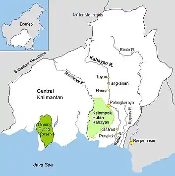 Barito and other rivers in Central and South Kalimantan | |
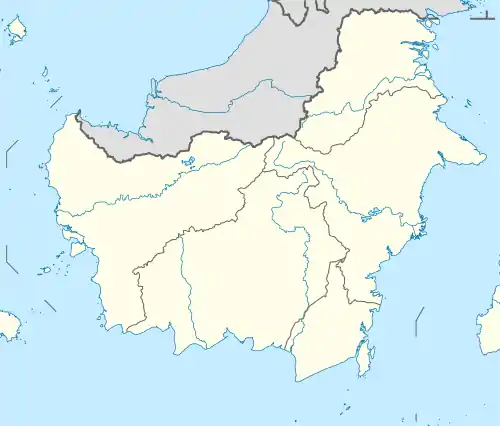  Location of river mouth 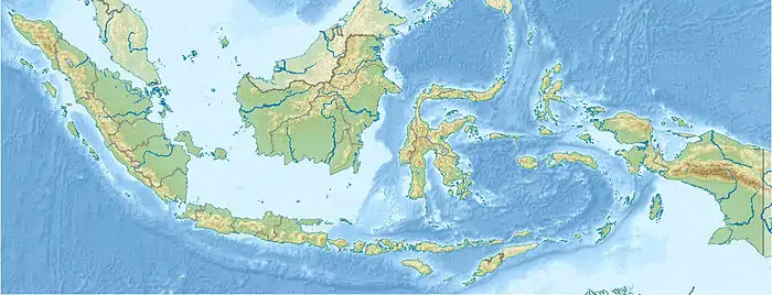 Barito River (Indonesia) | |
| Location | |
| Country | Indonesia |
| Physical characteristics | |
| Source | |
| • location | Müller Mountain Range |
| Mouth | |
• location | Java Sea |
• elevation | 0 m (0 ft) |
| Length | 1,090 km (680 mi) |
| Basin size | 81,675 km2 (31,535 sq mi)[1] |
| Discharge | |
| • location | Barito Delta, Java Sea, Indonesia, Borneo (Kalimantan) |
| • average | 5,497 m3/s (194,100 cu ft/s)[2] |
| • maximum | 27,000 m3/s (950,000 cu ft/s) |
| Basin features | |
| Tributaries | |
| • left | Mangkatip, Negara River, Martapura River |
| • right | Murung River, Anjir Tamban, Anjir Serapat, Kapuas River (Barito River tributary)[3] |


This river is the location of the closest relative of the Malagasy language of Madagascar, the Ma'anyan language of Dayaks, from where settlers arrived in Madagascar (presumably in waves) from the 3rd to 10th century and from which the current island nation's population largely traces its origins.
Geography
The river flows in the southeast area of Borneo with predominantly tropical rainforest climate (designated as Af in the Köppen-Geiger climate classification).[7] The annual average temperature in the area is 24 °C (75 °F). The warmest month is October, when the average temperature is around 26 °C (79 °F), and the coldest is January, at 20 °C (68 °F).[8] The average annual rainfall is 2,735 millimeters (107.7 inches). The wettest month is December, with an average of 437-millimeter (17.2 in) rainfall, and the driest is September, with a 62-millimeter (2.4 in) rainfall.[9]
Images
 Dutch boat on the Barito River (1917)
 Inhabitants along the Barito
 A boat on the Barito
References
- https://id.scribd.com/doc/211844751/STRATEGI-KEBIJAKAN-PENGELOLAAN-WILAYAH-SUNGAI-BARITO-KAPUAS-DALAM-RANGKA-MENDUKUNG-PENGEMBANGAN-KAWASAN-PERKOTAAN-YANG-BERKELANJUTAN&ved=2ahUKEwilrZ24vpfzAhWSv4sKHbJQA_k4RhAWegQIBRAB&usg=AOvVaw336KphLD4eRuJl10LvTa7E. Missing or empty
|title=(help) - https://id.scribd.com/doc/211844751/STRATEGI-KEBIJAKAN-PENGELOLAAN-WILAYAH-SUNGAI-BARITO-KAPUAS-DALAM-RANGKA-MENDUKUNG-PENGEMBANGAN-KAWASAN-PERKOTAAN-YANG-BERKELANJUTAN&ved=2ahUKEwilrZ24vpfzAhWSv4sKHbJQA_k4RhAWegQIBRAB&usg=AOvVaw336KphLD4eRuJl10LvTa7E. Missing or empty
|title=(help) - "Archived copy". Archived from the original on 16 May 2017. Retrieved 8 January 2019.CS1 maint: archived copy as title (link)
- van Hoëvell, Wolter Robert (1838). Tijdschrift voor Nederlandsch Indië (in Dutch). 1. Ter Lands-drukkerij. p. 6.
- Buddingh, Steven Adriaan (1861). Neêrlands-Oost-Indië: Reizen over Java, Madura, Makasser, Saleijer, Bima, Menado, Sangier-eilanden, Talau-eilanden, Ternate, Batjan, Gilolo en omliggende eilanden, Banda-eilanden, Amboina, Haroekoe, Saparoea, Noussalaut, Zuidkust van Ceram, Boeroe, Boano, Banka, Palembang, Riouw, Benkoelen, Sumatra's West-Kust, Floris, Timor, Rotty, Borneo's West-Kust, en Borneo's Zuid- en Oost-Kust; gedaan gedurende het tijdvak van 1852-1857 (in Dutch). M. Wijt. pp. 442.
de groote Banjersche rivier (de Barito).
- Nederlandsch-Indië (1838). "Tijdschrift voor Nederlandsch-Indië" (in Dutch). 1–2. Lands-drukk.: 6. Cite journal requires
|journal=(help) - Peel, M C; Finlayson, B L; McMahon, T A (2007). "Updated world map of the Köppen-Geiger climate classification". Hydrology and Earth System Sciences. 11 (5): 1633–1644. doi:10.5194/hess-11-1633-2007. Retrieved 30 January 2016.
- "NASA Earth Observations Data Set Index". NASA. 30 January 2016.
- "NASA Earth Observations: Rainfall (1 month - TRMM)". NASA/Tropical Rainfall Monitoring Mission. 30 January 2016.
External links
 Media related to Barito River at Wikimedia Commons