Boende
Boende is a town and capital of Tshuapa Province, lying on the Tshuapa River, in the Democratic Republic of Congo. It is a river port with riverboats sailing to Kinshasa via Mbandaka and is also home to an airport. As of 2009 it had an estimated population of 36,158.[2] The national language used locally is Lingala.
Boende | |
|---|---|
Provincial capital and city | |
| Ville de Boende | |
.jpg.webp) A partial aerial view of Boende territory, Equateur province, DR Congo. Boende, the epicenter of the current Ebola viral disease, is located on the banks of the river Tshuapa, east of Mbandaka. It encompasses a port and an airport allowing regular connections to Kinshasa via Mbandaka. | |
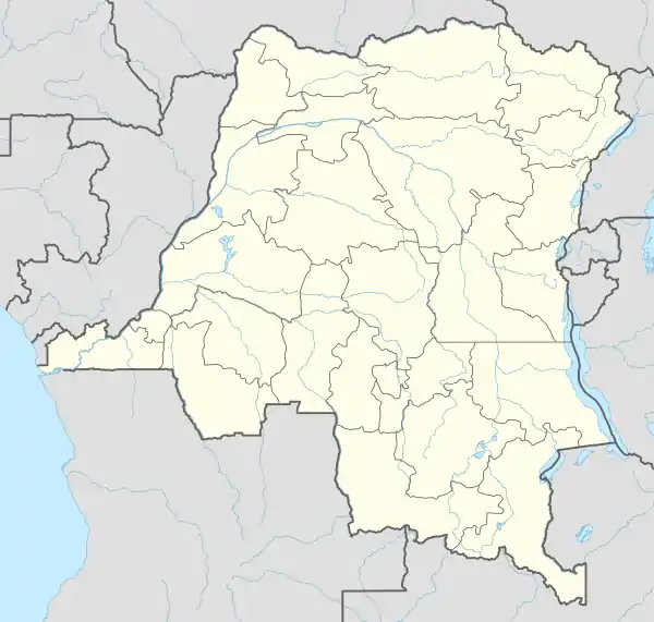  Boende Location in Democratic Republic of the Congo | |
| Coordinates: 0.281°S 20.876°E | |
| Country |  DR Congo DR Congo |
| Province | Tshuapa |
| Communes | Boende, Tshuapa |
| Government | |
| • Mayor | Mustafa Bosenge |
| Population (2009) | |
| • Total | 36,158 |
| Time zone | UTC+1 (West Africa Time) |
| Climate | Af |
Climate
Boende has an equatorial tropical rainforest climate (Köppen Af) and is hot, humid and wet all year round without pronounced variations in temperature or rainfall.
| Climate data for Boende | |||||||||||||
|---|---|---|---|---|---|---|---|---|---|---|---|---|---|
| Month | Jan | Feb | Mar | Apr | May | Jun | Jul | Aug | Sep | Oct | Nov | Dec | Year |
| Average high °C (°F) | 30.7 (87.3) |
31.5 (88.7) |
31.3 (88.3) |
31.1 (88.0) |
31.2 (88.2) |
30.2 (86.4) |
29.1 (84.4) |
29.4 (84.9) |
30.1 (86.2) |
30.1 (86.2) |
30.1 (86.2) |
30.3 (86.5) |
30.4 (86.8) |
| Daily mean °C (°F) | 25.5 (77.9) |
26.0 (78.8) |
25.9 (78.6) |
25.9 (78.6) |
25.9 (78.6) |
25.2 (77.4) |
24.6 (76.3) |
24.7 (76.5) |
25.1 (77.2) |
25.2 (77.4) |
25.2 (77.4) |
25.4 (77.7) |
25.4 (77.7) |
| Average low °C (°F) | 20.3 (68.5) |
20.5 (68.9) |
20.6 (69.1) |
20.8 (69.4) |
20.7 (69.3) |
20.3 (68.5) |
20.1 (68.2) |
20.0 (68.0) |
20.2 (68.4) |
20.3 (68.5) |
20.4 (68.7) |
20.5 (68.9) |
20.4 (68.7) |
| Average rainfall mm (inches) | 152 (6.0) |
135 (5.3) |
202 (8.0) |
176 (6.9) |
171 (6.7) |
136 (5.4) |
131 (5.2) |
175 (6.9) |
189 (7.4) |
218 (8.6) |
230 (9.1) |
162 (6.4) |
2,077 (81.9) |
| Source: Climate-Data.org[3] | |||||||||||||
References
- "Terrible bilan en République démocratique du Congo après la mort de 50 personnes suite au naufrage d'une embarcation. Le drame s'est déroulé mercredi dans le nord-ouest du pays sur la rivière Momboyo". RFI Afrique (in French). 25 May 2018. Retrieved 1 September 2019.
- "Congo (Dem. Rep.): largest cities and towns and statistics of their population". World Gazetteer. Retrieved 21 January 2009.
- "Climate: Boende". Climate-Data.org. Retrieved 10 April 2020.
Capitals of the provinces of the Democratic Republic of the Congo | ||
|---|---|---|
| Flag of the Democratic Republic of the Congo | |
Provinces are shown between brackets | ||
This article is issued from Wikipedia. The text is licensed under Creative Commons - Attribution - Sharealike. Additional terms may apply for the media files.