Chuy Region
Chuy Region (Kyrgyz: Чүй облусу, romanized: Chüy oblusu; Russian: Чуйская область, romanized: Chuyskaya oblast) is the northernmost region (oblast) of the Kyrgyz Republic. This region surrounds the national capital of Kyrgyzstan, Bishkek. It is bounded on the north by Kazakhstan, and clockwise, Issyk-Kul Region, Naryn Region, Jalal-Abad Region, and Talas Region. Its administrative center is Bishkek,[2] but from 2003 to May 2006, it was Tokmok.
Chuy Region
| |
|---|---|
 Flag  Coat of arms | |
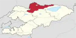 Map of Kyrgyzstan, location of Chuy Region highlighted | |
| Coordinates: 42°30′N 74°30′E | |
| Country |  Kyrgyzstan Kyrgyzstan |
| Capital | Bishkek |
| Government | |
| • Gubernator | Abdrakhmanov Sagynbek Umetalievich |
| Area | |
| • Total | 20,200 km2 (7,800 sq mi) |
| Population (2020-01-01)[1] | |
| • Total | 959,884 |
| • Density | 48/km2 (120/sq mi) |
| Time zone | UTC+6 (East) |
| • Summer (DST) | UTC+6 (not observed) |
| ISO 3166 code | KG-C |
| Districts | 8 |
| Cities | 7 |
| Towns | 1 |
| Villages | 331 |
History
In 1926, the region became part of the newly established Kirghiz ASSR. During the Soviet period, various agro-processing and other industries were established throughout the province, giving rise to several urban centers such as Tokmok, Kant and Kara-Balta.
Geography
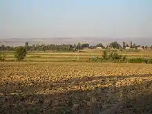
The main northwest part of the region is flat, a rarity in Kyrgyzstan. This is the valley of the Chu River. The valley's black soil is fertile and largely irrigated with water diverted from the Chu River. The region's Agricultural production includes wheat, maize, sugar beets, potatoes, lucerne, and various vegetables and fruits.
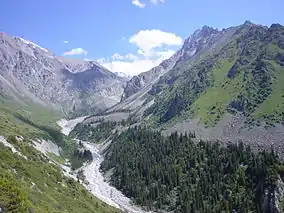
The Kyrgyz Ala-Too mountains form the southern border of the region and the northern border of the Talas Region. There are many hiking and trekking routes accessible from the towns in the valley. The southwestern heel of the region over the Kirgiz Alatau is geographically more like Naryn Region.
The northeast panhandle is the Chong Kemin Valley.
Divisions
The Chuy Region is divided administratively into one city of regional significance (Tokmok), and eight districts:[2][3][4][5]
| District | Seat | Population (2009 Census) | Map |
|---|---|---|---|
| City of Tokmok | Tokmok | 53,087 | |
| Alamüdün District | Lebedinovka | 147,208 | 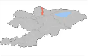 |
| Chuy District | Tokmok | 44,753 | 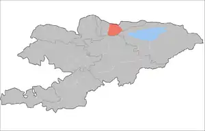 |
| Jayyl District | Kara-Balta | 90,348 | 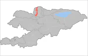 |
| Kemin District | Kemin | 41,924 | 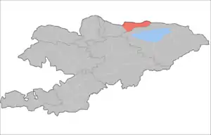 |
| Moskva District | Belovodskoye | 83,641 | 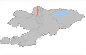 |
| Panfilov District | Kayyngdy | 39,837 | 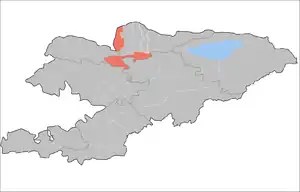 |
| Sokuluk District | Sokuluk | 158,137 | 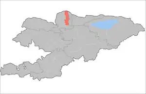 |
| Ysyk-Ata District | Kant | 131,503 | 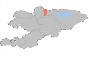 |
Kant, Kara-Balta, Kayyngdy, Kemin, Orlovka and Shopokov are cities of district significance. There is one urban-type settlement in the region: Bordu (part of Kemin District).[2]
The Chuy District surrounds the city of Tokmok. The Alamüdün District surrounds the city of Bishkek, which however is not part of Chuy Region but a region-level administrative unit in its own right. The southwestern heel is administered as two exclaves of Jayyl and Panfilov Districts, Panfilov having a valley to the southeast and Jaiyl the mountains to the north, west and southwest.
Economy
Agricultural production includes wheat, maize, sugar beets, potatoes, lucerne, and various vegetables and fruits. There is little industry in the region.
Transport
The main east-west transportation axis of the region is the Taraz-Bishkek-Balykchy highway, running through most major cities of the region. This road's section west of Bishkek is part of European route E40, known locally as Highway M-39 (based on the old USSR highway numbering scheme). The same numbers apply to the road that continues north-east from Bishkek toward Almaty, crossing the Chuy River and leaving the region for Kazakhstan at Korday border crossing.
The only railway in the region runs along the same Taraz-Bishkek-Balykchy route; it sees comparatively little use these days.
Socioeconomic indicators
Demographics
The population of Chuy Region, according to the Population and Housing Census of 2009, was 790,438. The Region's estimated population was at 959,884 in the beginning of 2020.[1]
| Year | Pop. | ±% |
|---|---|---|
| 1970 | 621,309 | — |
| 1979 | 698,127 | +12.4% |
| 1989 | 801,902 | +14.9% |
| 1999 | 772,188 | −3.7% |
| 2009 | 790,438 | +2.4% |
| Note: de facto population; Source:[7] | ||
Ethnic composition
The population is considerably more heterogeneous than that of the other regions of the country, with many ethnic Russians, Ukrainians, Dungans, Koreans, Germans, etc.
According to the 2009 Census, the ethnic composition (de jure population) of Chuy Region was:[7]
| Ethnic group | Population | Proportion of Chuy Region population |
|---|---|---|
| Kyrgyzs | 474,805 | 59.1% |
| Russians | 167,135 | 20.8% |
| Dungans | 49,802 | 6.2% |
| Uygurs | 15,276 | 1.9% |
| Uzbeks | 14,755 | 1.8% |
| Kazakhs | 12,800 | 1.6% |
| Turks | 11,124 | 1.4% |
| Ukrainians | 10,850 | 1.4% |
| Azerbaijanis | 10,196 | 1.3% |
| Tatars | 6,482 | 0.8% |
| Germans | 5,919 | 0.7% |
| Kurds | 4,544 | 0.6% |
| Koreans | 4,388 | 0.5% |
| Tajiks | 2,600 | 0.3% |
| Lesgins | 2,246 | 0.3% |
| Dargins | 1,812 | 0.2% |
| Karachays | 1,379 | 0.2% |
| Chechens | 1,316 | 0.2% |
| other groups | 5,801 | 0.7% |
Notable People
- Dzhokhar Tsarnaev, Kyrgyz-American terrorist responsible for the Boston Marathon bombing.
Gallery
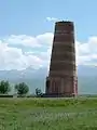
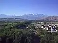 Southern outskirts of Bishkek
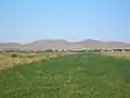 In the Chuy Valley
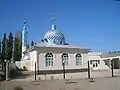 A new mosque in Milianfan, Ysyk-Ata District
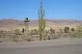 On the Kazakh border
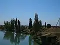 The Chuy River near Korday
References
- Population of regions,districts, towns, urban-type settlements, rural communities and villages of Kyrgyz Republic (National Statistical Committee estimate as of beginning of 2020) Численность населения областей, районов, городов, поселков городского типа,айылных аймаков и сел Кыргызской Республики (оценка НСК на начало 2020г)
- "Classification system of territorial units of the Kyrgyz Republic" (in Kyrgyz). National Statistics Committee of the Kyrgyz Republic. May 2021. pp. 67–81.
- Чуйская областная госадминистрация: Чуйский район Archived 2011-07-22 at the Wayback Machine (The Government of the Chuy Region: Chuy District) (in Russian)
- Чуйская областная госадминистрация: Город Токмок Archived 2011-07-22 at the Wayback Machine (The Government of the Chuy Region: City of Tokmok) (in Russian)
- Чуйская областная госадминистрация: Список районов на главной странице Archived 2007-06-29 at the Wayback Machine (The Government of the Chuy Region: The districts of the Chuy Oblast) (in Russian)
- National Statistical Committee of Kyrgyz Republic. Statistical YearBook of Kyrgyz Republic for 2005-2009 (PDF) (Report) (in Kyrgyz and Russian). Archived from the original (PDF) on 2011-12-06.
- Population and Housing Census 2009. Book 3 (in tables). Provinces of Kyrgyzstan: Chuy Region (Перепись населения и жилищного фонда Кыргызской Республики 2009. Книга 3 (в таблицах). Регионы Кыргызстана: Чуйская область (PDF), Bishkek: National Committee on Statistics, 2010, archived from the original (PDF) on 2011-08-10
External links
 |
Wikimedia Commons has media related to Chuy Province. |
.svg.png.webp) Asia portal
Asia portal
Places adjacent to Chuy Region | |
|---|---|








 | | ||