Daund
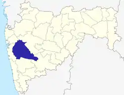
Daund is a City, municipal council and headquarters of Daund tehsil in Pune district in the state of Maharashtra, India. In ancient times a sage, 'Dhaumya Rishi' used to stay here, hence people started calling this place after him: 'Dhaum'. Gradually 'Dhaum' became 'Dhoand', then 'Dhaundh', and before it getting corrupted to the present name 'Daund'. According to the Epic Mahabharata Krishna's wife Rukhmini had gone in the 'Dhindir forest', this ancient 'Dhindir Van' is today's Daund. Daund is located on bank of Bhima river.
Daund | |
|---|---|
City | |
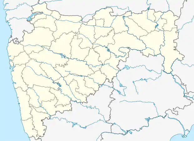  Daund Location in Maharashtra, India | |
| Coordinates: 18°27′47″N 74°34′44″E | |
| Country |  India India |
| State | Maharashtra |
| District | Pune |
| Named for | Dhaumya Rishi |
| Government | |
| • Body | Municipality |
| Elevation | 514 m (1,686 ft) |
| Population (2011) | |
| • Total | 202,566 |
| Languages | |
| • Official | Marathi |
| Time zone | UTC+5:30 (IST) |
| PIN | 413801 and 413802 |
| Telephone code | 02117 |
| Vehicle registration | MH 12,42 |
| Website | www |
History
Maratha era
Shahaji raje Bhosale (father of Chhatrapati Shivaji Maharaj) was a sardar in the Nizam Shahi. He had been given Daund as a jagir, including the Bahadurgad fort in Pedgaon (which is still extant on the banks of the Bhima River).
Peshwa era
In 1739 the Bajirao - Mastani affair had brought clashes among the Peshwa family, hence Bajirao Peshwa took Mastani away from Pune and made her stay in Patas. Hence forth Bajirao and Mastani met at the Firangai Devi temple in Kurkumbh. Water of the rivers Bhima, Nira, Pravara, Ghod and Godavari are best suited to the horses, hence the horses breeding on these waters used to be strong, quick and loyal. The area of 'Bhimthadi' which is close to Daund was known for getting good breed of horses and people preferred to get a pony only from this place. Hence the horse business in Daund has flourished. At the end of the Peshwa Era due to heavy loans on them Daund and some villages from Pune had gone in control of 'Girgosavi'.
British rule
When railways were started during the British rule in 1850s, the Bombay-Chennai broad-gauge track passed via Daund, and the Daund-Baramati metre-gauge track was constructed. Daund became a junction after the broad-gauge Daund-Manmad connection was established. Daund got connected to Srigonda when in 1928 the bridge over river Bhima was constructed. A receiver station of the Imperial Wireless Chain was installed three kilometers outside the town. From 1942 to 1945 two military camps were set up in Daund.
Geography and climate
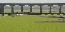
Daund is located at 18.47°N 74.6°E, about 514 m (1,686 ft) above sea level on the western margin of the Deccan plateau. The town is mostly flat terrain, with hills rising 600 m (2,000 ft) to the south of the town near Kurkumbh. Daund is located on the southern bank of Bhima river, a major river in Maharashtra. The Ujjani reservoir on the river is around 25 km (16 mi) southeast of the town. Daund lies very close to the seismically active zone around Koyna Dam, about 130 km (81 mi) southeast of the town, and has been rated in Zone 3 (on a scale of 2 to 5, with 5 being the most prone to earthquakes) by the India Meteorological Department. The climate of Daund is generally hot and dry, and the area receives scant rainfall.
Economy
Primary crops include wheat, sugar cane, oranges and sweet limes. Daund has a large working class population, and the primary occupation is farming. MIDC provides employment for the people. Daund is currently being developed as a hub for Pharmaceutical Industries. Pharmaceutical majors such as Cipla, Emcure Pharmaceuticals, Dia Ichi already have their base here.
Transportation
Roads
Daund is just 9 km (5.6 mi) north of NH 65 and MH SH 10 passes through Daund. MSRTC buses are available to Pune and Mumbai from here.
Rail
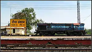
Daund is served by rail by the Daund Junction and the Daund Chord Line. Daund Junction and Daund Chord Line are managed by the Pune railway division of the Central Railway. Daund Junction lies on the Mumbai–Chennai line, Daund–Manmad line and the Daund–Baramati branch line. Daund Chord Line lies on a short line which connects Mumbai–Chennai line and Daund–Manmad line. Daund is a major freight redistribution hub.
Demographics
As of 2011 India Census,[1] Daund had a population of 49,450 of which 25,117 were males and 24,333 were females. There were 5,721 children of age below 6 years. Daund had an average literacy rate of 77.34%, higher than the national average of 74.04%. Male literacy was 80.44% and female literacy was 74.13%.
The town has a significant population working as an employee of the Indian Railways and State Reserve Police Force (SRPF).
Religion
The Hindu temples in Daund are Vitthal Temple, Balaji temple. Ram Navami is a large religious event, marked by Lord Rama's sculpture carried throughout the town on a palanquin.
The town has a Jain Digambar temple known as the 1008 Chandraprabhu Bhagwan Mandir which is known for its architecture and no use of iron. The temple is built by marble and is situated on Ahmednagar road. This temple was completed on 7 February 2013 under the guidance of Munishri 108 Suvirsagarji Maharaj. The temple has a Manasthambh which is also made from marble. The temple is built only using Makrana marble.
There are 9 mosques in Daund and 12 churches.
References
- "Census of India 2011: Data from the 2001 Census, including cities, villages and towns (Provisional)". Census Commission of India. Retrieved 3 June 2015.
Pune district topics | ||||||||||||||||||
|---|---|---|---|---|---|---|---|---|---|---|---|---|---|---|---|---|---|---|
| History |
| |||||||||||||||||
| Geography |
| |||||||||||||||||
| Cities and towns |
| |||||||||||||||||
| Transport | ||||||||||||||||||
| Culture | ||||||||||||||||||
| Constituencies |
| |||||||||||||||||