Deir kifa
Deir kifa (Arabic: دير كيفا) is a local authority in Southern Lebanon, located in Tyre District, Governorate of South Lebanon.
Deir kifa
دير كيفا Dyr kifa | |
|---|---|
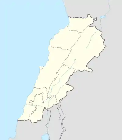  Deir kifa Location within Lebanon | |
| Coordinates: 33°16′23″N 35°21′14″E | |
| Grid position | 183/297 PAL |
| Country |  Lebanon Lebanon |
| Governorate | South Lebanon Governorate |
| District | Tyre District |
| Elevation | 390 m (1,280 ft) |
| Time zone | UTC+2 (EET) |
| • Summer (DST) | UTC+3 (EEST) |
Name
E. H. Palmer wrote in 1881 that it meant The convent of Kifa. p.n. [1] Kifa is a Syriac Aramaic word that means rock in Arabic and Peter in Greek. It is the title of Saint Simon, son of Jonah, a disciple of Jesus Christ.
Location
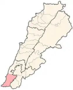
Deir Kifa is located in the South Governorate, Tyre District.[2] It is 390 m above sea level and 107 kilometers to the southwest of Beirut, the capital city of Lebanon, or about two hours, and 16 km from the center of its district Tyre. Its population is about five thousand people; about a thousand live in the village, while the rest are distributed in expatriate countries such as Brazil, the United States, Germany, and some Arab Gulf countries. A large number of her sons settled in the capital, Beirut, in order to search for ways of life and work that are missing in the village.
History
Among its monuments is the Maroun Castle; it is historically named after the castle of Maroun, the French Crusader leader who renovated its construction. [3] The castle has seven huge circular towers, some parts of which have collapsed due to time. Deir Kifa Castle was built on a mountainous hill by Aram ibn Yaqoub, adjacent to the agricultural plains. Yaron and Tibnin, and a commercial and military relationship arose between them. Deir Kifa Castle consists of three layers and extends over an area of twenty thousand square meters. It has four springs, and 12 towers, some of which are circular, Aramaic-Canaanite, and some are square-cruciform. Inside are gymnasiums and others for meetings. It contains the king’s palace to the west and vaults that take a square shape. And Christ stayed there. The town of Deir Kifa was considered one of the ten villages that Hiram, King of Tyre, gave him. The area of the castle is 17,000 square meters and consists of three floors. It contains many cellars, destroyed inns, rooms, multiple stone houses, horse stables, prisons, playgrounds, courtyards, and wheat stores. 365 wells are spread to collect water and 4 springs that dried up years ago. Its wall is 6 to 12 meters high and two meters wide. It has seven corners on each of them, a semi-circular watchtower with a diameter of 8 meters, used for guarding, hunting and defense. It rises 400 m above sea level. It overlooks many towns: from the east, Jebel Maroun and Burj Qalawiya, from the south, Deir Kifa, from the north Srifa and Al-Nafakhiya, and the west, the valleys to the sea.[4]
Education
| Educational establishments | Barish (2005-2006) | Lebanon (2005–2006) |
|---|---|---|
| Number of Schools | 2 | 2788 |
| Public School | 2 | 1763 |
| Private School | 0 | 1025 |
| Students schooled in the public schools | 474 | 439905 |
| Students schooled in the private schools | 0 | 471409 |
References
- Palmer, Edward Henry (1881). The Survey of Western Palestine. p. 20.
- "Deir Kifa". www.localiban.org. Retrieved 23 October 2015.
- "The ancient castle of Deir Kifa: The largest Castle in the South and the Oldest in history." nna-leb.gov.lb. Retrieved 16 Nov 2017.
- "The Ancient Castle of Deir Kifa in southern Lebanon, a descendant of a Challenging History". www.alquds.co.uk. Retrieved 24 April 2021.
Bibliography
- Conder, C.R.; Kitchener, H.H. (1881). The Survey of Western Palestine: Memoirs of the Topography, Orography, Hydrography, and Archaeology. 1. London: Committee of the Palestine Exploration Fund.
- Guérin, V. (1880). Description Géographique Historique et Archéologique de la Palestine (in French). 3: Galilee, pt. 2. Paris: L'Imprimerie Nationale.
- Palmer, E.H. (1881). The Survey of Western Palestine: Arabic and English Name Lists Collected During the Survey by Lieutenants Conder and Kitchener, R. E. Transliterated and Explained by E.H. Palmer. Committee of the Palestine Exploration Fund.
External links
- Survey of Western Palestine, Map 2: IAA, Wikimedia commons

Capital: Tyre | ||
| Towns and villages |
|  |
| Palestinian refugee camps | ||
| Other | ||